| Birth | : | 9 Nov 1891 Manchester, Delaware County, Iowa, USA |
| Death | : | 28 Jun 1962 Anthon, Woodbury County, Iowa, USA |
| Burial | : | Methven Cemetery, Methven, Ashburton District, New Zealand |
| Coordinate | : | -43.6346810, 171.6563070 |
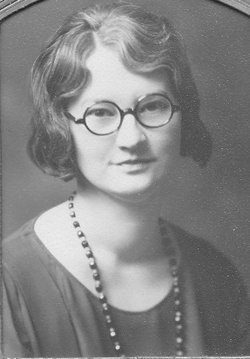
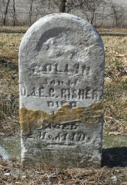
| Description | : | Waldo Oliver Risher, son of Oliver and Esther Risher, was born November 9, 1891, at Manchester, Iowa. When a young boy he moved with his parents to Missouri where they resided for several years. He spent two years in California and for the last 49 years he lived in Woodbury County in the Anthon and Correctionville communities. Mr. Risher married Angie B. Dicks February 3, 1929, at Pierson. His occupation was farming and he was also employed by Woodbury County for several years. He served in the U.S. Navy during World War I as a... Read More |
frequently asked questions (FAQ):
-
Where is Waldo Oliver Risher's memorial?
Waldo Oliver Risher's memorial is located at: Methven Cemetery, Methven, Ashburton District, New Zealand.
-
When did Waldo Oliver Risher death?
Waldo Oliver Risher death on 28 Jun 1962 in Anthon, Woodbury County, Iowa, USA
-
Where are the coordinates of the Waldo Oliver Risher's memorial?
Latitude: -43.6346810
Longitude: 171.6563070
Family Members:
Parent
Spouse
Siblings
Flowers:
Nearby Cemetories:
1. Methven Cemetery
Methven, Ashburton District, New Zealand
Coordinate: -43.6346810, 171.6563070
2. Highbank Cemetery
Highbank, Ashburton District, New Zealand
Coordinate: -43.6228060, 171.7387780
3. Alford Forest Cemetery
Alford Forest, Ashburton District, New Zealand
Coordinate: -43.6428200, 171.4933300
4. Barrhill Cemetery
Barrhill, Ashburton District, New Zealand
Coordinate: -43.6756950, 171.8480790
5. Rockwood Station Cemetery
Windwhistle, Selwyn District, New Zealand
Coordinate: -43.4928406, 171.7730184
6. Glenroy War Memorial
Glenroy, Selwyn District, New Zealand
Coordinate: -43.5199750, 171.8345040
7. Mt Somers Old Cemetery
Mount Somers, Ashburton District, New Zealand
Coordinate: -43.7050700, 171.3969000
8. Mount Somers Cemetery
Mount Somers, Ashburton District, New Zealand
Coordinate: -43.7093900, 171.3962830
9. Westerfield Cemetery
Westerfield, Ashburton District, New Zealand
Coordinate: -43.8324380, 171.5806230
10. Hororata Cemetery
Hororata, Selwyn District, New Zealand
Coordinate: -43.5196600, 171.9461100
11. St Johns Churchyard
Hororata, Selwyn District, New Zealand
Coordinate: -43.5189100, 171.9457550
12. Chertsey Cemetery
Chertsey, Ashburton District, New Zealand
Coordinate: -43.8030500, 171.9319400
13. South Malvern Cemetery
Glentunnel, Selwyn District, New Zealand
Coordinate: -43.4807300, 171.9475200
14. Ashburton Public Cemetery
Ashburton, Ashburton District, New Zealand
Coordinate: -43.8903240, 171.7702810
15. Rakaia Cemetery
Rakaia, Ashburton District, New Zealand
Coordinate: -43.7548910, 171.9939270
16. Lake Coleridge Cemetery
Lake Coleridge, Selwyn District, New Zealand
Coordinate: -43.3695530, 171.5264300
17. Pioneer Park Memorial
Ashburton, Ashburton District, New Zealand
Coordinate: -43.9106400, 171.7485300
18. Ruapuna Cemetery
Ruapuna, Ashburton District, New Zealand
Coordinate: -43.8436110, 171.3680400
19. Greendale Cemetery
Greendale, Selwyn District, New Zealand
Coordinate: -43.5447560, 172.0772460
20. Winslow Cemetery
Winslow, Ashburton District, New Zealand
Coordinate: -43.9576290, 171.6522810
21. Dunsandel Cemetery
Dunsandel, Selwyn District, New Zealand
Coordinate: -43.6710940, 172.1382620
22. Windermere Cemetery
Windermere, Ashburton District, New Zealand
Coordinate: -43.9874945, 171.6232358
23. Trinity Church Columbarium
Darfield, Selwyn District, New Zealand
Coordinate: -43.4888350, 172.1052750
24. Kowai Pass Cemetery
Springfield, Selwyn District, New Zealand
Coordinate: -43.3399830, 171.9334560


