
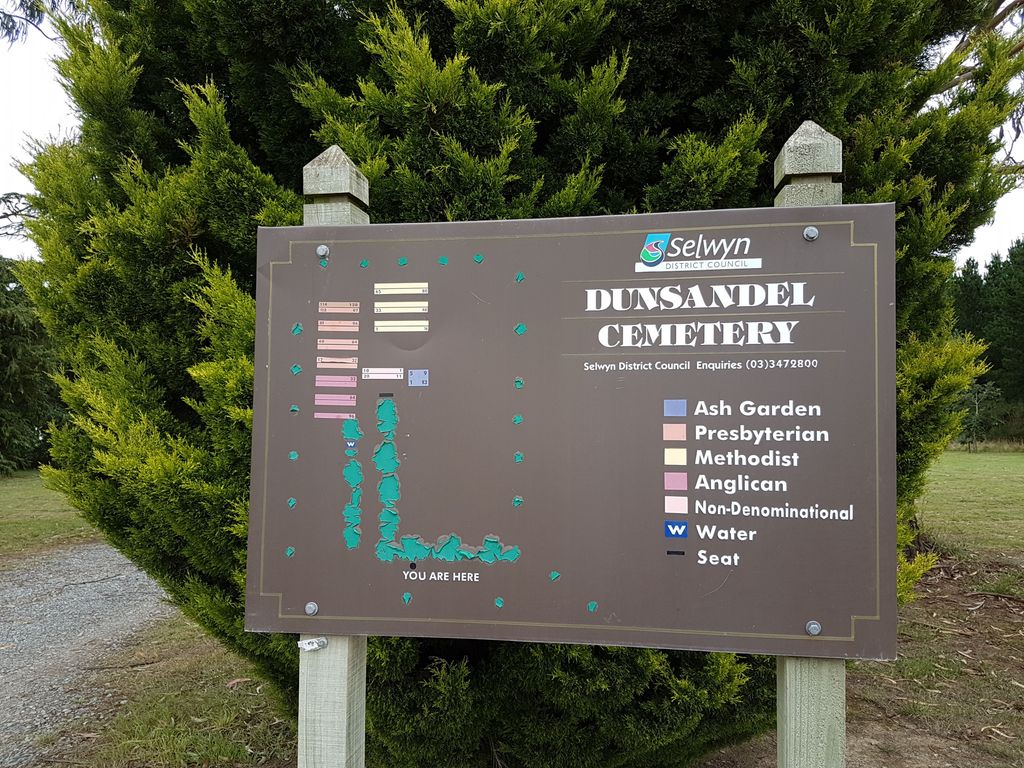
| Memorials | : | 17 |
| Location | : | Dunsandel, Selwyn District, New Zealand |
| Website | : | www.selwyn.govt.nz/facilities-and-parks/cemeteries |
| Coordinate | : | -43.6710940, 172.1382620 |
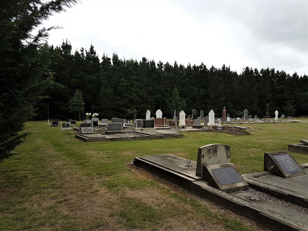
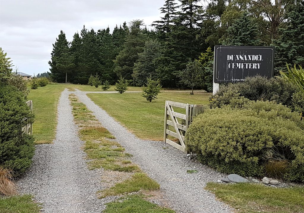
| Description | : | Entrance to cemetery can be found down a gravel driveway off Old South Road about 500m from the junction of Old South Road and Sheats Road. Sheats Road is a gravel road off State Highway 1 south of Dunsandel. Old South Road is tar-sealed from the Dunsandel approach up to the cemetery entrance. Cemetery is in a very secluded setting, surrounded by tall pine trees and is not visible from the road. |
frequently asked questions (FAQ):
-
Where is Dunsandel Cemetery?
Dunsandel Cemetery is located at 535 Old South Road Dunsandel, Selwyn District ,Canterbury , 7682New Zealand.
-
Dunsandel Cemetery cemetery's updated grave count on graveviews.com?
15 memorials
-
Where are the coordinates of the Dunsandel Cemetery?
Latitude: -43.6710940
Longitude: 172.1382620
Nearby Cemetories:
1. Brookside Cemetery
Brookside, Selwyn District, New Zealand
Coordinate: -43.6751800, 172.2683700
2. Killinchy Cemetery
Leeston, Selwyn District, New Zealand
Coordinate: -43.7325610, 172.2411540
3. St Luke's Anglican Churchyard
Brookside, Selwyn District, New Zealand
Coordinate: -43.6903100, 172.3029000
4. Rakaia Cemetery
Rakaia, Ashburton District, New Zealand
Coordinate: -43.7548910, 171.9939270
5. Greendale Cemetery
Greendale, Selwyn District, New Zealand
Coordinate: -43.5447560, 172.0772460
6. Bishops Corner Cemetery
Southbridge, Selwyn District, New Zealand
Coordinate: -43.7824100, 172.2422900
7. Ellesmere Public Cemetery
Leeston, Selwyn District, New Zealand
Coordinate: -43.7775690, 172.2599220
8. Ellesmere Catholic Cemetery
Leeston, Selwyn District, New Zealand
Coordinate: -43.7845860, 172.2690990
9. St James Churchyard
Southbridge, Selwyn District, New Zealand
Coordinate: -43.8092360, 172.2502680
10. St Joseph's Catholic Cemetery
Darfield, Selwyn District, New Zealand
Coordinate: -43.4918030, 172.1081060
11. Trinity Church Columbarium
Darfield, Selwyn District, New Zealand
Coordinate: -43.4888350, 172.1052750
12. Kirwee Cemetery
Kirwee, Selwyn District, New Zealand
Coordinate: -43.4935800, 172.2118100
13. St George's Anglican Churchyard
Kirwee, Selwyn District, New Zealand
Coordinate: -43.4940826, 172.2182446
14. Chertsey Cemetery
Chertsey, Ashburton District, New Zealand
Coordinate: -43.8030500, 171.9319400
15. Hororata Cemetery
Hororata, Selwyn District, New Zealand
Coordinate: -43.5196600, 171.9461100
16. St Johns Churchyard
Hororata, Selwyn District, New Zealand
Coordinate: -43.5189100, 171.9457550
17. Sedgemere Cemetery
Sedgemere, Selwyn District, New Zealand
Coordinate: -43.8366600, 172.3149500
18. Dorie Cemetery
Dorie, Ashburton District, New Zealand
Coordinate: -43.8772900, 172.0862500
19. Barrhill Cemetery
Barrhill, Ashburton District, New Zealand
Coordinate: -43.6756950, 171.8480790
20. St Mary's Churchyard
Springston, Selwyn District, New Zealand
Coordinate: -43.6446560, 172.4263590
21. St Matthew's Churchyard
Courtenay, Selwyn District, New Zealand
Coordinate: -43.4819060, 172.2792350
22. Halkett Presbyterian Churchyard
Halkett, Selwyn District, New Zealand
Coordinate: -43.5011000, 172.3220900
23. Weedons Cemetery
Weedons, Selwyn District, New Zealand
Coordinate: -43.5670010, 172.4015870
24. St Paul's Anglican Church Cemetery
West Melton, Selwyn District, New Zealand
Coordinate: -43.5261700, 172.3701800