
| Birth | : | 23 Dec 1913 Mitchell, Mitchell County, Iowa, USA |
| Death | : | 26 Sep 1992 Fort Meade, Meade County, South Dakota, USA |
| Burial | : | Riverside Cemetery, Pierre, Hughes County, USA |
| Coordinate | : | 44.3608017, -100.3071976 |
| Plot | : | ADDNA Block 6, Lot 11, Site 5 |
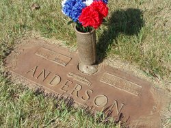
| Inscription | : | SFC US ARMY KOREA TOGETHER FOREVER |
| Description | : | Walt first married Gertrude Martin. They had one son. They later divorced. He married Verna Titze on June 26, 1943 at Pierre, Hughes County, South Dakota. They had two sons and one daughter. Walt was survived by two sons, one daughter, seven grandchildren, and three great--grandchildren. He was preceded in death by his wife, one son and four brothers and five sisters. He was the last surviving child of Frank and Lillie Huebner. Memorial updated June 25, 2022. |
frequently asked questions (FAQ):
-
Where is Walter Emil “Walt” Huebner's memorial?
Walter Emil “Walt” Huebner's memorial is located at: Riverside Cemetery, Pierre, Hughes County, USA.
-
When did Walter Emil “Walt” Huebner death?
Walter Emil “Walt” Huebner death on 26 Sep 1992 in Fort Meade, Meade County, South Dakota, USA
-
Where are the coordinates of the Walter Emil “Walt” Huebner's memorial?
Latitude: 44.3608017
Longitude: -100.3071976
Family Members:
Parent

Spouse
Siblings
Children
Flowers:


Nearby Cemetories:
1. Riverside Cemetery
Pierre, Hughes County, USA
Coordinate: 44.3608017, -100.3071976
2. South Dakota State Capitol Grounds
Pierre, Hughes County, USA
Coordinate: 44.3660100, -100.3448000
3. Fort Pierre Chouteau Cemetery
Fort Pierre, Stanley County, USA
Coordinate: 44.3908700, -100.3878300
4. Mount Calvary Cemetery
Pierre, Hughes County, USA
Coordinate: 44.4197006, -100.3557968
5. Cedar Hill Cemetery
Fort Pierre, Stanley County, USA
Coordinate: 44.3356018, -100.3964005
6. Scotty Philip Cemetery
Fort Pierre, Stanley County, USA
Coordinate: 44.4019012, -100.4036026
7. Byron Township Cemetery
Blunt, Hughes County, USA
Coordinate: 44.4979200, -100.1904700
8. Canning Cemetery
Hughes County, USA
Coordinate: 44.3986890, -100.0278460
9. Holy Name Episcopal Cemetery
Fort Pierre, Stanley County, USA
Coordinate: 44.2694960, -100.0357300
10. Holy Name Chapel Cemetery
Fort Pierre, Stanley County, USA
Coordinate: 44.2694292, -100.0356989
11. Mathews Family Cemetery
Stanley County, USA
Coordinate: 44.1816040, -100.5581080
12. Pleasant Hill Cemetery
Blunt, Hughes County, USA
Coordinate: 44.5135994, -100.0156021
13. Okobojo Cemetery
Sully County, USA
Coordinate: 44.6568985, -100.3647003
14. Meers Cemetery
Stanley County, USA
Coordinate: 44.4116970, -100.7360760
15. Fort Sully Post Cemetery
Sully County, USA
Coordinate: 44.5866480, -100.6087530
16. Holy Faith Cemetery
Lyman County, USA
Coordinate: 44.1356010, -99.9878006
17. Chapelle Cemetery
Hughes County, USA
Coordinate: 44.3025017, -99.8653030
18. Fort Bennett Post Cemetery
Stanley County, USA
Coordinate: 44.6716500, -100.6404200
19. Onida Cemetery
Onida, Sully County, USA
Coordinate: 44.7147000, -100.0650000
20. Immanuel Lutheran Cemetery
Van Metre, Jones County, USA
Coordinate: 44.0958800, -100.7263300
21. Saint Catherines Cemetery
Harrold, Hughes County, USA
Coordinate: 44.2091100, -99.7868200
22. Ascension Cemetery
Canning, Hughes County, USA
Coordinate: 44.1523700, -99.7927100
23. Medicine Hill Cemetery
Harrold, Hughes County, USA
Coordinate: 44.5116997, -99.7453003
24. Saint John Catholic Cemetery
Harrold, Hughes County, USA
Coordinate: 44.5127983, -99.7335968