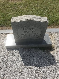
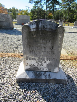
Walter Lafatte Hunter
| Birth | : | 5 Aug 1887 Greenwood County, South Carolina, USA |
| Death | : | 24 Jun 1969 South Carolina, USA |
| Burial | : | Bethia Cemetery, Clatworthy Crossroads, Abbeville County, USA |
| Coordinate | : | 34.0617810, -82.3759150 |
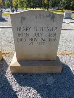
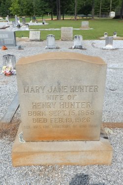
| Description | : | Walter Lafatte Hunter, a son of Henry Bryson Hunter and the former Miss Mary Jane "May" Malone, was born in Greenwood, South Carolina. Walter worked as a Conductor on the Southern Railroad. |
frequently asked questions (FAQ):
-
Where is Walter Lafatte Hunter's memorial?
Walter Lafatte Hunter's memorial is located at: Bethia Cemetery, Clatworthy Crossroads, Abbeville County, USA.
-
When did Walter Lafatte Hunter death?
Walter Lafatte Hunter death on 24 Jun 1969 in South Carolina, USA
-
Where are the coordinates of the Walter Lafatte Hunter's memorial?
Latitude: 34.0617810
Longitude: -82.3759150
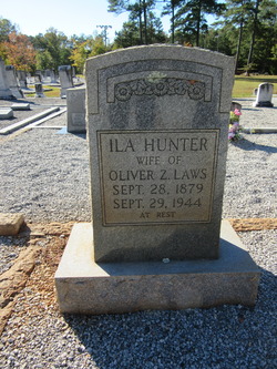
Family Members:
Parent
Siblings
Flowers:
Nearby Cemetories:
1. Bethia Cemetery
Clatworthy Crossroads, Abbeville County, USA
Coordinate: 34.0617810, -82.3759150
2. Saint Goodwill Baptist Church Cemetery
McCormick County, USA
Coordinate: 34.0419720, -82.3831670
3. Little Mountain African Methodist Episcopal Church
Abbeville, Abbeville County, USA
Coordinate: 34.0842820, -82.3758020
4. Chapel Cemetery
McCormick County, USA
Coordinate: 34.0388985, -82.3569031
5. Glover Chapel Baptist Church Cemetery
McCormick County, USA
Coordinate: 34.0356080, -82.3615130
6. Chisholm Cemetery
McCormick County, USA
Coordinate: 34.0283012, -82.3688965
7. William Vickery Family
McCormick County, USA
Coordinate: 34.0282220, -82.3693130
8. Glasgow Family Cemetery
McCormick County, USA
Coordinate: 34.0307500, -82.3938333
9. Reid Cemetery
Calhoun Falls, Abbeville County, USA
Coordinate: 34.0653333, -82.4236167
10. Hopewell Presbyterian Church
Mount Carmel, McCormick County, USA
Coordinate: 34.0391650, -82.4174590
11. Poplar Grove Baptist Church Cemetery
Abbeville County, USA
Coordinate: 34.0882100, -82.3312400
12. Ritchie Cemetery
Abbeville County, USA
Coordinate: 34.0758800, -82.4301200
13. Saint Mary A. M. E. Cemetery
Mount Carmel, McCormick County, USA
Coordinate: 34.0229400, -82.3424970
14. Neel Cemetery
Abbeville County, USA
Coordinate: 34.0686300, -82.4337200
15. Tittle Cemetery
Bradley Corner, McCormick County, USA
Coordinate: 34.0325400, -82.3258800
16. Lower Long Cane Cemetery
McCormick County, USA
Coordinate: 34.0158005, -82.3491974
17. Walnut Grove Baptist Church
Abbeville County, USA
Coordinate: 34.0996990, -82.4272550
18. Calhoun Cemetery
Abbeville County, USA
Coordinate: 34.0619011, -82.4458008
19. Mulberry African Methodist Episcopal Church Cemete
Abbeville, Abbeville County, USA
Coordinate: 34.0633640, -82.4477310
20. Rock Buffalo Baptist Church Cemetery
Abbeville, Abbeville County, USA
Coordinate: 34.1223770, -82.3793010
21. Cedar Springs A.R.P. Church Cemetery
Greenwood County, USA
Coordinate: 34.0792400, -82.3025300
22. Lee Cemetery
McCormick County, USA
Coordinate: 34.0263800, -82.4396900
23. Lebanon Presbyterian Church Cemetery
Abbeville County, USA
Coordinate: 34.1149930, -82.4181590
24. Lebanon Church Enslaved Persons Burial Site
Abbeville County, USA
Coordinate: 34.1151470, -82.4192810

