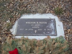
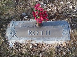
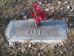
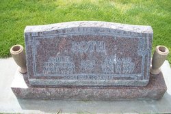
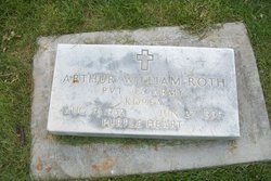
Walter Richard Roth
| Birth | : | 28 Dec 1930 Sterling, Logan County, Colorado, USA |
| Death | : | 31 Dec 2001 Sterling, Logan County, Colorado, USA |
| Burial | : | Henson Family Cemetery, Botto, Clay County, USA |
| Coordinate | : | 37.0993900, -83.6690500 |
| Plot | : | Christus Garden Lot 161 |
| Description | : | Walter Richard Roth, 71, of Sterling, died Monday, Dec. 31, 2001, in Sterling of natural causes. Visitation will be until 7 p.m. today, Jan. 2, at Tennant Funeral Home. Funeral services will be at 10:30 a.m. Thursday, Jan. 3, at the Trinity Lutheran Church with Rev. Eugene Thiemann officiating. Burial will followat Sunset Memorial Gardens. Mr. Roth was born Dec. 28, 1930, to Victor and Anna (Fritzier) Roth in Sterling. He entered the service during the Korean War. On June 1, 1952, he married Beulah Clark. He farmed for a few years with his father. He worked for CB &... Read More |
frequently asked questions (FAQ):
-
Where is Walter Richard Roth's memorial?
Walter Richard Roth's memorial is located at: Henson Family Cemetery, Botto, Clay County, USA.
-
When did Walter Richard Roth death?
Walter Richard Roth death on 31 Dec 2001 in Sterling, Logan County, Colorado, USA
-
Where are the coordinates of the Walter Richard Roth's memorial?
Latitude: 37.0993900
Longitude: -83.6690500
Family Members:
Parent
Siblings
Flowers:
Nearby Cemetories:
1. Henson Family Cemetery
Botto, Clay County, USA
Coordinate: 37.0993900, -83.6690500
2. Bill Henson Cemetery
Botto, Clay County, USA
Coordinate: 37.0993700, -83.6681700
3. Earnest Henson Cemetery
Botto, Clay County, USA
Coordinate: 37.0981900, -83.6692000
4. Henson-Marcum Cemetery
Botto, Clay County, USA
Coordinate: 37.0961500, -83.6695300
5. Daugh Henson Cemetery
Botto, Clay County, USA
Coordinate: 37.0946500, -83.6690700
6. Mitchell Cemetery
Botto, Clay County, USA
Coordinate: 37.0958300, -83.6646400
7. Hubbard-Brumley Cemetery
Botto, Clay County, USA
Coordinate: 37.0945000, -83.6659300
8. Mitchell-Combs Cemetery
Botto, Clay County, USA
Coordinate: 37.0946000, -83.6644100
9. Steve Mitchell Cemetery
Botto, Clay County, USA
Coordinate: 37.0930100, -83.6668400
10. Brush Harbor
Goose Rock, Clay County, USA
Coordinate: 37.0949170, -83.6606730
11. Wagers Cemetery
Botto, Clay County, USA
Coordinate: 37.0949100, -83.6606700
12. Thompson Family Cemetery
Botto, Clay County, USA
Coordinate: 37.0912660, -83.6730770
13. Al Marcum Cemetery
Botto, Clay County, USA
Coordinate: 37.1058200, -83.6611800
14. Joe B Smith Cemetery
Goose Rock, Clay County, USA
Coordinate: 37.1069600, -83.6624600
15. Smith Cemetery #12
Goose Rock, Clay County, USA
Coordinate: 37.0928400, -83.6804400
16. Jackson Family Cemetery
Botto, Clay County, USA
Coordinate: 37.0876500, -83.6742500
17. Nick Marcum Cemetery
Clay County, USA
Coordinate: 37.1078100, -83.6573500
18. Collins-France Cemetery
Botto, Clay County, USA
Coordinate: 37.1098300, -83.6571900
19. Hollen Cemetery
Botto, Clay County, USA
Coordinate: 37.0852200, -83.6758700
20. Cleveland Marcum Cemetery
Botto, Clay County, USA
Coordinate: 37.0868100, -83.6845200
21. Hoskins Cemetery
Botto, Clay County, USA
Coordinate: 37.0988300, -83.6465200
22. Lipps Cemetery
Goose Rock, Clay County, USA
Coordinate: 37.0823300, -83.6618300
23. Jones Cemetery
Big Creek, Clay County, USA
Coordinate: 37.0987510, -83.6464560
24. Myers Cemetery
Goose Rock, Clay County, USA
Coordinate: 37.0906600, -83.6908200

