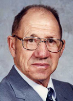
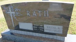
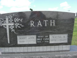
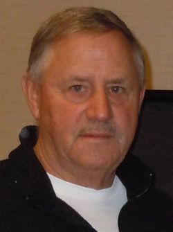
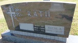
Wayne Allen Rath
| Birth | : | 30 Aug 1926 Clay County, Nebraska, USA |
| Death | : | 9 Mar 2007 Aurora, Hamilton County, Nebraska, USA |
| Burial | : | Calvary Cemetery, Riceville, Mitchell County, USA |
| Coordinate | : | 43.3497009, -92.5550003 |
| Description | : | Wayne Allen Rath, the son of William and Eva Blanche (Ayer) Rath, was born in Clay County, Nebraska on August 30, 1926 and died in Aurora, Nebraska on March 9, 2007, at the age of 80. Wayne attended Eldorado country school and then went onto Harvard to finish his schooling. Wayne lived in Clay and Hamilton Counties all of his life, except for the two years he spent working for Lockheed Air Company in California and the Lincoln Telephone Company, before returning to farm. Wayne was united in marriage to Mary Ann Buller on August 26, 1949 at... Read More |
frequently asked questions (FAQ):
-
Where is Wayne Allen Rath's memorial?
Wayne Allen Rath's memorial is located at: Calvary Cemetery, Riceville, Mitchell County, USA.
-
When did Wayne Allen Rath death?
Wayne Allen Rath death on 9 Mar 2007 in Aurora, Hamilton County, Nebraska, USA
-
Where are the coordinates of the Wayne Allen Rath's memorial?
Latitude: 43.3497009
Longitude: -92.5550003
Family Members:
Parent
Spouse
Siblings
Children
Flowers:
Nearby Cemetories:
1. Calvary Cemetery
Riceville, Mitchell County, USA
Coordinate: 43.3497009, -92.5550003
2. Riverside Cemetery
Riceville, Mitchell County, USA
Coordinate: 43.3676834, -92.5576324
3. Saint Peters Lutheran Cemetery
Riceville, Mitchell County, USA
Coordinate: 43.3163986, -92.5547028
4. Reckner Cemetery
Howard County, USA
Coordinate: 43.2743988, -92.5152969
5. Beaver Creek Cemetery
Brownville, Mitchell County, USA
Coordinate: 43.3397217, -92.6727829
6. Saint Peters Cemetery
New Haven, Mitchell County, USA
Coordinate: 43.2858315, -92.6427765
7. Wayne Cemetery
McIntire, Mitchell County, USA
Coordinate: 43.4411011, -92.5744019
8. Robbins Cemetery
David (historical), Mitchell County, USA
Coordinate: 43.4150009, -92.6718979
9. Saint Pauls Lutheran Church Cemetery
Maple Leaf, Howard County, USA
Coordinate: 43.3217000, -92.4082000
10. Saratoga Township Cemetery
Saratoga, Howard County, USA
Coordinate: 43.3710000, -92.4023000
11. Liberty Cemetery
Little Cedar, Mitchell County, USA
Coordinate: 43.3856010, -92.7230988
12. Calvary Cemetery
Elma, Howard County, USA
Coordinate: 43.2522011, -92.4421997
13. Howard Cemetery
Elma, Howard County, USA
Coordinate: 43.2517014, -92.4372025
14. Saint Patricks Cemetery
Howard County, USA
Coordinate: 43.2200012, -92.5149994
15. Saint Patricks Church Cemetery
McIntire, Mitchell County, USA
Coordinate: 43.4771996, -92.6508026
16. Sacred Heart Cemetery
Meyer, Mitchell County, USA
Coordinate: 43.4583282, -92.7011108
17. Stillwater Cemetery
Orchard, Mitchell County, USA
Coordinate: 43.2130585, -92.6780624
18. Le Roy Cemetery
Le Roy, Mower County, USA
Coordinate: 43.5214005, -92.5227966
19. Saint Patricks Cemetery
Le Roy, Mower County, USA
Coordinate: 43.5217018, -92.5207977
20. Le Roy Lutheran Cemetery
Le Roy, Mower County, USA
Coordinate: 43.5217750, -92.5196340
21. Chester Hill Cemetery
Chester, Howard County, USA
Coordinate: 43.4897003, -92.4072037
22. Calvary Cemetery
Alta Vista, Chickasaw County, USA
Coordinate: 43.1983520, -92.4241590
23. Union Cemetery
Alta Vista, Chickasaw County, USA
Coordinate: 43.1955605, -92.4169388
24. Sacred Heart Cemetery
Osage, Mitchell County, USA
Coordinate: 43.2742004, -92.7917023

