
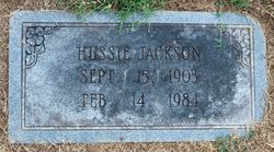
| Birth | : | 20 Oct 1900 Surry County, North Carolina, USA |
| Death | : | 7 Jan 1923 Mount Airy, Surry County, North Carolina, USA |
| Burial | : | All Saints Churchyard, Moddershall, Stafford Borough, England |
| Coordinate | : | 52.9296310, -2.1126940 |
frequently asked questions (FAQ):
-
Where is Wilford Shelton's memorial?
Wilford Shelton's memorial is located at: All Saints Churchyard, Moddershall, Stafford Borough, England.
-
When did Wilford Shelton death?
Wilford Shelton death on 7 Jan 1923 in Mount Airy, Surry County, North Carolina, USA
-
Where are the coordinates of the Wilford Shelton's memorial?
Latitude: 52.9296310
Longitude: -2.1126940
Family Members:
Parent

Spouse
Siblings
Children
Flowers:


Nearby Cemetories:
1. All Saints Churchyard
Moddershall, Stafford Borough, England
Coordinate: 52.9296310, -2.1126940
2. St John the Evangelist
Oulton, Stafford Borough, England
Coordinate: 52.9159400, -2.1330400
3. St Dominic's Convent Churchyard
Stone, Stafford Borough, England
Coordinate: 52.9106500, -2.1407000
4. St Nicholas Churchyard
Fulford, Stafford Borough, England
Coordinate: 52.9428060, -2.0722970
5. Barlaston Cemetery
Barlaston, Stafford Borough, England
Coordinate: 52.9433490, -2.1537310
6. Christ Church Churchyard
Hilderstone, Stafford Borough, England
Coordinate: 52.9100990, -2.0755470
7. Christ Church Churchyard
Stone, Stafford Borough, England
Coordinate: 52.9042670, -2.1477510
8. St. Michael and St. Wulfad Churchyard
Stone, Stafford Borough, England
Coordinate: 52.9016030, -2.1433420
9. Stone Priory
Stone, Stafford Borough, England
Coordinate: 52.9013610, -2.1441120
10. Stone Cemetery
Stone, Stafford Borough, England
Coordinate: 52.8874860, -2.1369430
11. St Saviour Churchyard
Aston-by-Stone, Stafford Borough, England
Coordinate: 52.8841410, -2.1283140
12. St Luke Churchyard
Tittensor, Stafford Borough, England
Coordinate: 52.9407830, -2.1889820
13. St Peter Churchyard
Forsbrook, Staffordshire Moorlands District, England
Coordinate: 52.9675780, -2.0593040
14. Resurrection Churchyard
Dresden, Stoke-on-Trent Unitary Authority, England
Coordinate: 52.9781480, -2.1317140
15. St. Bartholomews Churchyard
Stoke-on-Trent Unitary Authority, England
Coordinate: 52.9743050, -2.1519670
16. Longton Garden of Remembrance
Longton, Stoke-on-Trent Unitary Authority, England
Coordinate: 52.9831560, -2.1359530
17. Longton Cemetery
Longton, Stoke-on-Trent Unitary Authority, England
Coordinate: 52.9833150, -2.1380000
18. St. James the Less Churchyard
Longton, Stoke-on-Trent Unitary Authority, England
Coordinate: 52.9854360, -2.1291320
19. St. Paul's Cemetery
Longton, Stoke-on-Trent Unitary Authority, England
Coordinate: 52.9840874, -2.1408574
20. St Peter Churchyard
Caverswall, Staffordshire Moorlands District, England
Coordinate: 52.9824410, -2.0733810
21. St. Margaret Churchyard
Draycott, Staffordshire Moorlands District, England
Coordinate: 52.9594640, -2.0297030
22. All Saints Churchyard
Milwich, Stafford Borough, England
Coordinate: 52.8852590, -2.0443610
23. Trentham Cemetery
Trentham, Stoke-on-Trent Unitary Authority, England
Coordinate: 52.9665640, -2.1980300
24. Britannia Stadium
Stoke-on-Trent, Stoke-on-Trent Unitary Authority, England
Coordinate: 52.9884070, -2.1754520