
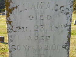
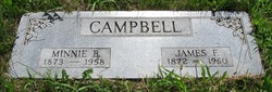
William Alexander Ogg III
| Birth | : | 4 Apr 1831 Madison County, Kentucky, USA |
| Death | : | 25 Apr 1891 |
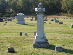
| Burial | : | Bardney Cemetery, Bardney, West Lindsey District, England |
| Coordinate | : | 53.2078350, -0.3208830 |
| Plot | : | Top/Sect.5 |
frequently asked questions (FAQ):
-
Where is William Alexander Ogg III's memorial?
William Alexander Ogg III's memorial is located at: Bardney Cemetery, Bardney, West Lindsey District, England.
-
When did William Alexander Ogg III death?
William Alexander Ogg III death on 25 Apr 1891 in
-
Where are the coordinates of the William Alexander Ogg III's memorial?
Latitude: 53.2078350
Longitude: -0.3208830
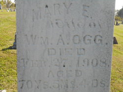
Family Members:
Parent
Spouse
Siblings
Children

Flowers:


Nearby Cemetories:
1. Bardney Cemetery
Bardney, West Lindsey District, England
Coordinate: 53.2078350, -0.3208830
2. St. Lawrence Churchyard
Bardney, West Lindsey District, England
Coordinate: 53.2095580, -0.3254380
3. Bardney Abbey
Bardney, West Lindsey District, England
Coordinate: 53.2204000, -0.3336000
4. St. John the Devine Churchyard
Southrey, West Lindsey District, England
Coordinate: 53.1843135, -0.2972542
5. St Andrew's Churchyard
Bardney, West Lindsey District, England
Coordinate: 53.2442000, -0.3351800
6. St. Margaret's Churchyard
Bucknall, East Lindsey District, England
Coordinate: 53.2039920, -0.2513250
7. St. Andrew's Churchyard
Apley, West Lindsey District, England
Coordinate: 53.2613400, -0.3390200
8. All Saints Churchyard
Gautby, East Lindsey District, England
Coordinate: 53.2359800, -0.2413800
9. All Saints Churchyard
Horsington, East Lindsey District, England
Coordinate: 53.2023100, -0.2160600
10. St. Edward's Churchyard
Barlings, West Lindsey District, England
Coordinate: 53.2600000, -0.3890000
11. St. Andrew Churchyard
Potterhanworth, North Kesteven District, England
Coordinate: 53.1814000, -0.4229000
12. St. Clement's Churchyard
Fiskerton, West Lindsey District, England
Coordinate: 53.2345500, -0.4315200
13. All Saints Churchyard
Nocton, North Kesteven District, England
Coordinate: 53.1637001, -0.4151000
14. St. Giles' Churchyard
Langton by Wragby, East Lindsey District, England
Coordinate: 53.2764400, -0.2777700
15. St Peters Churchyard
Dunston, North Kesteven District, England
Coordinate: 53.1529600, -0.4120730
16. Barlings Cemetery
Langworth, West Lindsey District, England
Coordinate: 53.2728290, -0.4041870
17. St. Stephen's Churchyard
Hatton, East Lindsey District, England
Coordinate: 53.2758321, -0.2357834
18. St Wilfrid Churchyard
Metheringham, North Kesteven District, England
Coordinate: 53.1380350, -0.4016960
19. St. Peter & St. Paul Churchyard
Cherry Willingham, West Lindsey District, England
Coordinate: 53.2387000, -0.4553800
20. St. Peter and St. Paul Churchyard
Reepham, West Lindsey District, England
Coordinate: 53.2518050, -0.4450120
21. Hawthorn Road Cemetery
Reepham, West Lindsey District, England
Coordinate: 53.2489252, -0.4513445
22. St. Oswald's Churchyard
Rand, West Lindsey District, England
Coordinate: 53.2970600, -0.3404500
23. Branston Cemetery
Branston, North Kesteven District, England
Coordinate: 53.1937400, -0.4720700
24. All Saints Churchyard
Branston, North Kesteven District, England
Coordinate: 53.1929200, -0.4728800