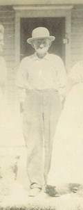
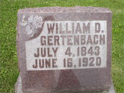
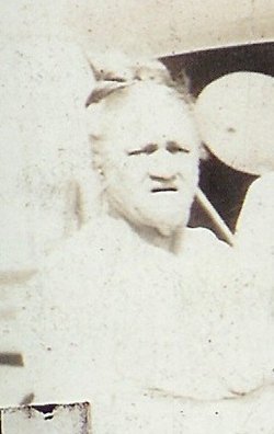
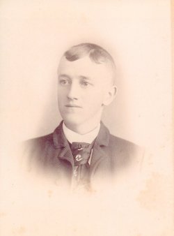
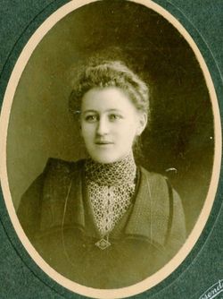
William Daniel Gertenbach
| Birth | : | 4 Jul 1843 Germany |
| Death | : | 16 Jun 1920 Muscatine County, Iowa, USA |
| Burial | : | Cedar Cemetery, Cedar, Smith County, USA |
| Coordinate | : | 39.6685982, -98.9310989 |
| Description | : | William D. Gertenbach, 303 East Seventh street, died at his home following an illness of more than a year, at 7:30 o'clock this morning. Hardening of the arteries was the cause of his death. He was 76 years old. William D. Gertenbach was born at Hessen Castle, Germany, July 4, 1843. His parents brought him to this country when he was but three years of age. They settled in Muscatine county, where Mr. Gertenbach since resided. During the civil war he served with the Thirty-fifth Iowa Infantry, Company B, for three years. He was married to Joanna Hesselik on February 27,... Read More |
frequently asked questions (FAQ):
-
Where is William Daniel Gertenbach's memorial?
William Daniel Gertenbach's memorial is located at: Cedar Cemetery, Cedar, Smith County, USA.
-
When did William Daniel Gertenbach death?
William Daniel Gertenbach death on 16 Jun 1920 in Muscatine County, Iowa, USA
-
Where are the coordinates of the William Daniel Gertenbach's memorial?
Latitude: 39.6685982
Longitude: -98.9310989
Family Members:
Spouse
Children
Flowers:
Nearby Cemetories:
1. Cedar Cemetery
Cedar, Smith County, USA
Coordinate: 39.6685982, -98.9310989
2. Saint Francis Catholic Cemetery
Cedar, Smith County, USA
Coordinate: 39.6328011, -98.9816971
3. Saint John Lutheran Cemetery
Athol, Smith County, USA
Coordinate: 39.7269900, -98.8971600
4. Christ Cemetery
Gaylord, Smith County, USA
Coordinate: 39.6988100, -98.8556700
5. Gaylord Cemetery
Gaylord, Smith County, USA
Coordinate: 39.6598300, -98.8416700
6. Leasburg Cemetery
Cedar, Smith County, USA
Coordinate: 39.5819016, -98.9728012
7. Bohemian Cemetery
Claudell, Smith County, USA
Coordinate: 39.6187800, -99.0428200
8. Olive Branch Cemetery
Kensington, Smith County, USA
Coordinate: 39.7418800, -99.0470800
9. Pleasant View Cemetery
Athol, Smith County, USA
Coordinate: 39.7859000, -98.8982000
10. Saint John Lutheran Cemetery
Kensington, Smith County, USA
Coordinate: 39.7744700, -99.0308700
11. Old Harlan Cemetery
Harlan, Smith County, USA
Coordinate: 39.6153520, -98.7632390
12. Butler Cemetery
Osborne County, USA
Coordinate: 39.5400009, -98.8494034
13. Lawrence Creek Cemetery
Portis, Osborne County, USA
Coordinate: 39.5541440, -98.8148290
14. Grant Center Cemetery
Alton, Osborne County, USA
Coordinate: 39.5242004, -98.9708023
15. Hammond Cemetery
Harlan, Smith County, USA
Coordinate: 39.5896500, -98.7479700
16. Kirwin Cemetery
Kirwin, Phillips County, USA
Coordinate: 39.6781006, -99.1421967
17. Pleasant Ridge Cemetery
Kirwin, Phillips County, USA
Coordinate: 39.5963000, -99.1234000
18. Fairview Cemetery
Smith Center, Smith County, USA
Coordinate: 39.7966995, -98.7881012
19. Bell Cemetery
Smith Center, Smith County, USA
Coordinate: 39.6477700, -98.7102200
20. Agra Cemetery
Agra, Phillips County, USA
Coordinate: 39.7571600, -99.1220400
21. Zion Cemetery
Athol, Smith County, USA
Coordinate: 39.8434100, -98.9171700
22. Garrett Cemetery
Harlan, Smith County, USA
Coordinate: 39.5873500, -98.7290900
23. Germantown Cemetery
Kensington, Smith County, USA
Coordinate: 39.8292300, -99.0450800
24. Ash Rock Cemetery
Woodston, Rooks County, USA
Coordinate: 39.5248909, -99.0817719

