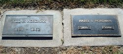
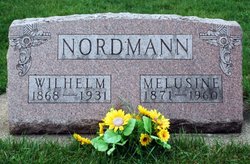
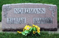
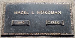
William H “Bill” Nordman
| Birth | : | 12 Sep 1891 Germany |
| Death | : | 25 Sep 1962 Iowa, USA |
| Burial | : | Hopewell Primitive Baptist Church Cemetery, Taits Gap, Blount County, USA |
| Coordinate | : | 33.9655991, -86.3739014 |
| Plot | : | G14 |
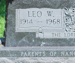
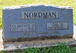
| Description | : | 1962 Greene Recorder, The (Greene, Iowa) October 3, 1962 RITES HELD FOR WILLIAM NORDMAN William H Nordman, 71, a life long resident of Clarksville, died at his home, September 25th. He had been an invalid since suffering a stroke several years ago. He is survived by his wife, the former Hazel Bye, a son, Raymond of Garden Grove, California, two daughters, Mrs. B. E. Bruns of Santa Ana, California and Mrs Harry Bates of Jesup; five brothers, Ed of Charles City, Otto of Oelwein, Clarence, Leo, and Alvin of Nashua; two sisters, Mrs Lenn Bean... Read More |
frequently asked questions (FAQ):
-
Where is William H “Bill” Nordman's memorial?
William H “Bill” Nordman's memorial is located at: Hopewell Primitive Baptist Church Cemetery, Taits Gap, Blount County, USA.
-
When did William H “Bill” Nordman death?
William H “Bill” Nordman death on 25 Sep 1962 in Iowa, USA
-
Where are the coordinates of the William H “Bill” Nordman's memorial?
Latitude: 33.9655991
Longitude: -86.3739014
Family Members:
Parent
Spouse
Siblings
Children
Flowers:
Nearby Cemetories:
1. Robin Hill Missionary Baptist Cemetery
Straight Mountain, Blount County, USA
Coordinate: 33.9385180, -86.3851550
2. Antioch Methodist Cemetery
Oneonta, Blount County, USA
Coordinate: 33.9449997, -86.4000015
3. Mauldin Cemetery
Oneonta, Blount County, USA
Coordinate: 33.9366989, -86.3318024
4. Mauldin Cemetery
Etowah County, USA
Coordinate: 33.9366989, -86.3317032
5. Old Mount Moriah Cemetery
Hoods Crossroads, Blount County, USA
Coordinate: 34.0045900, -86.4031090
6. Blount Memory Gardens
Oneonta, Blount County, USA
Coordinate: 33.9644012, -86.4319000
7. Bynum Family Cemetery
Ellison Crossroads, Blount County, USA
Coordinate: 34.0158005, -86.3842010
8. Union Hill Church of the Nazarene Cemetery
Straight Mountain, Blount County, USA
Coordinate: 33.9152960, -86.3541860
9. Lebanon United Methodist Church Cemetery
Blount County, USA
Coordinate: 34.0008011, -86.4244003
10. Moodys Chapel Cemetery
Altoona, Etowah County, USA
Coordinate: 33.9967003, -86.3169022
11. Mount Carmel Baptist Cemetery
Straight Mountain, Blount County, USA
Coordinate: 33.9292679, -86.4284210
12. Ragsdale Road Cemetery
Blount County, USA
Coordinate: 34.0233733, -86.3634003
13. Altoona Cemetery
Altoona, Etowah County, USA
Coordinate: 34.0145416, -86.3235922
14. Harris Cemetery
Blount County, USA
Coordinate: 34.0293999, -86.3600006
15. Moody Cemetery
Altoona, Etowah County, USA
Coordinate: 34.0088997, -86.3080978
16. Old Liberty Cemetery
Oneonta, Blount County, USA
Coordinate: 33.9508018, -86.4638977
17. Centre Methodist Cemetery
Oneonta, Blount County, USA
Coordinate: 34.0180660, -86.4455100
18. Oak Hill Cemetery
Oneonta, Blount County, USA
Coordinate: 33.9486008, -86.4672012
19. Painter Cemetery
Blount County, USA
Coordinate: 34.0346985, -86.4210968
20. Fosters Chapel Cemetery
Straight Mountain, Blount County, USA
Coordinate: 33.8884964, -86.4051132
21. Pine Grove Cemetery
Ellison Crossroads, Blount County, USA
Coordinate: 34.0422760, -86.3407800
22. Clements Family Cemetery #2
Straight Mountain, Blount County, USA
Coordinate: 33.8888092, -86.4074402
23. Clear Springs United Methodist Church Cemetery
Oneonta, Blount County, USA
Coordinate: 33.9480591, -86.4727783
24. Ellison Cemetery
Blount County, USA
Coordinate: 34.0456009, -86.3358002

