
| Memorials | : | 2 |
| Location | : | Straight Mountain, Blount County, USA |
| Coordinate | : | 33.8884964, -86.4051132 |
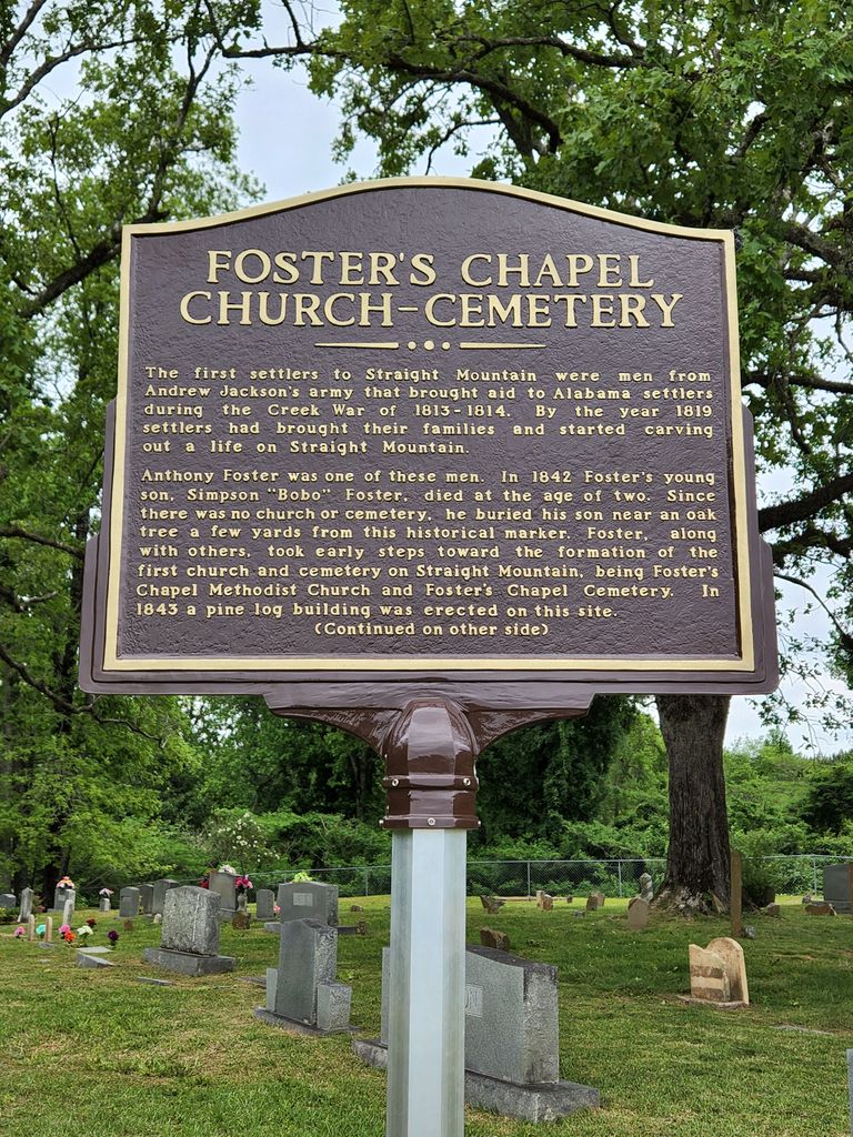
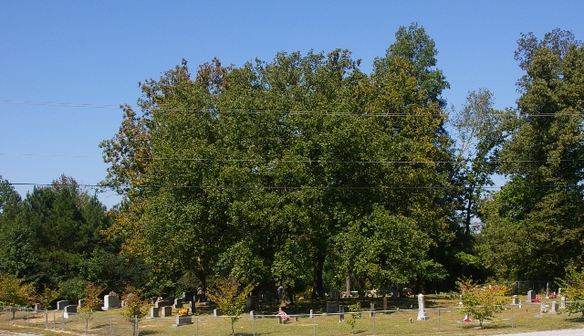
| Description | : | A man called Anthony Foster was one of the earliest settlers in the community. His home was a short distance North of where the old church once stood. In 1842 Mr. Foster's young son, Simpson B. "Bobo" Foster died after a short illness and since there was no church or cemetery near, Mr. Foster wanted the boy buried near a big oak tree down in the flat. This same tree still stands a short distance from the present church. Because of his son's grave, probably, it was Mr. Foster who took the first steps toward the... Read More |
frequently asked questions (FAQ):
-
Where is Fosters Chapel Cemetery?
Fosters Chapel Cemetery is located at Straight Mountain, Blount County ,Alabama ,USA.
-
Fosters Chapel Cemetery cemetery's updated grave count on graveviews.com?
2 memorials
-
Where are the coordinates of the Fosters Chapel Cemetery?
Latitude: 33.8884964
Longitude: -86.4051132
Nearby Cemetories:
1. Clements Family Cemetery #2
Straight Mountain, Blount County, USA
Coordinate: 33.8888092, -86.4074402
2. Straight Mountain Memory Gardens
Oneonta, Blount County, USA
Coordinate: 33.8735008, -86.3942032
3. Straight Mountain Mennonite Church Cemetery
St. Clair County, USA
Coordinate: 33.8479740, -86.3921190
4. Mount Carmel Baptist Cemetery
Straight Mountain, Blount County, USA
Coordinate: 33.9292679, -86.4284210
5. Union Hill Church of the Nazarene Cemetery
Straight Mountain, Blount County, USA
Coordinate: 33.9152960, -86.3541860
6. Robin Hill Missionary Baptist Cemetery
Straight Mountain, Blount County, USA
Coordinate: 33.9385180, -86.3851550
7. Antioch Methodist Cemetery
Oneonta, Blount County, USA
Coordinate: 33.9449997, -86.4000015
8. Early Chapel
Whitney, St. Clair County, USA
Coordinate: 33.8684200, -86.3239570
9. Pleasant Hill United Methodist Church Cemetery
Springville, St. Clair County, USA
Coordinate: 33.8202900, -86.3780600
10. Mauldin Cemetery
Oneonta, Blount County, USA
Coordinate: 33.9366989, -86.3318024
11. Mauldin Cemetery
Etowah County, USA
Coordinate: 33.9366989, -86.3317032
12. Blount Memory Gardens
Oneonta, Blount County, USA
Coordinate: 33.9644012, -86.4319000
13. Old Liberty Cemetery
Oneonta, Blount County, USA
Coordinate: 33.9508018, -86.4638977
14. Oak Hill Cemetery
Oneonta, Blount County, USA
Coordinate: 33.9486008, -86.4672012
15. Shiloh Cemetery
Chepultepec, Blount County, USA
Coordinate: 33.9068413, -86.4983673
16. Hopewell Primitive Baptist Church Cemetery
Taits Gap, Blount County, USA
Coordinate: 33.9655991, -86.3739014
17. Clear Springs United Methodist Church Cemetery
Oneonta, Blount County, USA
Coordinate: 33.9480591, -86.4727783
18. Reeves Grove Cemetery
Steele, St. Clair County, USA
Coordinate: 33.8708000, -86.3078000
19. Beason-Union Cemetery
St. Clair County, USA
Coordinate: 33.8913920, -86.3051610
20. Tidwell Cemetery
Allgood, Blount County, USA
Coordinate: 33.9141998, -86.5109024
21. New Hope Methodist Church Cemetery
Holly Springs, Blount County, USA
Coordinate: 33.8307991, -86.4931030
22. Whitney Cemetery
Ashville, St. Clair County, USA
Coordinate: 33.8797140, -86.2928910
23. William Cornelius Cemetery
Blount County, USA
Coordinate: 33.9302559, -86.5061798
24. Hooper Cemetery
St. Clair County, USA
Coordinate: 33.8081017, -86.4697037