

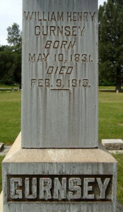
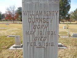
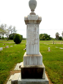
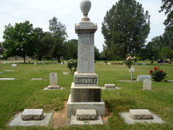
William Henry Gurnsey
| Birth | : | 10 May 1831 Jefferson County, New York, USA |
| Death | : | 9 Feb 1915 Red Bluff, Tehama County, California, USA |
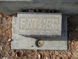
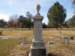
| Burial | : | Oak Hill Cemetery, Red Bluff, Tehama County, USA |
| Coordinate | : | 40.1699982, -122.2433014 |
| Plot | : | Block HH, Row 5, Grave 16 |
| Description | : | Son of Van Rensselaer Garnsey Birth 27 Aug 1806 in Ellisburg, Jefferson, New York Death 17 Mar 1845 in St. Lawerence Co. N.Y. and Miranda Persons Garnsey Clark Nash Birth ABT 1814 in New York Death 06 May 1889 in Red Bluff, Tehama, CA |
frequently asked questions (FAQ):
-
Where is William Henry Gurnsey's memorial?
William Henry Gurnsey's memorial is located at: Oak Hill Cemetery, Red Bluff, Tehama County, USA.
-
When did William Henry Gurnsey death?
William Henry Gurnsey death on 9 Feb 1915 in Red Bluff, Tehama County, California, USA
-
Where are the coordinates of the William Henry Gurnsey's memorial?
Latitude: 40.1699982
Longitude: -122.2433014
Family Members:
Spouse
Children


Flowers:


Nearby Cemetories:
1. Red Bluff Memorial Chapel Mausoleum & Columbarium
Red Bluff, Tehama County, USA
Coordinate: 40.1717130, -122.2466860
2. Saint Mary's Cemetery
Red Bluff, Tehama County, USA
Coordinate: 40.1716995, -122.2521973
3. Growney Ranch Family Cemetery
Red Bluff, Tehama County, USA
Coordinate: 40.1167300, -122.1952500
4. Los Molinos Cemetery
Los Molinos, Tehama County, USA
Coordinate: 40.0475650, -122.1011820
5. Tehama Cemetery
Tehama, Tehama County, USA
Coordinate: 40.0233002, -122.1433029
6. Red Bank Cemetery
Red Bank, Tehama County, USA
Coordinate: 40.1036970, -122.4458540
7. Inks Creek Cemetery
Tehama County, USA
Coordinate: 40.3419800, -122.1297100
8. Cottonwood Creek Ranch Cemetery
Cottonwood, Shasta County, USA
Coordinate: 40.3663100, -122.2598800
9. Cottonwood Cemetery
Cottonwood, Shasta County, USA
Coordinate: 40.3856100, -122.2936500
10. Major Pierson B Reading Family Cemetery
Cottonwood, Shasta County, USA
Coordinate: 40.3924300, -122.2126900
11. Sunset Hill Cemetery
Corning, Tehama County, USA
Coordinate: 39.9271600, -122.1586100
12. Sleepy Hollow Pet Cemetery
Anderson, Shasta County, USA
Coordinate: 40.4199430, -122.2858410
13. Rosewood Cemetery
Rosewood, Tehama County, USA
Coordinate: 40.2685360, -122.5575190
14. New Clairvaux Abbey Cemetery
Vina, Tehama County, USA
Coordinate: 39.9381450, -122.0641890
15. Anderson District Cemetery
Anderson, Shasta County, USA
Coordinate: 40.4419518, -122.2967300
16. Oddfellows Cemetery
Anderson, Shasta County, USA
Coordinate: 40.4431590, -122.2907070
17. Anderson Pioneer Cemetery
Anderson, Shasta County, USA
Coordinate: 40.4439011, -122.2904968
18. Vina Cemetery
Vina, Tehama County, USA
Coordinate: 39.9636440, -121.9957070
19. Lowrey Cemetery
Tehama County, USA
Coordinate: 40.0066986, -122.5635986
20. Cameron-Davis Cemetery
Tehama County, USA
Coordinate: 40.2709800, -121.8778500
21. Parkville Cemetery
Anderson, Shasta County, USA
Coordinate: 40.4640200, -122.1897500
22. Lanes Valley Cemetery
Paynes Creek, Tehama County, USA
Coordinate: 40.3998400, -121.9762400
23. Pinckney Cemetery
Cottonwood, Shasta County, USA
Coordinate: 40.3997002, -122.5180969
24. Kirkwood Cemetery
Corning, Tehama County, USA
Coordinate: 39.8624992, -122.1519012