
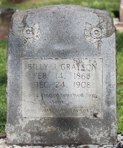
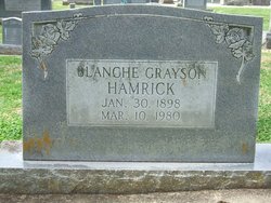
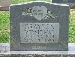
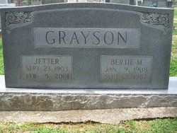
William J. S. “Billy” Grayson
| Birth | : | 14 Feb 1868 North Carolina, USA |
| Death | : | 24 Dec 1908 |
| Burial | : | Golden Valley United Methodist Church Cemetery, Bostic, Rutherford County, USA |
| Coordinate | : | 35.5203018, -81.7900009 |
| Description | : | s/o John S and Minerva Jones Grayson |
frequently asked questions (FAQ):
-
Where is William J. S. “Billy” Grayson's memorial?
William J. S. “Billy” Grayson's memorial is located at: Golden Valley United Methodist Church Cemetery, Bostic, Rutherford County, USA.
-
When did William J. S. “Billy” Grayson death?
William J. S. “Billy” Grayson death on 24 Dec 1908 in
-
Where are the coordinates of the William J. S. “Billy” Grayson's memorial?
Latitude: 35.5203018
Longitude: -81.7900009
Family Members:
Parent

Spouse
Siblings
Children
Flowers:


Nearby Cemetories:
1. Golden Valley United Methodist Church Cemetery
Bostic, Rutherford County, USA
Coordinate: 35.5203018, -81.7900009
2. Mooney-Van Zandt Cemetery
Rutherford County, USA
Coordinate: 35.5335800, -81.7932500
3. Golden Valley Church of the Brethren Cemetery
Sunshine, Rutherford County, USA
Coordinate: 35.5368800, -81.7974200
4. Fairview Church Cemetery
Forest City, Rutherford County, USA
Coordinate: 35.5409640, -81.8010940
5. Fortune Cemetery
Rutherford County, USA
Coordinate: 35.5092010, -81.7647018
6. Weast Cemetery
Sunshine, Rutherford County, USA
Coordinate: 35.5341320, -81.8145960
7. First Broad Baptist Church Cemetery
Bostic, Rutherford County, USA
Coordinate: 35.5176770, -81.7543960
8. Golden Valley Missionary Methodist Church Cemetery
Bostic, Rutherford County, USA
Coordinate: 35.4961700, -81.7678800
9. Cooper Springs Congregational Holiness Church Ceme
Rutherford County, USA
Coordinate: 35.4755700, -81.7844540
10. Cane Creek Baptist Church Cemetery
Union Mills, Rutherford County, USA
Coordinate: 35.5222250, -81.8530630
11. Mount Harmony Baptist Church Cemetery
Bostic, Rutherford County, USA
Coordinate: 35.4588380, -81.7996940
12. Ross Hill Baptist Church Cemetery
Bostic, Rutherford County, USA
Coordinate: 35.4575280, -81.7922220
13. Silver Creek Knob
Burke County, USA
Coordinate: 35.5835000, -81.7970000
14. Duncans Creek Presbyterian Church Cemetery
Hollis, Rutherford County, USA
Coordinate: 35.4742680, -81.7276620
15. Diviney Cemetery
Duncans Creek, Rutherford County, USA
Coordinate: 35.5143920, -81.7042200
16. Fellowship Baptist Church Cemetery
Bostic, Rutherford County, USA
Coordinate: 35.5650630, -81.7235360
17. Cedar Grove United Methodist Church Cemetery
Rutherford County, USA
Coordinate: 35.4506110, -81.8097540
18. Fork Creek Baptist Church Cemetery
Rutherford County, USA
Coordinate: 35.5249710, -81.8802872
19. Kirksey Family Cemetery
McDowell County, USA
Coordinate: 35.5810600, -81.8431900
20. Sweezy-Murray Family Cemetery
Rutherford County, USA
Coordinate: 35.4432090, -81.7671363
21. Sandy Level Baptist Cemetery
Bostic, Rutherford County, USA
Coordinate: 35.4591400, -81.8520440
22. Mount Pleasant Baptist Church Cemetery
Rutherford County, USA
Coordinate: 35.5509280, -81.6976340
23. Freedom Baptist Church Cemetery
McDowell County, USA
Coordinate: 35.5883900, -81.8445700
24. Pisgah United Methodist Church Cemetery
Rutherfordton, Rutherford County, USA
Coordinate: 35.4770130, -81.8799750