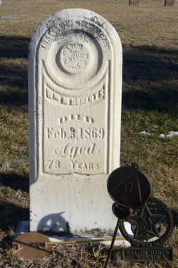
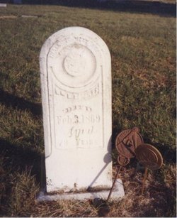
William Martin Roberts
| Birth | : | 12 Jun 1791 Enosburg, Franklin County, Vermont, USA |
| Death | : | 3 Feb 1869 Dunlap, Harrison County, Iowa, USA |
| Burial | : | Haydon Bridge Churchyard Extension, Haydon Bridge, Northumberland Unitary Authority, England |
| Coordinate | : | 54.9766250, -2.2478820 |
| Plot | : | Block 14 Row 7 |
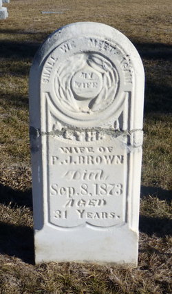
| Inscription | : | Father/Mason Age 78 years |
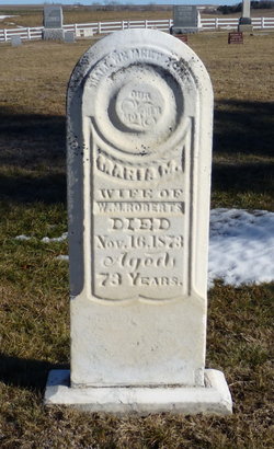
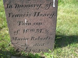
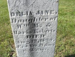
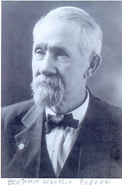
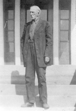
| Description | : | Among the early settlers of Harrison Township [Iowa] was William M. ROBERTS, a native of Vermont, of Welch and Scotch parentage. When a young man he left his native state and settled in Connecticut. In 1818 he was married to Maria MACK, a native of Watertown, Conn. Thirteen children were the result of this marriage, nine sons and four daughters. Two sons, two daughters having died previous to his removal to Iowa, they, therefore occupy no important place in this history. Of the remaining sons and daughters we will make especial mention herafter. Mr. ROBERTS, for many years after... Read More |
frequently asked questions (FAQ):
-
Where is William Martin Roberts's memorial?
William Martin Roberts's memorial is located at: Haydon Bridge Churchyard Extension, Haydon Bridge, Northumberland Unitary Authority, England.
-
When did William Martin Roberts death?
William Martin Roberts death on 3 Feb 1869 in Dunlap, Harrison County, Iowa, USA
-
Where are the coordinates of the William Martin Roberts's memorial?
Latitude: 54.9766250
Longitude: -2.2478820
Family Members:
Spouse
Children
Flowers:
Nearby Cemetories:
1. Haydon Bridge Churchyard Extension
Haydon Bridge, Northumberland Unitary Authority, England
Coordinate: 54.9766250, -2.2478820
2. St Cuthbert Churchyard
Haydon Bridge, Northumberland Unitary Authority, England
Coordinate: 54.9740620, -2.2473570
3. Haydon Old Churchyard
Haydon Bridge, Northumberland Unitary Authority, England
Coordinate: 54.9818710, -2.2483010
4. Haydon Bridge Cemetery
Haydon Bridge, Northumberland Unitary Authority, England
Coordinate: 54.9694700, -2.2467715
5. St. Cuthbert's Churchyard
Beltingham, Northumberland Unitary Authority, England
Coordinate: 54.9694330, -2.3305080
6. Beltingham Cemetery
Beltingham, Northumberland Unitary Authority, England
Coordinate: 54.9690700, -2.3312200
7. St Andrew's Cemetery
Haydon Bridge, Northumberland Unitary Authority, England
Coordinate: 54.9788680, -2.1276850
8. Hexham Cemetery
Hexham, Northumberland Unitary Authority, England
Coordinate: 54.9788580, -2.1276740
9. All Hallows Churchyard
Henshaw, Northumberland Unitary Authority, England
Coordinate: 54.9731030, -2.3704408
10. St. Cuthbert's Churchyard
Allendale, Northumberland Unitary Authority, England
Coordinate: 54.8978260, -2.2545020
11. Keenley Methodist Chapel Graveyard
Allendale, Northumberland Unitary Authority, England
Coordinate: 54.9053170, -2.3075580
12. Friends Meeting House
Allendale, Northumberland Unitary Authority, England
Coordinate: 54.8957750, -2.2598490
13. St John of Beverley Churchyard
Acomb, Northumberland Unitary Authority, England
Coordinate: 54.9859680, -2.1061560
14. St John Lee, St John of Beverley Old Churchyard
Hexham, Northumberland Unitary Authority, England
Coordinate: 54.9860620, -2.1056870
15. St. John Lee of Beverley New Churchyard
Acomb, Northumberland Unitary Authority, England
Coordinate: 54.9861290, -2.1049280
16. Allendale Old Cemetery
Allendale, Northumberland Unitary Authority, England
Coordinate: 54.8941650, -2.2612690
17. St Mary Roman Catholic Churchyard
Hexham, Northumberland Unitary Authority, England
Coordinate: 54.9697070, -2.1040520
18. Hexham Abbey
Hexham, Northumberland Unitary Authority, England
Coordinate: 54.9715940, -2.1026190
19. Allendale Woodland Cemetery
Allendale, Northumberland Unitary Authority, England
Coordinate: 54.8932624, -2.2618136
20. St Peter's Churchyard
Humshaugh, Northumberland Unitary Authority, England
Coordinate: 55.0368780, -2.1264880
21. St Giles Churchyard
Chollerton, Northumberland Unitary Authority, England
Coordinate: 55.0414100, -2.1094900
22. High House Methodist Chapel Graveyard
Allendale, Northumberland Unitary Authority, England
Coordinate: 54.8844090, -2.3285218
23. Cowburn Primitive Methodist Chapel
Cowburn, Northumberland Unitary Authority, England
Coordinate: 55.0034880, -2.4323380
24. Dilston Castle Chapelyard
Corbridge, Northumberland Unitary Authority, England
Coordinate: 54.9639270, -2.0393460

