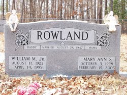
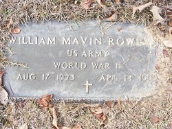
William Marvin Rowland Jr.
| Birth | : | 17 Aug 1923 Union County, Arkansas, USA |
| Death | : | 14 Apr 1999 El Dorado, Union County, Arkansas, USA |
| Burial | : | Wise Cemetery, Winchester, Jefferson County, USA |
| Coordinate | : | 39.3107986, -95.2485962 |
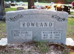
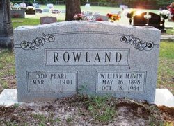
| Description | : | William Marvin "Junior" Rowland, Jr. was born August 17, 1923, in Union County, Arkansas to William Marvin Rowland, Sr. and his wife, Pearl Graves. William Marvin married Mary Ann Stegall August 28, 1947, in Union County. Mary Ann was born October 5, 1928, in Union County. Mary Ann and "Junior" had six children: Judy Kay, Danny Leroy, William Eugene "Gene," Richard Clyde "Ricky," Tommy Wayne and Terry Dean. |
frequently asked questions (FAQ):
-
Where is William Marvin Rowland Jr.'s memorial?
William Marvin Rowland Jr.'s memorial is located at: Wise Cemetery, Winchester, Jefferson County, USA.
-
When did William Marvin Rowland Jr. death?
William Marvin Rowland Jr. death on 14 Apr 1999 in El Dorado, Union County, Arkansas, USA
-
Where are the coordinates of the William Marvin Rowland Jr.'s memorial?
Latitude: 39.3107986
Longitude: -95.2485962
Family Members:
Parent
Spouse
Children
Flowers:
Nearby Cemetories:
1. Wise Cemetery
Winchester, Jefferson County, USA
Coordinate: 39.3107986, -95.2485962
2. Reformed Presbyterian Church Cemetery
Winchester, Jefferson County, USA
Coordinate: 39.3258100, -95.2680400
3. Wright Family Cemetery
Winchester, Jefferson County, USA
Coordinate: 39.2817200, -95.2519200
4. Plum Grove Cemetery
Winchester, Jefferson County, USA
Coordinate: 39.2672005, -95.2794037
5. Hull Grove Cemetery
Winchester, Jefferson County, USA
Coordinate: 39.3630981, -95.2435989
6. Lamar-Rogers Cemetery
Jefferson County, USA
Coordinate: 39.3867400, -95.2604900
7. Spring Grove Cemetery
Winchester, Jefferson County, USA
Coordinate: 39.3272018, -95.3471985
8. Corpus Christi Cemetery
Winchester, Jefferson County, USA
Coordinate: 39.3908005, -95.2394028
9. County Poor Farm Cemetery
Jefferson County, USA
Coordinate: 39.2343050, -95.2842700
10. Langley Cemetery
Easton, Leavenworth County, USA
Coordinate: 39.3616982, -95.1611023
11. Fowler Cemetery
McLouth, Jefferson County, USA
Coordinate: 39.2383003, -95.1911011
12. Sparks Cemetery
Easton, Leavenworth County, USA
Coordinate: 39.2958336, -95.1355591
13. Springdale Cemetery
Springdale, Leavenworth County, USA
Coordinate: 39.2672200, -95.1413900
14. Saint Lawrence Cemetery
Easton, Leavenworth County, USA
Coordinate: 39.3443985, -95.1335983
15. Easton Cemetery
Easton, Leavenworth County, USA
Coordinate: 39.3395882, -95.1237793
16. Fairview Cemetery
Dunavant, Jefferson County, USA
Coordinate: 39.2672005, -95.3672028
17. Hart Cemetery
Boyle, Jefferson County, USA
Coordinate: 39.3770485, -95.3482819
18. Pleasant View Cemetery
Oskaloosa, Jefferson County, USA
Coordinate: 39.2224998, -95.3167038
19. Ebenezer Amish Mennonite Church Cemetery
Oskaloosa, Jefferson County, USA
Coordinate: 39.2156400, -95.3218500
20. Saint Thomas Cemetery
Springdale, Leavenworth County, USA
Coordinate: 39.2597008, -95.1192017
21. Friends Church Cemetery
Springdale, Leavenworth County, USA
Coordinate: 39.2532800, -95.1237100
22. Stranger Creek Cemetery
Easton, Leavenworth County, USA
Coordinate: 39.3211100, -95.1016700
23. Evergreen Cemetery
Millwood, Leavenworth County, USA
Coordinate: 39.3833008, -95.1333008
24. Old Methodist Cemetery
Oskaloosa, Jefferson County, USA
Coordinate: 39.2093700, -95.3251400

