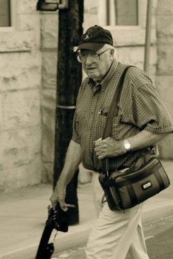
| Birth | : | 15 Feb 1932 Mount Airy, Surry County, North Carolina, USA |
| Death | : | 7 Sep 2004 Mount Airy, Surry County, North Carolina, USA |
| Burial | : | Koshkonong Cemetery, Koshkonong, Oregon County, USA |
| Coordinate | : | 36.6055374, -91.6439133 |
| Description | : | MOUNT AIRY ~ William Seth Hiatt, 72, a former commissioner of the N.C. Department of Motor Vehicles and a retired state representative, of Westfield Road, Mount Airy, passed away Tuesday, Sept. 7, 2004, at Northern Hospital of Surry County after a long and courageous battle with a lengthy illness. He was born in Surry County on Feb. 15, 1932, to the late David Lafayette and Ethel Puckett Hiatt. One of 11 children, Mr. Hiatt grew up during the Depression years and worked his way through Brigham Young University starting at the young age of 16. He became a wonderful teacher... Read More |
frequently asked questions (FAQ):
-
Where is William Seth “Bill” Hiatt's memorial?
William Seth “Bill” Hiatt's memorial is located at: Koshkonong Cemetery, Koshkonong, Oregon County, USA.
-
When did William Seth “Bill” Hiatt death?
William Seth “Bill” Hiatt death on 7 Sep 2004 in Mount Airy, Surry County, North Carolina, USA
-
Where are the coordinates of the William Seth “Bill” Hiatt's memorial?
Latitude: 36.6055374
Longitude: -91.6439133
Family Members:
Parent
Spouse
Siblings
Flowers:
Nearby Cemetories:
1. Koshkonong Cemetery
Koshkonong, Oregon County, USA
Coordinate: 36.6055374, -91.6439133
2. Saint Elmo Cemetery
Koshkonong, Oregon County, USA
Coordinate: 36.5840600, -91.6332800
3. Bussell Cemetery
Koshkonong, Oregon County, USA
Coordinate: 36.5667114, -91.6678009
4. Bridges Cemetery
Koshkonong, Oregon County, USA
Coordinate: 36.6495209, -91.6409683
5. Wayside Cemetery
Brandsville, Howell County, USA
Coordinate: 36.5722160, -91.6889343
6. Brandsville Cemetery
Brandsville, Howell County, USA
Coordinate: 36.6506195, -91.6873856
7. Walker Cemetery
Thayer, Oregon County, USA
Coordinate: 36.5985985, -91.5697021
8. Grand Gulf
Koshkonong, Oregon County, USA
Coordinate: 36.5443127, -91.6444665
9. Shiloh Cemetery
Thayer, Oregon County, USA
Coordinate: 36.5378990, -91.6444016
10. New Home Cemetery
Koshkonong, Oregon County, USA
Coordinate: 36.6199722, -91.5599289
11. Sergeant-Mount Olive Cemetery
Thayer, Oregon County, USA
Coordinate: 36.5634390, -91.5755830
12. Crazy Spring
Thayer, Oregon County, USA
Coordinate: 36.5818700, -91.5624100
13. Willard Dode Jones Farm Cemetery
Thayer, Oregon County, USA
Coordinate: 36.5808300, -91.5572300
14. Dode Jones Farm Cemetery
Sloan Ford, Oregon County, USA
Coordinate: 36.5804900, -91.5568800
15. Roth Cemetery
Sloan Ford, Oregon County, USA
Coordinate: 36.5808945, -91.5498657
16. Two Mile Cemetery
Thayer, Oregon County, USA
Coordinate: 36.5485700, -91.5748800
17. Warren Coats Farm Cemetery
Sloan Ford, Oregon County, USA
Coordinate: 36.5986700, -91.5438800
18. Blackjack Cemetery
Thayer, Oregon County, USA
Coordinate: 36.5210876, -91.6460648
19. Bledsaw Cemetery
Thayer, Oregon County, USA
Coordinate: 36.5595741, -91.5537949
20. Howell Cemetery
Koshkonong, Oregon County, USA
Coordinate: 36.6328011, -91.5306015
21. Clifton Cemetery
Sloan Ford, Oregon County, USA
Coordinate: 36.5677900, -91.5329000
22. Meltabarger Cemetery
West Plains, Howell County, USA
Coordinate: 36.6136017, -91.7658005
23. Meredith Cemetery
Lanton, Howell County, USA
Coordinate: 36.5394325, -91.7355804
24. McCameron Cemetery
Thayer, Oregon County, USA
Coordinate: 36.5103073, -91.6037903


