

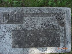
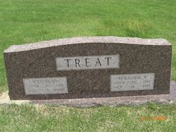
Willodean Still Treat
| Birth | : | 21 Jun 1918 Gilbert, Searcy County, Arkansas, USA |
| Death | : | 7 May 2002 Marshall, Searcy County, Arkansas, USA |
| Burial | : | Whitstable Cemetery, Whitstable, City of Canterbury, England |
| Coordinate | : | 51.3529870, 1.0338530 |
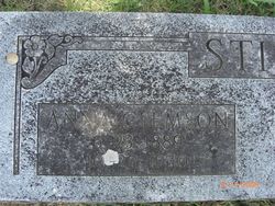
| Description | : | She was born to Uriah and Anna Clemson Still. She is preceeded in death by her parents, and her husband Benjamin F. Treat. She was 83 when she passed away,... According to her obit she was cremated, however she was buried here at Osborne. She has a stone there anyhow... |
frequently asked questions (FAQ):
-
Where is Willodean Still Treat's memorial?
Willodean Still Treat's memorial is located at: Whitstable Cemetery, Whitstable, City of Canterbury, England.
-
When did Willodean Still Treat death?
Willodean Still Treat death on 7 May 2002 in Marshall, Searcy County, Arkansas, USA
-
Where are the coordinates of the Willodean Still Treat's memorial?
Latitude: 51.3529870
Longitude: 1.0338530
Family Members:
Parent
Spouse
Siblings


Nearby Cemetories:
1. All Saints Churchyard
Whitstable, City of Canterbury, England
Coordinate: 51.3558090, 1.0396670
2. St Alphege Churchyard
Whitstable, City of Canterbury, England
Coordinate: 51.3576330, 1.0251080
3. St. Alphege's Churchyard
Seasalter, City of Canterbury, England
Coordinate: 51.3432041, 1.0041740
4. St John the Baptist Churchyard
Swalecliffe, City of Canterbury, England
Coordinate: 51.3645500, 1.0667200
5. St Cosmus and St Damian Churchyard
Blean, City of Canterbury, England
Coordinate: 51.3052720, 1.0530480
6. Herne Bay Cemetery
Herne Bay, City of Canterbury, England
Coordinate: 51.3571810, 1.1304820
7. All Saints Churchyard
Graveney, Swale Borough, England
Coordinate: 51.3261450, 0.9447880
8. St Martins
Herne, City of Canterbury, England
Coordinate: 51.3500600, 1.1333200
9. St Martin's Churchyard
Herne, City of Canterbury, England
Coordinate: 51.3497060, 1.1334370
10. St Michael Churchyard
Hernhill, Swale Borough, England
Coordinate: 51.3077430, 0.9612050
11. Canterbury City Cemetery
Canterbury, City of Canterbury, England
Coordinate: 51.2843285, 1.0637640
12. St Nicholas Hospital Church
Harbledown, City of Canterbury, England
Coordinate: 51.2828200, 1.0536580
13. Christ Church Churchyard
Dunkirk, Swale Borough, England
Coordinate: 51.2916540, 0.9741890
14. St Michael and All Angels Church
Harbledown, City of Canterbury, England
Coordinate: 51.2824590, 1.0556800
15. Canterbury Jewish Cemetery
Canterbury, City of Canterbury, England
Coordinate: 51.2846135, 1.0706660
16. St. Dunstan Churchyard
Canterbury, City of Canterbury, England
Coordinate: 51.2836820, 1.0707800
17. St Bartholomew Churchyard
Goodnestone, Dover District, England
Coordinate: 51.3166220, 0.9322200
18. Sturry Cemetery
Sturry, City of Canterbury, England
Coordinate: 51.3058100, 1.1277700
19. St. John the Baptist Hospital Chapelyard
Canterbury, City of Canterbury, England
Coordinate: 51.2832713, 1.0837677
20. Holy Cross Church
Canterbury, City of Canterbury, England
Coordinate: 51.2811350, 1.0755710
21. St Nicholas Churchyard
Sturry, City of Canterbury, England
Coordinate: 51.2984830, 1.1201330
22. Westgate Gardens
Canterbury, City of Canterbury, England
Coordinate: 51.2805250, 1.0745040
23. St Gregory's Priory (defunct)
Canterbury, City of Canterbury, England
Coordinate: 51.2831127, 1.0855358
24. St Peter the Apostle Churchyard
Canterbury, City of Canterbury, England
Coordinate: 51.2807260, 1.0775370