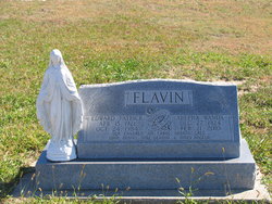
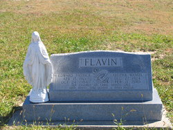
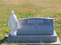
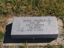
Xrepha Wanda Griffin Flavin
| Birth | : | 27 Dec 1924 Cassoday, Butler County, Kansas, USA |
| Death | : | 21 May 2010 Newton, Harvey County, Kansas, USA |
| Burial | : | Whenua Tapu Cemetery, Porirua, Porirua City, New Zealand |
| Coordinate | : | -41.0550200, 174.8757150 |
| Plot | : | Block 3 Lot 20 |
| Description | : | Xrepha Wanda Flavin-Martin, the daughter of Viola (Danby) and Elmer Griffin, was born December 27, 1924 at Cassody, Kansas. She departed this life on February 21, 2010 at the Newton Medical Center in Newton, Kansas. Xrepha spent her childhood years in Cassody and graduated from high school with the class of 1942. She continued her formal education in Wichita, where she studied for nursing training. It was here that she met and married Edward Patrick "Pat" Flavin on November 15, 1944. Pat and Xrepha made their home in Wichita for a number of years. Pursuing their love of farming, they later... Read More |
frequently asked questions (FAQ):
-
Where is Xrepha Wanda Griffin Flavin's memorial?
Xrepha Wanda Griffin Flavin's memorial is located at: Whenua Tapu Cemetery, Porirua, Porirua City, New Zealand.
-
When did Xrepha Wanda Griffin Flavin death?
Xrepha Wanda Griffin Flavin death on 21 May 2010 in Newton, Harvey County, Kansas, USA
-
Where are the coordinates of the Xrepha Wanda Griffin Flavin's memorial?
Latitude: -41.0550200
Longitude: 174.8757150
Family Members:
Parent
Spouse
Siblings
Children
Flowers:
Nearby Cemetories:
1. Whenua Tapu Cemetery
Porirua, Porirua City, New Zealand
Coordinate: -41.0550200, 174.8757150
2. Hongoeka Urupā
Plimmerton, Porirua City, New Zealand
Coordinate: -41.0651560, 174.8525070
3. Plimmerton Urupā
Plimmerton, Porirua City, New Zealand
Coordinate: -41.0822790, 174.8641890
4. Pukerua Bay Urupā
Pukerua Bay, Porirua City, New Zealand
Coordinate: -41.0300425, 174.8969530
5. Battle Hill Burial Ground
Wellington, Wellington City, New Zealand
Coordinate: -41.0578590, 174.9352810
6. Pauatahanui Burial Ground
Pauatahanui, Porirua City, New Zealand
Coordinate: -41.1068190, 174.9173310
7. Saint Albans Burial Ground
Pauatahanui, Porirua City, New Zealand
Coordinate: -41.1067240, 174.9179340
8. Bradey Grave
Whitby, Porirua City, New Zealand
Coordinate: -41.1173161, 174.9056161
9. St Josephs Catholic Cemetery
Pauatahanui, Porirua City, New Zealand
Coordinate: -41.1135060, 174.9196220
10. Mataiwhetu St Urupā
Takapuwahia, Porirua City, New Zealand
Coordinate: -41.1208070, 174.8364500
11. Takapu Urupā
Takapuwahia, Porirua City, New Zealand
Coordinate: -41.1203960, 174.8330360
12. Ngati Toa Street Urupā
Takapuwahia, Porirua City, New Zealand
Coordinate: -41.1264070, 174.8344310
13. Porirua Cemetery
Porirua, Porirua City, New Zealand
Coordinate: -41.1453640, 174.8420300
14. Mira Family Urupā
Paraparaumu, Kapiti Coast District, New Zealand
Coordinate: -40.9753380, 174.9643460
15. Tawa Flat Cemetery
Tawa, Wellington City, New Zealand
Coordinate: -41.1580600, 174.8281800
16. Grasslees Reserve
Tawa, Wellington City, New Zealand
Coordinate: -41.1647415, 174.8284302
17. MacKay Family Cemetery
Kapiti Coast District, New Zealand
Coordinate: -40.9726800, 174.9833330
18. Christ Church Anglican Cemetery
Taita, Lower Hutt City, New Zealand
Coordinate: -41.1820960, 174.9600920
19. St. John's Anglican Churchyard Cemetery
Trentham, Upper Hutt City, New Zealand
Coordinate: -41.1303100, 175.0443500
20. Taita Old Cemetery
Naenae, Lower Hutt City, New Zealand
Coordinate: -41.1945700, 174.9564000
21. Boulcott Farm Cemetery
Lower Hutt, Lower Hutt City, New Zealand
Coordinate: -41.2030590, 174.9272750
22. Knox Presbyterian Church Cemetery
Lower Hutt, Lower Hutt City, New Zealand
Coordinate: -41.1965430, 174.9579920
23. Taita Lawn Cemetery
Naenae, Lower Hutt City, New Zealand
Coordinate: -41.1968900, 174.9634900
24. Bridge Street Cemetery
Lower Hutt, Lower Hutt City, New Zealand
Coordinate: -41.2117740, 174.8969660


