
| Memorials | : | 0 |
| Location | : | Andalsnes, Rauma kommune, Norway |
| Coordinate | : | 62.5649430, 7.6819810 |
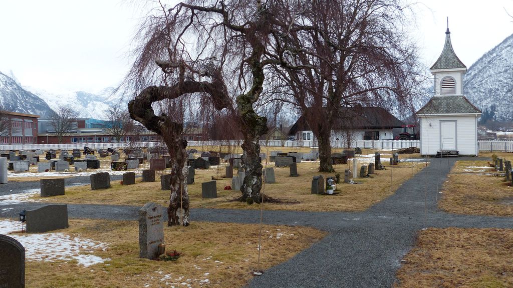
| Description | : | Andalsnes is a village in the province of More Og Romsdal, situated on Route E136. On travelling from the south turn right at the T junction towards Andalsnes. Follow this road under the bridge and at the roundabout take the third exit into Storgata. Follow this road to the "S Marked" (a local supermarket) and then turn left into Kansvegen. Follow along Kansvegen and take the first turning on the left into Kapellvegen; the cemetery is at the end of the road. |
frequently asked questions (FAQ):
-
Where is Aandalsnes Church Cemetery?
Aandalsnes Church Cemetery is located at Andalsnes, Rauma kommune ,Møre og Romsdal fylke ,Norway.
-
Aandalsnes Church Cemetery cemetery's updated grave count on graveviews.com?
0 memorials
-
Where are the coordinates of the Aandalsnes Church Cemetery?
Latitude: 62.5649430
Longitude: 7.6819810
Nearby Cemetories:
1. Grytten Churchyard
Andalsnes, Rauma kommune, Norway
Coordinate: 62.5526010, 7.6725270
2. Hen Churchyard
Andalsnes, Rauma kommune, Norway
Coordinate: 62.5774668, 7.7914010
3. Sandnes Cemetery
Afarnes, Rauma kommune, Norway
Coordinate: 62.6313000, 7.5198540
4. Sekken kyrkje
Molde kommune, Norway
Coordinate: 62.6606700, 7.3823400
5. Røvik Cemetery
Rovika, Molde kommune, Norway
Coordinate: 62.7320560, 7.4241730
6. Eresfjord Cemetery
Nesset kommune, Norway
Coordinate: 62.6659420, 8.1129100
7. Kleive Cemetery
Kleive, Molde kommune, Norway
Coordinate: 62.7991406, 7.6556246
8. Tøndergaard Gravlund
Molde kommune, Norway
Coordinate: 62.7418120, 7.2093450
9. Vestnes Church Cemetery
Vestnes, Vestnes kommune, Norway
Coordinate: 62.6277670, 7.0842080
10. Øverdalen Gravsted
Andalsnes, Rauma kommune, Norway
Coordinate: 62.3356460, 8.0683020
11. Molde Nedre Cemetery
Molde kommune, Norway
Coordinate: 62.7388170, 7.1544200
12. Molde Upper Cemetery
Molde, Molde kommune, Norway
Coordinate: 62.7392100, 7.1533500
13. Osmarka Bedehus Cemetery
Gjemnes kommune, Norway
Coordinate: 62.8653140, 7.8751580
14. Øre
Gjemnes kommune, Norway
Coordinate: 62.9200000, 7.7542000
15. Stordal Gamle Kirke
Stordal, Stordal kommune, Norway
Coordinate: 62.3839700, 7.0143400
16. Myrbostad Cemetery
Elnesvågen, Fræna kommune, Norway
Coordinate: 62.8525444, 7.2150454
17. Hestadholen gravkapell
Fræna kommune, Norway
Coordinate: 62.7872570, 7.0685344
18. Stordal Nye Kirke
Stordal, Stordal kommune, Norway
Coordinate: 62.3826000, 7.0008000
19. Eide nye kirkegård
Eide, Eide kommune, Norway
Coordinate: 62.9182171, 7.4394277
20. Noddal Cemetery
Eidsdal, Norddal kommune, Norway
Coordinate: 62.2559322, 7.2371636
21. Øksendal Old Cemetery
Oksendalsora, Sunndal kommune, Norway
Coordinate: 62.7139050, 8.4293530
22. Øksendal Cemetery
Oksendalsora, Sunndal kommune, Norway
Coordinate: 62.7166020, 8.4310220
23. Vågøy Cemetery
Fræna kommune, Norway
Coordinate: 62.8227080, 7.0297509
24. Orskog Church Cemetery
Ørskog kommune, Norway
Coordinate: 62.4789930, 6.8135780