
| Memorials | : | 0 |
| Location | : | Wrightsville, Johnson County, USA |
| Coordinate | : | 32.7416590, -82.7732390 |
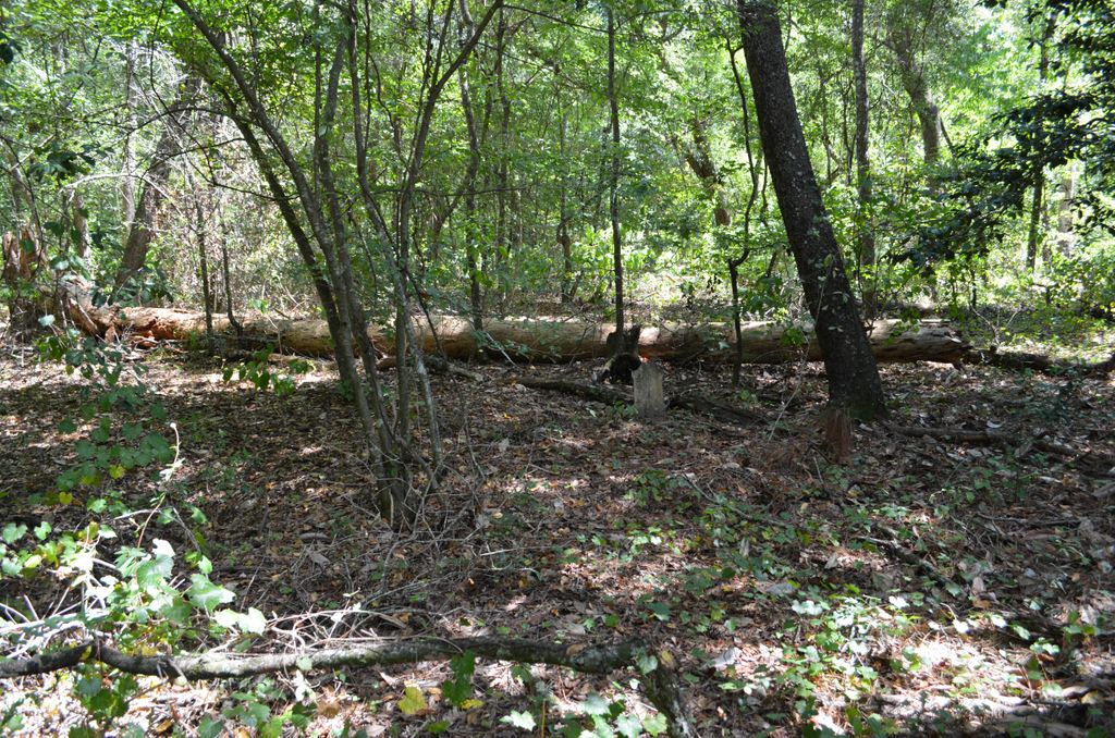
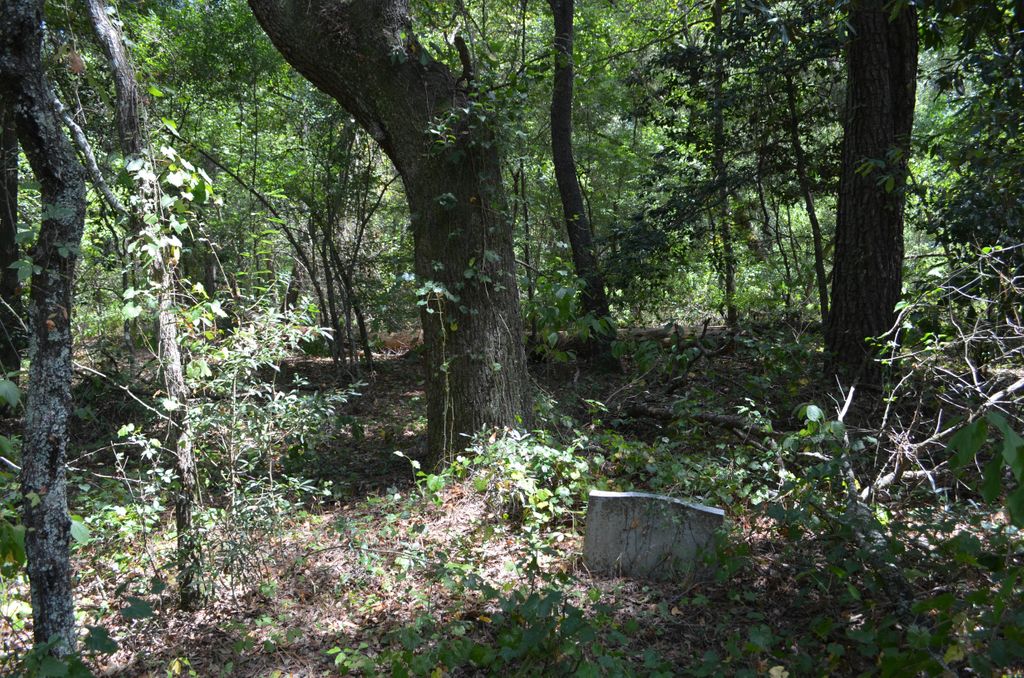
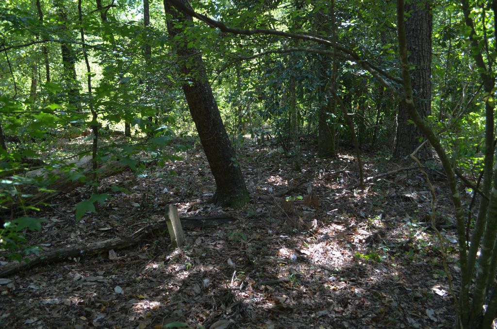
| Description | : | Surname is spelled Rains on the graves. Go about two and half miles west on Hwy. 57 from Wrightsville city limits. Turn right at Tucker Grove Church Road. Go about three fourths of a mile, you will see a dirt path on your right. You can park here. Follow the path going around the back side of the pine tree grove that's on your right. Once you get around back of the pine trees, start looking to your left and look for the biggest oak tree you can find. It will be about 30 feet in the woods. Julia Raines Johnson... Read More |
frequently asked questions (FAQ):
-
Where is John M. Raines Cemetery?
John M. Raines Cemetery is located at Wrightsville, Johnson County ,Georgia ,USA.
-
John M. Raines Cemetery cemetery's updated grave count on graveviews.com?
0 memorials
-
Where are the coordinates of the John M. Raines Cemetery?
Latitude: 32.7416590
Longitude: -82.7732390
Nearby Cemetories:
1. Price Parker Cemetery
Wrightsville, Johnson County, USA
Coordinate: 32.7486200, -82.7710400
2. McAfee Family Cemetery
Johnson County, USA
Coordinate: 32.7463270, -82.7838510
3. Vickers Hill Baptist Church Cemetery
Wrightsville, Johnson County, USA
Coordinate: 32.7509940, -82.7570824
4. Maddux Cemetery
Wrightsville, Johnson County, USA
Coordinate: 32.7242610, -82.7768500
5. U. R. Jenkins Cemetery
Wrightsville, Johnson County, USA
Coordinate: 32.7667780, -82.7777660
6. Price-Knight Cemetery
Johnson County, USA
Coordinate: 32.7602220, -82.7970040
7. West View Cemetery
Wrightsville, Johnson County, USA
Coordinate: 32.7310982, -82.7319031
8. Mount Pleasant AME Church Cemetery
Wrightsville, Johnson County, USA
Coordinate: 32.7561070, -82.8167000
9. Dent Cemetery
Johnson County, USA
Coordinate: 32.7275009, -82.8189011
10. Walker Cemetery
Wrightsville, Johnson County, USA
Coordinate: 32.7130300, -82.8110400
11. Mitchell Grove Baptist Church Cemetery
Wrightsville, Johnson County, USA
Coordinate: 32.6987990, -82.7770830
12. Williams Cemetery
Johnson County, USA
Coordinate: 32.7024994, -82.7966995
13. Home Circle Cemetery
Wrightsville, Johnson County, USA
Coordinate: 32.7358670, -82.7164980
14. Abattoir Cemetery
Wrightsville, Johnson County, USA
Coordinate: 32.7341700, -82.7157100
15. Galilee Church Cemetery
Wrightsville, Johnson County, USA
Coordinate: 32.7059010, -82.7299100
16. Pine Grove AME Church Cemetery
Donovan, Johnson County, USA
Coordinate: 32.7698610, -82.7221440
17. Pleasant Grove Baptist Church Cemetery
Wrightsville, Johnson County, USA
Coordinate: 32.6900690, -82.7841220
18. Bethel Methodist Church Cemetery
Wrightsville, Johnson County, USA
Coordinate: 32.7582110, -82.8327670
19. Old Dent Cemetery
Wrightsville, Johnson County, USA
Coordinate: 32.7150500, -82.8290500
20. Sumner-Anthony Cemetery
Wrightsville, Johnson County, USA
Coordinate: 32.7034264, -82.7170105
21. Community Missionary Baptist Church Cemetery
Wrightsville, Johnson County, USA
Coordinate: 32.7030550, -82.7140480
22. Lovett Grove Community Baptist Church Cemetery
Wrightsville, Johnson County, USA
Coordinate: 32.6800750, -82.7399620
23. Ivey Baptist Church Cemetery
Wrightsville, Johnson County, USA
Coordinate: 32.7430970, -82.8560980
24. Brantley Chapel Church Cemetery
Wrightsville, Johnson County, USA
Coordinate: 32.6779300, -82.7384700