
| Memorials | : | 9 |
| Location | : | Topeka, Shawnee County, USA |
| Coordinate | : | 39.0102997, -95.7685776 |
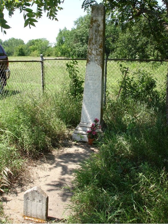
| Description | : | Turn south off SW 29th Street onto Lincolnshire Rd. or Arvonia Place, which are about half way between Wanamaker and Urish Roads. Follow the street until the two streets join at SW 32nd Street where you will find a narrow road that will pass through a gate with a sign "Private Drive, No Trespassing". (Owner permits access to burial site.) Pass through the gate and turn left to follow a path of grass about a tenth of a mile where it deadends at the grave, which is surrounded by a fence. |
frequently asked questions (FAQ):
-
Where is Abram Burnett Burial Site?
Abram Burnett Burial Site is located at Topeka, Shawnee County ,Kansas ,USA.
-
Abram Burnett Burial Site cemetery's updated grave count on graveviews.com?
9 memorials
-
Where are the coordinates of the Abram Burnett Burial Site?
Latitude: 39.0102997
Longitude: -95.7685776
Nearby Cemetories:
1. Mission Center Cemetery
Topeka, Shawnee County, USA
Coordinate: 39.0145493, -95.7819290
2. Elevation Cemetery
Shawnee County, USA
Coordinate: 38.9832993, -95.7613983
3. Mount Hope Cemetery
Topeka, Shawnee County, USA
Coordinate: 39.0367393, -95.7386703
4. Saint Davids Episcopal Church Columbarium
Topeka, Shawnee County, USA
Coordinate: 39.0369860, -95.7259480
5. Mount Calvary Cemetery
Topeka, Shawnee County, USA
Coordinate: 39.0532990, -95.7360992
6. Foster Cemetery
Topeka, Shawnee County, USA
Coordinate: 38.9942017, -95.7061005
7. Ritchie Cemetery
Topeka, Shawnee County, USA
Coordinate: 39.0228010, -95.7027530
8. Security Benefit Association Cemetery
Topeka, Shawnee County, USA
Coordinate: 39.0630989, -95.7606583
9. West Lawn Memorial Gardens
Topeka, Shawnee County, USA
Coordinate: 39.0518112, -95.8167419
10. Carnegie Hall
Topeka, Shawnee County, USA
Coordinate: 39.0350600, -95.6999100
11. Westminster Presbyterian Church Memorial Garden
Topeka, Shawnee County, USA
Coordinate: 39.0430400, -95.7021700
12. Memorial Park Cemetery
Topeka, Shawnee County, USA
Coordinate: 39.0619011, -95.7221985
13. Topeka State Hospital Cemetery
Topeka, Shawnee County, USA
Coordinate: 39.0671005, -95.7080994
14. Grace Episcopal Cathedral Columbarium
Topeka, Shawnee County, USA
Coordinate: 39.0511284, -95.6843719
15. Grace Episcopal Cathedral Sanctuary
Topeka, Shawnee County, USA
Coordinate: 39.0506925, -95.6839273
16. Topeka Cemetery
Topeka, Shawnee County, USA
Coordinate: 39.0388985, -95.6528015
17. Mount Auburn Cemetery
Topeka, Shawnee County, USA
Coordinate: 39.0393982, -95.6500015
18. Simerwell Cemetery
Shawnee County, USA
Coordinate: 38.9132004, -95.7483597
19. Prairie Home Cemetery
Topeka, Shawnee County, USA
Coordinate: 39.1077118, -95.7482910
20. Valencia Cemetery
Valencia, Shawnee County, USA
Coordinate: 39.0586014, -95.8806000
21. Curtis Family Cemetery
North Topeka, Shawnee County, USA
Coordinate: 39.0792870, -95.6702270
22. Lynn Creek Cemetery
Berryton, Shawnee County, USA
Coordinate: 38.9575005, -95.6408005
23. Bennie Lee Graham Memorial Cemetery
Shawnee County, USA
Coordinate: 39.1020584, -95.6836472
24. Auburn Cemetery
Auburn, Shawnee County, USA
Coordinate: 38.9091988, -95.8341980