
| Memorials | : | 0 |
| Location | : | Shawnee County, USA |
| Coordinate | : | 39.1020584, -95.6836472 |
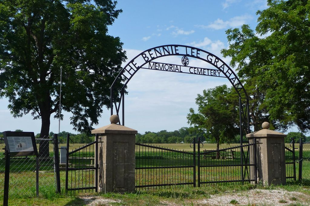
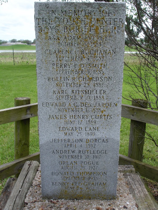
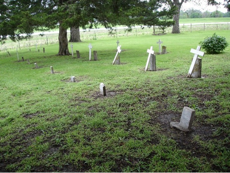
| Description | : | This "State Reform School" was established in 1879 and the facility opened in the summer of 1881. In 1901 it was named "The Boys' Industrial School at Topeka", (also known as B.I.S.). The name was changed to "The State Industrial School for Boys at Topeka", in 1907. The "Youth Center at Topeka" was the name it was known by in 1980. Then in 1997, it was named the "Topeka Juvenile Correctional Facility". In 2008, it became known as the "Kansas Juvenile Correctional Complex", which is its present name. The boys came here due to... Read More |
frequently asked questions (FAQ):
-
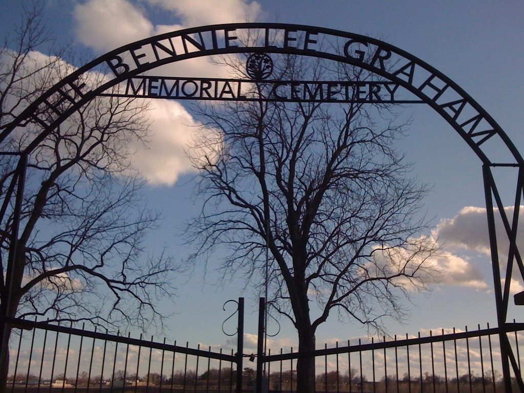
Where is Bennie Lee Graham Memorial Cemetery?
Bennie Lee Graham Memorial Cemetery is located at Shawnee County ,Kansas ,USA.
-
Bennie Lee Graham Memorial Cemetery cemetery's updated grave count on graveviews.com?
0 memorials
-
Where are the coordinates of the Bennie Lee Graham Memorial Cemetery?
Latitude: 39.1020584
Longitude: -95.6836472

Nearby Cemetories:
1. Rochester Cemetery
Topeka, Shawnee County, USA
Coordinate: 39.1044006, -95.6800003
2. Curtis Family Cemetery
North Topeka, Shawnee County, USA
Coordinate: 39.0792870, -95.6702270
3. Topeka State Hospital Cemetery
Topeka, Shawnee County, USA
Coordinate: 39.0671005, -95.7080994
4. Memorial Park Cemetery
Topeka, Shawnee County, USA
Coordinate: 39.0619011, -95.7221985
5. Prairie Home Cemetery
Topeka, Shawnee County, USA
Coordinate: 39.1077118, -95.7482910
6. Grace Episcopal Cathedral Columbarium
Topeka, Shawnee County, USA
Coordinate: 39.0511284, -95.6843719
7. Grace Episcopal Cathedral Sanctuary
Topeka, Shawnee County, USA
Coordinate: 39.0506925, -95.6839273
8. Westminster Presbyterian Church Memorial Garden
Topeka, Shawnee County, USA
Coordinate: 39.0430400, -95.7021700
9. Half-Day Cemetery
Elmont, Shawnee County, USA
Coordinate: 39.1584702, -95.7143402
10. Mount Calvary Cemetery
Topeka, Shawnee County, USA
Coordinate: 39.0532990, -95.7360992
11. Topeka Cemetery
Topeka, Shawnee County, USA
Coordinate: 39.0388985, -95.6528015
12. Mount Auburn Cemetery
Topeka, Shawnee County, USA
Coordinate: 39.0393982, -95.6500015
13. Carnegie Hall
Topeka, Shawnee County, USA
Coordinate: 39.0350600, -95.6999100
14. Security Benefit Association Cemetery
Topeka, Shawnee County, USA
Coordinate: 39.0630989, -95.7606583
15. Saint Davids Episcopal Church Columbarium
Topeka, Shawnee County, USA
Coordinate: 39.0369860, -95.7259480
16. Mount Hope Cemetery
Topeka, Shawnee County, USA
Coordinate: 39.0367393, -95.7386703
17. Ritchie Cemetery
Topeka, Shawnee County, USA
Coordinate: 39.0228010, -95.7027530
18. Old Grantville Cemetery
Grantville, Jefferson County, USA
Coordinate: 39.0949500, -95.5771300
19. Grantville Cemetery
Grantville, Jefferson County, USA
Coordinate: 39.0957400, -95.5745800
20. Foster Cemetery
Topeka, Shawnee County, USA
Coordinate: 38.9942017, -95.7061005
21. Abram Burnett Burial Site
Topeka, Shawnee County, USA
Coordinate: 39.0102997, -95.7685776
22. West Lawn Memorial Gardens
Topeka, Shawnee County, USA
Coordinate: 39.0518112, -95.8167419
23. Mission Center Cemetery
Topeka, Shawnee County, USA
Coordinate: 39.0145493, -95.7819290
24. Saint Aloysius Cemetery
Meriden, Jefferson County, USA
Coordinate: 39.1872482, -95.5795593