
| Memorials | : | 0 |
| Location | : | Calstock, Cornwall Unitary Authority, England |
| Coordinate | : | 50.5133240, -4.2225080 |
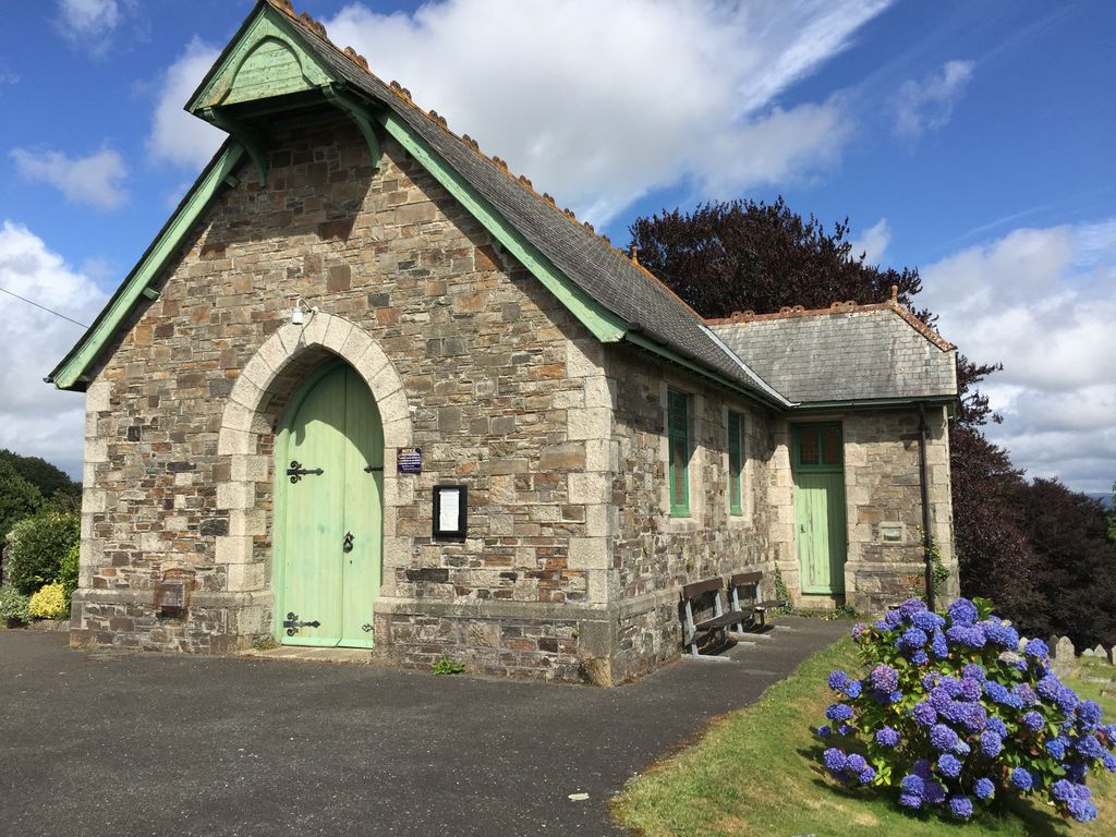
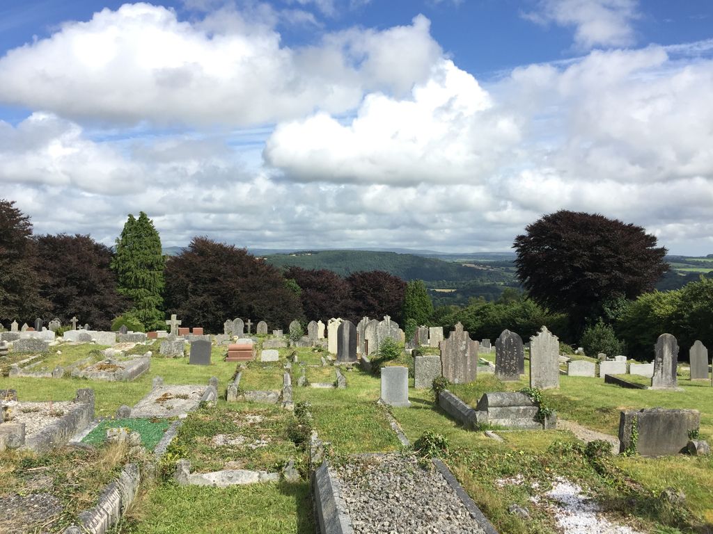
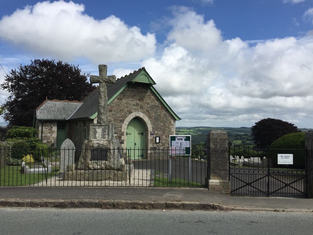
| Description | : | Albaston (Trevalba in Cornish) is a hamlet with a population of under 1,000 near the Devon border. It is located just south of the A390 (Sand Hill Road). Albaston is between Tavistock, Devon to the northeast, Callington to the west and Calstock to the south. The cemetery is located in Albaston near the Tamar Valley Centre on Cemetery Road. The Albaston Cemetery is gated and faces onto Cemetery Road with a stone wall. It is well maintained with a large War Memorial with names of those who fell in World War I & II and Korea in the... Read More |
frequently asked questions (FAQ):
-
Where is Albaston Cemetery?
Albaston Cemetery is located at Cemetery Road Calstock, Cornwall Unitary Authority ,Cornwall ,England.
-
Albaston Cemetery cemetery's updated grave count on graveviews.com?
0 memorials
-
Where are the coordinates of the Albaston Cemetery?
Latitude: 50.5133240
Longitude: -4.2225080
Nearby Cemetories:
1. Calstock Cemetery
Calstock, Cornwall Unitary Authority, England
Coordinate: 50.5021300, -4.2082100
2. St Andrew Churchyard
Calstock, Cornwall Unitary Authority, England
Coordinate: 50.5021270, -4.2062400
3. St. Paul Churchyard
Gulworthy, West Devon Borough, England
Coordinate: 50.5335800, -4.1918400
4. Holy Trinity Churchyard
Bere Alston, West Devon Borough, England
Coordinate: 50.4789735, -4.1881879
5. St Mary
Sydenham Damerel, West Devon Borough, England
Coordinate: 50.5617270, -4.2604490
6. St Mary Churchyard
Callington, Cornwall Unitary Authority, England
Coordinate: 50.5035020, -4.3158890
7. Buckland Monachorum Village Cemetery
Buckland Monachorum, West Devon Borough, England
Coordinate: 50.4962980, -4.1305260
8. St. Eustachius Churchyard
Tavistock, West Devon Borough, England
Coordinate: 50.5498420, -4.1451830
9. Saint Andrew's Churchyard
Buckland Monachorum, West Devon Borough, England
Coordinate: 50.4951167, -4.1302055
10. Tavistock Abbey
Tavistock, West Devon Borough, England
Coordinate: 50.5499060, -4.1442700
11. Callington Cemetery
Callington, Cornwall Unitary Authority, England
Coordinate: 50.4992660, -4.3194640
12. Lamerton Cemetery
Lamerton, West Devon Borough, England
Coordinate: 50.5736420, -4.1907340
13. St. Andrew's Churchyard
Whitchurch, West Devon Borough, England
Coordinate: 50.5347576, -4.1278369
14. St. Andrew's Churchyard
Bere Ferrers, West Devon Borough, England
Coordinate: 50.4505300, -4.1715320
15. St. John the Baptist
Horrabridge, West Devon Borough, England
Coordinate: 50.5079900, -4.0992400
16. St. Leonard & St. Dilpe Churchyard
Landulph, Cornwall Unitary Authority, England
Coordinate: 50.4324670, -4.2104830
17. St Mary's Botus Fleming
Botus Fleming, Cornwall Unitary Authority, England
Coordinate: 50.4298100, -4.2483700
18. Golberdon Methodist Burial Ground
Golberdon, Cornwall Unitary Authority, England
Coordinate: 50.5167500, -4.3605400
19. All Saints Churchyard
Dunterton, West Devon Borough, England
Coordinate: 50.5909760, -4.2958300
20. Treburley Cemetery
Callington, Cornwall Unitary Authority, England
Coordinate: 50.5755556, -4.3308333
21. St Mary's Church
Tamerton Foliot, Plymouth Unitary Authority, England
Coordinate: 50.4279200, -4.1582500
22. St. Michael de Rupe Churchyard
Brentor, West Devon Borough, England
Coordinate: 50.6029880, -4.1621880
23. St. Melor Churchyard
Linkinhorne, Cornwall Unitary Authority, England
Coordinate: 50.5376040, -4.3728820
24. Sampford Spiney Parish Churchyard
Sampford Spinney, West Devon Borough, England
Coordinate: 50.5336118, -4.0695917