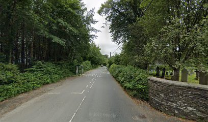
| Memorials | : | 0 |
| Location | : | Gulworthy, West Devon Borough, England |
| Coordinate | : | 50.5335800, -4.1918400 |
| Description | : | St Paul's Gulworthy is known as 'The Miner's Church' and was built in 1856 by Francis Sackville Russell, the 7th Duke of Bedford, to serve the large number of people working in the local metal mines. It is listed Grade II. St Paul's is now part of the Benefice of St Eustachius Tavistock & St Paul's Gulworthy. The church is to be found just off the roundabout at Gulworthy Cross on the road to Bere Alston (B3257), Gulworthy. |
frequently asked questions (FAQ):
-
Where is St. Paul Churchyard?
St. Paul Churchyard is located at Gulworthy Cross Gulworthy, West Devon Borough ,Devon , PL19 8JAEngland.
-
St. Paul Churchyard cemetery's updated grave count on graveviews.com?
0 memorials
-
Where are the coordinates of the St. Paul Churchyard?
Latitude: 50.5335800
Longitude: -4.1918400
Nearby Cemetories:
1. Albaston Cemetery
Calstock, Cornwall Unitary Authority, England
Coordinate: 50.5133240, -4.2225080
2. St Andrew Churchyard
Calstock, Cornwall Unitary Authority, England
Coordinate: 50.5021270, -4.2062400
3. Calstock Cemetery
Calstock, Cornwall Unitary Authority, England
Coordinate: 50.5021300, -4.2082100
4. St. Eustachius Churchyard
Tavistock, West Devon Borough, England
Coordinate: 50.5498420, -4.1451830
5. Tavistock Abbey
Tavistock, West Devon Borough, England
Coordinate: 50.5499060, -4.1442700
6. Lamerton Cemetery
Lamerton, West Devon Borough, England
Coordinate: 50.5736420, -4.1907340
7. St. Andrew's Churchyard
Whitchurch, West Devon Borough, England
Coordinate: 50.5347576, -4.1278369
8. St Mary
Sydenham Damerel, West Devon Borough, England
Coordinate: 50.5617270, -4.2604490
9. Buckland Monachorum Village Cemetery
Buckland Monachorum, West Devon Borough, England
Coordinate: 50.4962980, -4.1305260
10. Holy Trinity Churchyard
Bere Alston, West Devon Borough, England
Coordinate: 50.4789735, -4.1881879
11. Saint Andrew's Churchyard
Buckland Monachorum, West Devon Borough, England
Coordinate: 50.4951167, -4.1302055
12. St. John the Baptist
Horrabridge, West Devon Borough, England
Coordinate: 50.5079900, -4.0992400
13. St. Michael de Rupe Churchyard
Brentor, West Devon Borough, England
Coordinate: 50.6029880, -4.1621880
14. St. Peter's Churchyard
Peter Tavy, West Devon Borough, England
Coordinate: 50.5803842, -4.1011284
15. St. Mary's Churchyard
Mary Tavy, West Devon Borough, England
Coordinate: 50.5893371, -4.1073415
16. Sampford Spiney Parish Churchyard
Sampford Spinney, West Devon Borough, England
Coordinate: 50.5336118, -4.0695917
17. St. Mary the Virgin Churchyard
Walkhampton, West Devon Borough, England
Coordinate: 50.5128201, -4.0652793
18. Christ Church
Brentor, West Devon Borough, England
Coordinate: 50.6124252, -4.1464026
19. St. Andrew's Churchyard
Bere Ferrers, West Devon Borough, England
Coordinate: 50.4505300, -4.1715320
20. St Mary Churchyard
Callington, Cornwall Unitary Authority, England
Coordinate: 50.5035020, -4.3158890
21. All Saints Churchyard
Dunterton, West Devon Borough, England
Coordinate: 50.5909760, -4.2958300
22. Callington Cemetery
Callington, Cornwall Unitary Authority, England
Coordinate: 50.4992660, -4.3194640
23. Treburley Cemetery
Callington, Cornwall Unitary Authority, England
Coordinate: 50.5755556, -4.3308333
24. St. Leonard & St. Dilpe Churchyard
Landulph, Cornwall Unitary Authority, England
Coordinate: 50.4324670, -4.2104830

