
| Memorials | : | 0 |
| Location | : | Tuakau, Waikato District, New Zealand |
| Coordinate | : | -37.2858200, 174.9419600 |
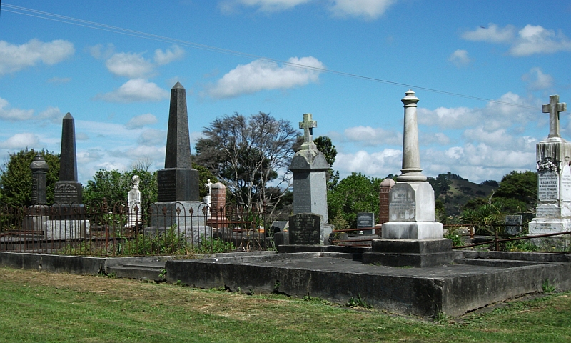
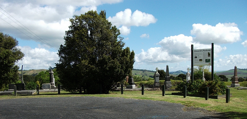
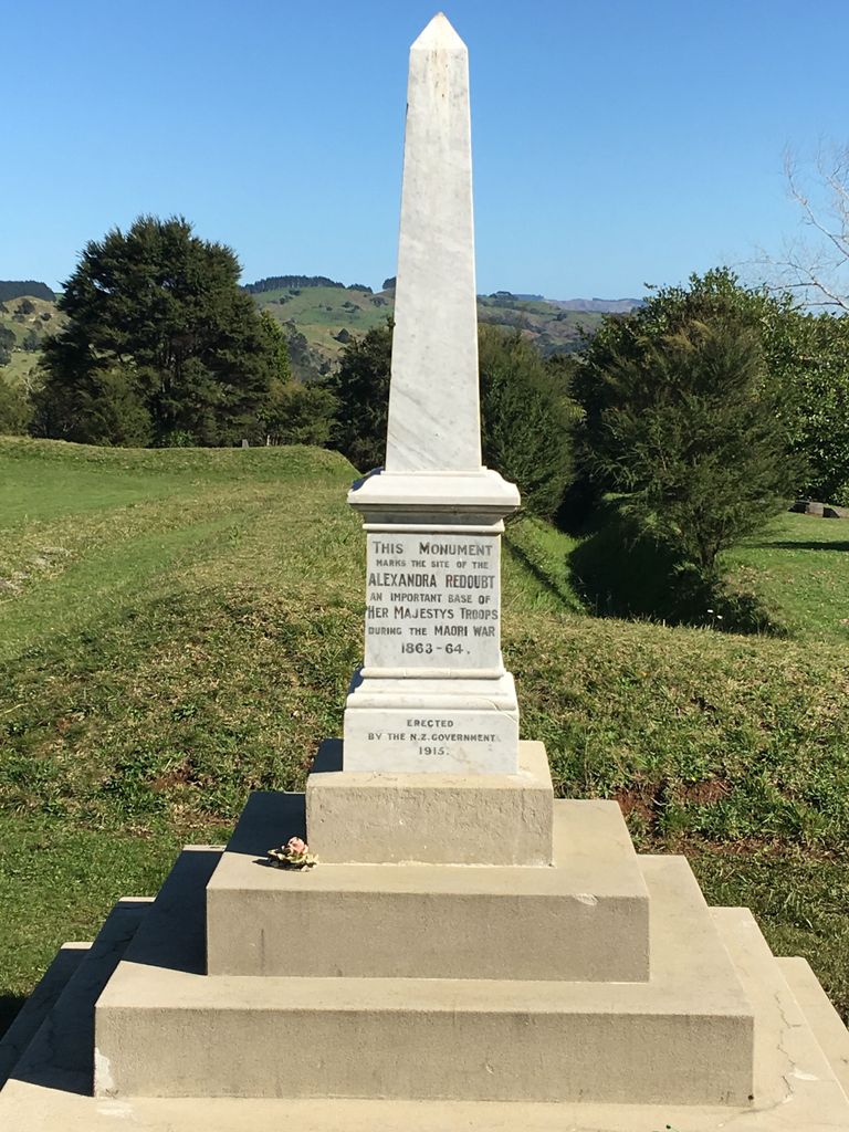
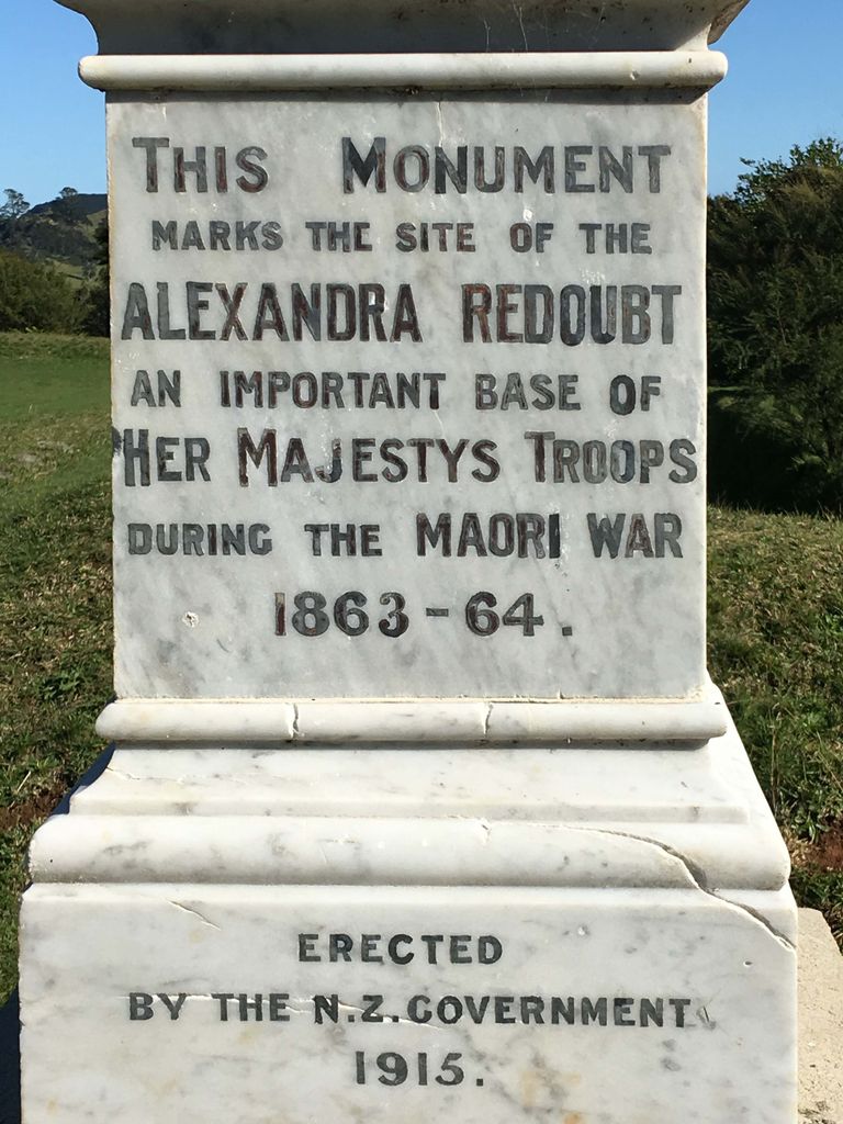
| Description | : | Named after Princess Alexandra of Wales, the redoubt was constructed and garrisoned in July 1863 by the 65th regiment under the command of Colonel Wyatt. The post was intended to protect General Cameron's right flank of the Waikato River and ensure safe passage of the steamer Avon. A detachment from the redoubt was in action near Camerontown on 7th September 1863. Capitan Swift and three men were killed and a number of men in the regiment were decorated for bravery. The redoubt has been preserved due to being surrounded by a cemetery virtually from the time of its military occupancy. The oldest... Read More |
frequently asked questions (FAQ):
-
Where is Alexandra Redoubt Cemetery?
Alexandra Redoubt Cemetery is located at Alexandra Redoubt Road Tuakau, Waikato District ,Waikato ,New Zealand.
-
Alexandra Redoubt Cemetery cemetery's updated grave count on graveviews.com?
0 memorials
-
Where are the coordinates of the Alexandra Redoubt Cemetery?
Latitude: -37.2858200
Longitude: 174.9419600
Nearby Cemetories:
1. Tuakau Cemetery
Tuakau, Waikato District, New Zealand
Coordinate: -37.2844420, 174.9465660
2. Onewhero Cemetery
Onewhero, Waikato District, New Zealand
Coordinate: -37.3158900, 174.9104900
3. Pokeno Old Soldiers Cemetery
Pokeno, Waikato District, New Zealand
Coordinate: -37.2386120, 175.0094760
4. Pokeno Cemetery
Pokeno, Waikato District, New Zealand
Coordinate: -37.2364600, 175.0215400
5. Pukekohe Public Cemetery
Pukekohe, Auckland Council, New Zealand
Coordinate: -37.2106400, 174.8974900
6. Mercer Cemetery
Mercer, Waikato District, New Zealand
Coordinate: -37.2764860, 175.0578300
7. Pukekohe Catholic Cemetery
Pukekohe, Auckland Council, New Zealand
Coordinate: -37.1951510, 174.9014640
8. Pukekohe East Cemetery
Pukekohe East, Auckland Council, New Zealand
Coordinate: -37.1883500, 174.9459000
9. St. Peter's in the Forest Anglican Cemetery
Bombay, Auckland Council, New Zealand
Coordinate: -37.1869100, 174.9914100
10. Manutahi Urupā
Port Waikato, Waikato District, New Zealand
Coordinate: -37.3337939, 174.8210091
11. Bombay Presbyterian Church Cemetery
Bombay, Auckland Council, New Zealand
Coordinate: -37.1790700, 174.9826900
12. Heights Park Cemetery
Paerata, Auckland Council, New Zealand
Coordinate: -37.1781928, 174.8938836
13. Tekohanga Urupā
Port Waikato, Waikato District, New Zealand
Coordinate: -37.3314940, 174.8085230
14. Opuatia Urupā
Opuatia, Auckland Council, New Zealand
Coordinate: -37.3983460, 174.9893180
15. St Brides Church of England Cemetery
Mauku, Auckland Council, New Zealand
Coordinate: -37.2011260, 174.8120370
16. Mauku Cemetery
Mauku, Auckland Council, New Zealand
Coordinate: -37.2011420, 174.8109100
17. Pratt's Road Catholic Cemetery
Ramarama, Auckland Council, New Zealand
Coordinate: -37.1425500, 174.9871300
18. Ararimu Schoolhouse Cemetery
Ararimu, Auckland Council, New Zealand
Coordinate: -37.1448376, 175.0359288
19. Mauku Historical Cemetery
Mauku, Auckland Council, New Zealand
Coordinate: -37.1743690, 174.7951870
20. Waiuku Cemetery
Waiuku, Auckland Council, New Zealand
Coordinate: -37.2612630, 174.7346520
21. Glen Murray Cemetery
Glen Murray, Waikato District, New Zealand
Coordinate: -37.4551820, 174.9591310
22. Ararimu Cemetery
Ararimu, Auckland Council, New Zealand
Coordinate: -37.1321000, 175.0484200
23. St John's Anglican Cemetery Drury
Drury, Auckland Council, New Zealand
Coordinate: -37.1033710, 174.9506070
24. Drury-Runciman War Memorial
Drury, Auckland Council, New Zealand
Coordinate: -37.1025480, 174.9528240