| Memorials | : | 0 |
| Location | : | Odell, Bedford Borough, England |
| Coordinate | : | 52.2114900, -0.5869800 |
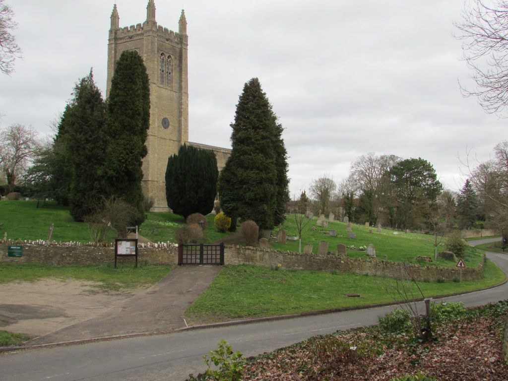
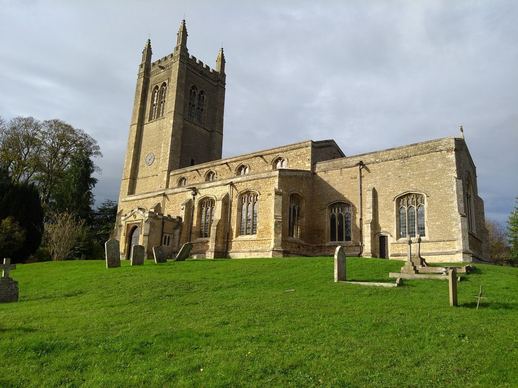
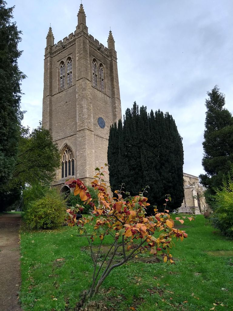
| Description | : | Odell is a village and civil parish in the north of the county of Bedfordshire in England that lies to the north-west of the county town of Bedford, near the villages of Harrold, Felmersham, Sharnbrook, and Carlton. The church is a building of great historical value, dating from the fifteenth century and built in the perpendicular style. The records of the incumbents date back to 1220, suggesting that this was also the site of an earlier church. Of particular interest, the church houses several windows containing ancient stained glass (currently under repair), a fine fifteenth-century rood screen and - of more... Read More |
frequently asked questions (FAQ):
-
Where is All Saints Churchyard?
All Saints Churchyard is located at High Street Odell, Bedford Borough ,Bedfordshire , MK43 7BBEngland.
-
All Saints Churchyard cemetery's updated grave count on graveviews.com?
0 memorials
-
Where are the coordinates of the All Saints Churchyard?
Latitude: 52.2114900
Longitude: -0.5869800
Nearby Cemetories:
1. St. Nicholas' Churchyard
Chellington, Bedford Borough, England
Coordinate: 52.1967000, -0.5956000
2. St. Peter and All Saints Churchyard
Harrold, Bedford Borough, England
Coordinate: 52.2000130, -0.6056760
3. Harrold United Reformed Church Cemetery
Harrold, Bedford Borough, England
Coordinate: 52.2021458, -0.6139397
4. St Marys Churchyard
Felmersham, Bedford Borough, England
Coordinate: 52.2099000, -0.5505000
5. Carlton Baptist Chapel Chapelyard
Carlton, Bedford Borough, England
Coordinate: 52.1870676, -0.6055073
6. St. Peter's Churchyard
Sharnbrook, Bedford Borough, England
Coordinate: 52.2255210, -0.5468540
7. St. Mary's Churchyard
Carlton, Bedford Borough, England
Coordinate: 52.1837270, -0.6093090
8. All Saints Churchyard
Souldrop, Bedford Borough, England
Coordinate: 52.2433000, -0.5584000
9. Stevington Baptist Chapel Chapelyard
Bedford Borough, England
Coordinate: 52.1730085, -0.5637366
10. St. Mary the Virgin Churchyard
Stevington, Bedford Borough, England
Coordinate: 52.1722000, -0.5532000
11. St Mary the Virgin Churchyard
Podington, Bedford Borough, England
Coordinate: 52.2539100, -0.6220900
12. Turvey Cemetery
Turvey, Bedford Borough, England
Coordinate: 52.1665007, -0.6243628
13. All Saints Churchyard
Milton Ernest, Bedford Borough, England
Coordinate: 52.1938000, -0.5091000
14. St. Mary the Virgin Churchyard
Bletsoe, Bedford Borough, England
Coordinate: 52.2145800, -0.4996100
15. All Saints Churchyard
Turvey, Bedford Borough, England
Coordinate: 52.1632000, -0.6267000
16. Lavendon Abbey
Addington, Aylesbury Vale District, England
Coordinate: 52.1799170, -0.6588330
17. St. Mary the Virgin Churchyard
Bozeat, Wellingborough Borough, England
Coordinate: 52.2235060, -0.6747470
18. St Lawrence Churchyard
Wymington, Bedford Borough, England
Coordinate: 52.2694310, -0.6017230
19. St. Margaret of Antioch Churchyard
Knotting, Bedford Borough, England
Coordinate: 52.2599172, -0.5323686
20. St. Michael's Churchyard
Lavendon, Milton Keynes Borough, England
Coordinate: 52.1734100, -0.6615200
21. St. Mary's Churchyard
Oakley, Bedford Borough, England
Coordinate: 52.1657680, -0.5238200
22. St. Mary's Churchyard
Cold Brayfield, Milton Keynes Borough, England
Coordinate: 52.1609580, -0.6414440
23. St. Michael's Church
Farndish, Bedford Borough, England
Coordinate: 52.2638108, -0.6416839
24. St Rumwold's Churchyard
Strixton, Wellingborough Borough, England
Coordinate: 52.2456740, -0.6777530


