
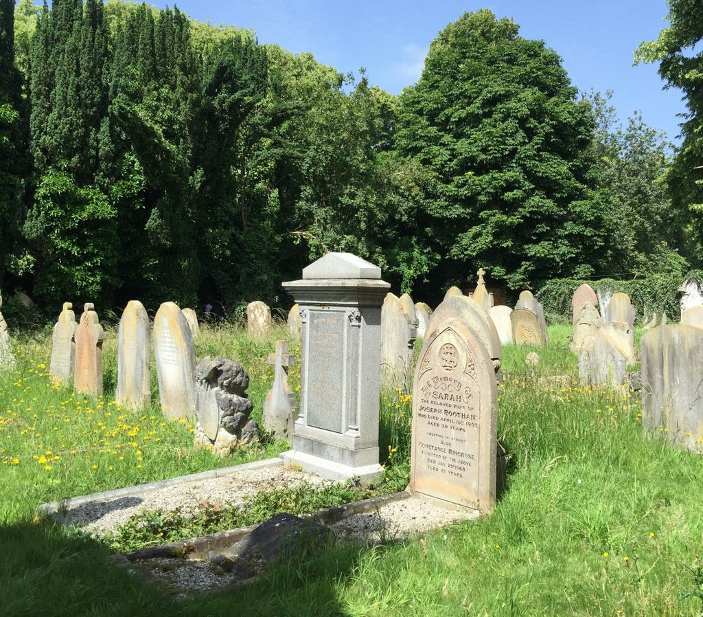
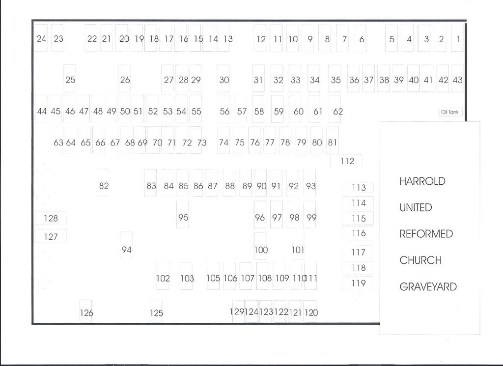
| Memorials | : | 0 |
| Location | : | Harrold, Bedford Borough, England |
| Coordinate | : | 52.2021458, -0.6139397 |
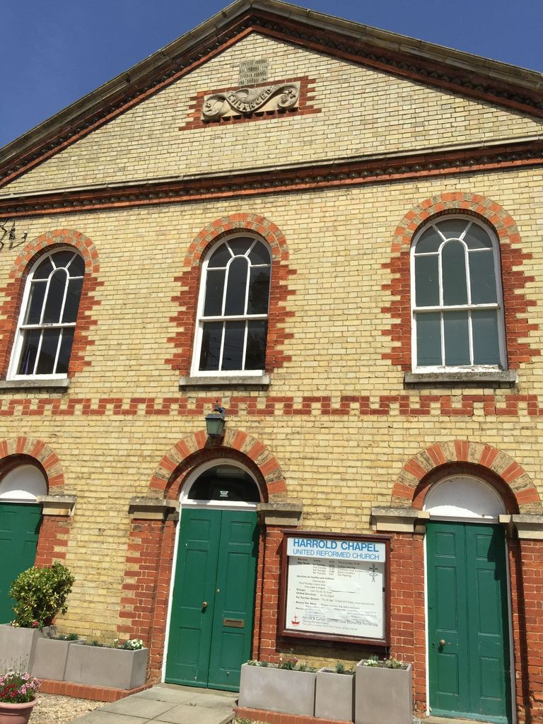
| Description | : | The Congregational church, now the United Reformed Church, in Harrold is two hundred years old, its first chapel having opened in 1808. |
frequently asked questions (FAQ):
-
Where is Harrold United Reformed Church Cemetery?
Harrold United Reformed Church Cemetery is located at 120 High St HarroldBedford Harrold, Bedford Borough ,Bedfordshire , MK43 7BJEngland.
-
Harrold United Reformed Church Cemetery cemetery's updated grave count on graveviews.com?
0 memorials
-
Where are the coordinates of the Harrold United Reformed Church Cemetery?
Latitude: 52.2021458
Longitude: -0.6139397
Nearby Cemetories:
1. St. Peter and All Saints Churchyard
Harrold, Bedford Borough, England
Coordinate: 52.2000130, -0.6056760
2. St. Nicholas' Churchyard
Chellington, Bedford Borough, England
Coordinate: 52.1967000, -0.5956000
3. Carlton Baptist Chapel Chapelyard
Carlton, Bedford Borough, England
Coordinate: 52.1870676, -0.6055073
4. St. Mary's Churchyard
Carlton, Bedford Borough, England
Coordinate: 52.1837270, -0.6093090
5. All Saints Churchyard
Odell, Bedford Borough, England
Coordinate: 52.2114900, -0.5869800
6. Lavendon Abbey
Addington, Aylesbury Vale District, England
Coordinate: 52.1799170, -0.6588330
7. Turvey Cemetery
Turvey, Bedford Borough, England
Coordinate: 52.1665007, -0.6243628
8. St Marys Churchyard
Felmersham, Bedford Borough, England
Coordinate: 52.2099000, -0.5505000
9. All Saints Churchyard
Turvey, Bedford Borough, England
Coordinate: 52.1632000, -0.6267000
10. St. Michael's Churchyard
Lavendon, Milton Keynes Borough, England
Coordinate: 52.1734100, -0.6615200
11. Stevington Baptist Chapel Chapelyard
Bedford Borough, England
Coordinate: 52.1730085, -0.5637366
12. St. Mary the Virgin Churchyard
Bozeat, Wellingborough Borough, England
Coordinate: 52.2235060, -0.6747470
13. St. Mary's Churchyard
Cold Brayfield, Milton Keynes Borough, England
Coordinate: 52.1609580, -0.6414440
14. St. Peter's Churchyard
Sharnbrook, Bedford Borough, England
Coordinate: 52.2255210, -0.5468540
15. St. Mary the Virgin Churchyard
Stevington, Bedford Borough, England
Coordinate: 52.1722000, -0.5532000
16. St. Nicholas Churchyard
Newton Blossomville, Milton Keynes Borough, England
Coordinate: 52.1546343, -0.6482556
17. St Mary the Virgin Churchyard
Podington, Bedford Borough, England
Coordinate: 52.2539100, -0.6220900
18. All Saints Churchyard
Souldrop, Bedford Borough, England
Coordinate: 52.2433000, -0.5584000
19. St Peter and St Paul Churchyard
Easton Maudit, Wellingborough Borough, England
Coordinate: 52.2204300, -0.7006700
20. St Rumwold's Churchyard
Strixton, Wellingborough Borough, England
Coordinate: 52.2456740, -0.6777530
21. St. Michael's Church
Farndish, Bedford Borough, England
Coordinate: 52.2638108, -0.6416839
22. All Saints Churchyard
Milton Ernest, Bedford Borough, England
Coordinate: 52.1938000, -0.5091000
23. St Mary's Churchyard
Clifton Reynes, Milton Keynes Borough, England
Coordinate: 52.1520000, -0.6820000
24. St. Mary's Churchyard
Oakley, Bedford Borough, England
Coordinate: 52.1657680, -0.5238200