
| Memorials | : | 0 |
| Location | : | Dorchester, West Dorset District, England |
| Coordinate | : | 50.7153670, -2.4355750 |
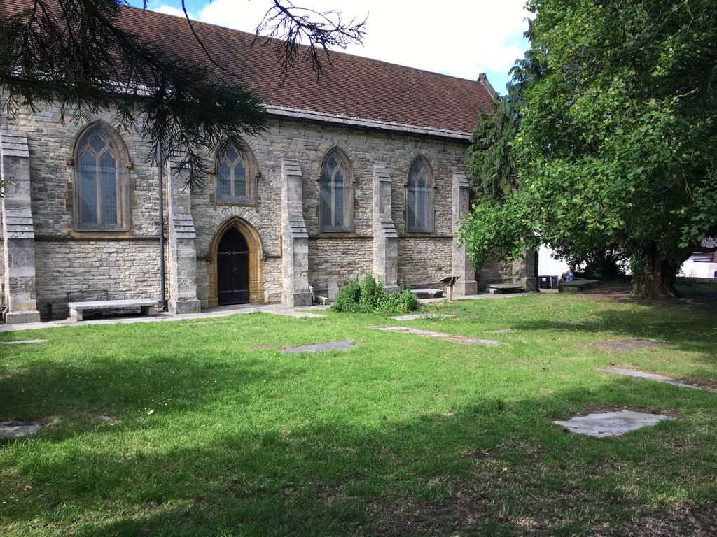
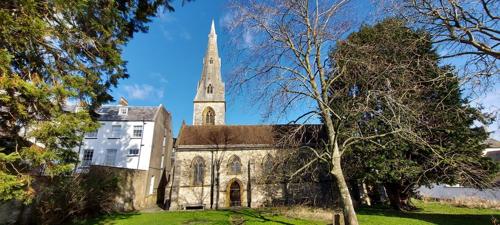
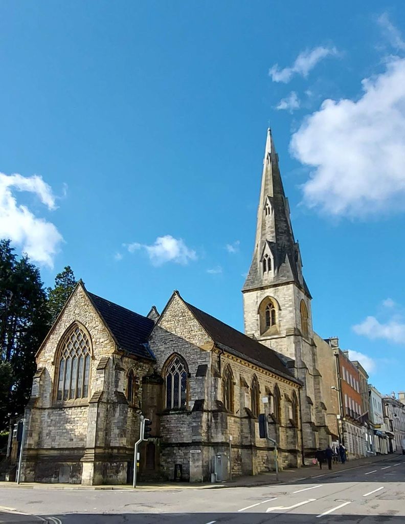
| Description | : | The site of Dorchester All Saints is considered to have been occupied by a church since the Norman period, although the earliest records date to the 12th century. The original church is believed to have been destroyed by fire in 1613 and subsequently rebuilt. A decision was made to rebuild the church in the mid-19th century, to the designs of Benjamin Ferrey. All Saints became redundant in 1970 and is now used as an archaeological store for the Dorset County Museum. The memorials in the churchyard are accessible however they are mainly floor slabs which are considerably worn and mostly illegible.... Read More |
frequently asked questions (FAQ):
-
Where is All Saints Churchyard?
All Saints Churchyard is located at 32 High East Street Dorchester, West Dorset District ,Dorset , DT1 1HFEngland.
-
All Saints Churchyard cemetery's updated grave count on graveviews.com?
0 memorials
-
Where are the coordinates of the All Saints Churchyard?
Latitude: 50.7153670
Longitude: -2.4355750
Nearby Cemetories:
1. Dorchester Gaol Cemetery
Dorchester, West Dorset District, England
Coordinate: 50.7153670, -2.4355750
2. St. Peter's Church
Dorchester, West Dorset District, England
Coordinate: 50.7155740, -2.4369030
3. Holy Trinity Church
Dorchester, West Dorset District, England
Coordinate: 50.7154890, -2.4379470
4. Greyfriars Churchyard
Dorchester, West Dorset District, England
Coordinate: 50.7172150, -2.4354070
5. Dorchester Gallows Hill Cemetery
Dorchester, West Dorset District, England
Coordinate: 50.7127930, -2.4315480
6. St George's Churchyard
Fordington, West Dorset District, England
Coordinate: 50.7136510, -2.4286550
7. Fordington Cemetery
Dorchester, West Dorset District, England
Coordinate: 50.7131110, -2.4263720
8. Maumbury Rings Cemetery
Dorchester, West Dorset District, England
Coordinate: 50.7079000, -2.4403900
9. Dorchester Cemetery
Dorchester, West Dorset District, England
Coordinate: 50.7062110, -2.4422800
10. Poundbury Cemetery
Dorchester, West Dorset District, England
Coordinate: 50.7181090, -2.4544830
11. St Mary the Virgin Churchyard
Charminster, West Dorset District, England
Coordinate: 50.7330600, -2.4557900
12. Charminster Cemetery
Charminster, Bournemouth Unitary Authority, England
Coordinate: 50.7341430, -2.4627060
13. West Stafford New Burial Ground
Dorchester, West Dorset District, England
Coordinate: 50.7050192, -2.3872764
14. St. Mary's Churchyard
Bradford Peverell, West Dorset District, England
Coordinate: 50.7356600, -2.4857900
15. St. Martin's Churchyard
Broadmayne, West Dorset District, England
Coordinate: 50.6787530, -2.3856840
16. Holy Trinity
Bincombe, West Dorset District, England
Coordinate: 50.6598000, -2.4449000
17. St Laurence Churchyard
Upwey, Weymouth and Portland Borough, England
Coordinate: 50.6658560, -2.4813840
18. St Mary the Virgin Churchyard
Piddlehinton, West Dorset District, England
Coordinate: 50.7732980, -2.4045680
19. Holy Trinity Churchyard
Godmanstone, West Dorset District, England
Coordinate: 50.7748310, -2.4750600
20. St. Mary the Virgin Churchyard
Puddletown, West Dorset District, England
Coordinate: 50.7484670, -2.3434700
21. Broadwey New Cemetery
Broadwey, Weymouth and Portland Borough, England
Coordinate: 50.6512040, -2.4702530
22. St Nicholas Churchyard
Broadwey, Weymouth and Portland Borough, England
Coordinate: 50.6504630, -2.4712110
23. All Saints
Nether Cerne, West Dorset District, England
Coordinate: 50.7824394, -2.4695370
24. St. Andrew's Churchyard
Preston, West Dorset District, England
Coordinate: 50.6456500, -2.4173900