
| Memorials | : | 0 |
| Location | : | Dorchester, West Dorset District, England |
| Coordinate | : | 50.7153670, -2.4355750 |
| Description | : | The Dorchester Gaol sits on the site of a former Norman Castle. The prison was opened in 1793 rebuilt in 1885 and subsequently closed in 2013. |
frequently asked questions (FAQ):
-
Where is Dorchester Gaol Cemetery?
Dorchester Gaol Cemetery is located at Dorchester, West Dorset District, Dorset, England Dorchester, West Dorset District ,Dorset ,England.
-
Dorchester Gaol Cemetery cemetery's updated grave count on graveviews.com?
0 memorials
-
Where are the coordinates of the Dorchester Gaol Cemetery?
Latitude: 50.7153670
Longitude: -2.4355750
Nearby Cemetories:
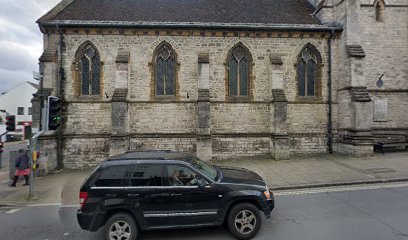
1. All Saints Churchyard
Dorchester, West Dorset District, England
Coordinate: 50.7153670, -2.4355750
2. St. Peter's Church
Dorchester, West Dorset District, England
Coordinate: 50.7155740, -2.4369030
3. Holy Trinity Church
Dorchester, West Dorset District, England
Coordinate: 50.7154890, -2.4379470
4. Greyfriars Churchyard
Dorchester, West Dorset District, England
Coordinate: 50.7172150, -2.4354070
5. Dorchester Gallows Hill Cemetery
Dorchester, West Dorset District, England
Coordinate: 50.7127930, -2.4315480
6. St George's Churchyard
Fordington, West Dorset District, England
Coordinate: 50.7136510, -2.4286550
7. Fordington Cemetery
Dorchester, West Dorset District, England
Coordinate: 50.7131110, -2.4263720
8. Maumbury Rings Cemetery
Dorchester, West Dorset District, England
Coordinate: 50.7079000, -2.4403900
9. Dorchester Cemetery
Dorchester, West Dorset District, England
Coordinate: 50.7062110, -2.4422800
10. Poundbury Cemetery
Dorchester, West Dorset District, England
Coordinate: 50.7181090, -2.4544830
11. St Mary the Virgin Churchyard
Charminster, West Dorset District, England
Coordinate: 50.7330600, -2.4557900
12. Charminster Cemetery
Charminster, Bournemouth Unitary Authority, England
Coordinate: 50.7341430, -2.4627060
13. West Stafford New Burial Ground
Dorchester, West Dorset District, England
Coordinate: 50.7050192, -2.3872764
14. St. Mary's Churchyard
Bradford Peverell, West Dorset District, England
Coordinate: 50.7356600, -2.4857900
15. St. Martin's Churchyard
Broadmayne, West Dorset District, England
Coordinate: 50.6787530, -2.3856840
16. Holy Trinity
Bincombe, West Dorset District, England
Coordinate: 50.6598000, -2.4449000
17. St Laurence Churchyard
Upwey, Weymouth and Portland Borough, England
Coordinate: 50.6658560, -2.4813840
18. St Mary the Virgin Churchyard
Piddlehinton, West Dorset District, England
Coordinate: 50.7732980, -2.4045680
19. Holy Trinity Churchyard
Godmanstone, West Dorset District, England
Coordinate: 50.7748310, -2.4750600
20. St. Mary the Virgin Churchyard
Puddletown, West Dorset District, England
Coordinate: 50.7484670, -2.3434700
21. Broadwey New Cemetery
Broadwey, Weymouth and Portland Borough, England
Coordinate: 50.6512040, -2.4702530
22. St Nicholas Churchyard
Broadwey, Weymouth and Portland Borough, England
Coordinate: 50.6504630, -2.4712110
23. All Saints
Nether Cerne, West Dorset District, England
Coordinate: 50.7824394, -2.4695370
24. St. Andrew's Churchyard
Preston, West Dorset District, England
Coordinate: 50.6456500, -2.4173900