
| Memorials | : | 17 |
| Location | : | Barling Magna, Rochford District, England |
| Coordinate | : | 51.5729840, 0.7865930 |
| Description | : | Barling is a village and civil parish in the district of Rochford, Essex, England. It is located approximately 4 miles northeast of Southend-on-Sea and is 18 miles southeast of the county town of Chelmsford. The village formerly known as Barling Magna, also includes the hamlets of Little Wakering and Stonebridge. The name "Barling" is said to derive from two Saxon words "ban", a boar, and "ing", a meadow, but it was also known as Baerlingum, and this is generally accepted to mean Baerla's people. The village and surrounding area has been inhabited for many thousands of years and it can... Read More |
frequently asked questions (FAQ):
-
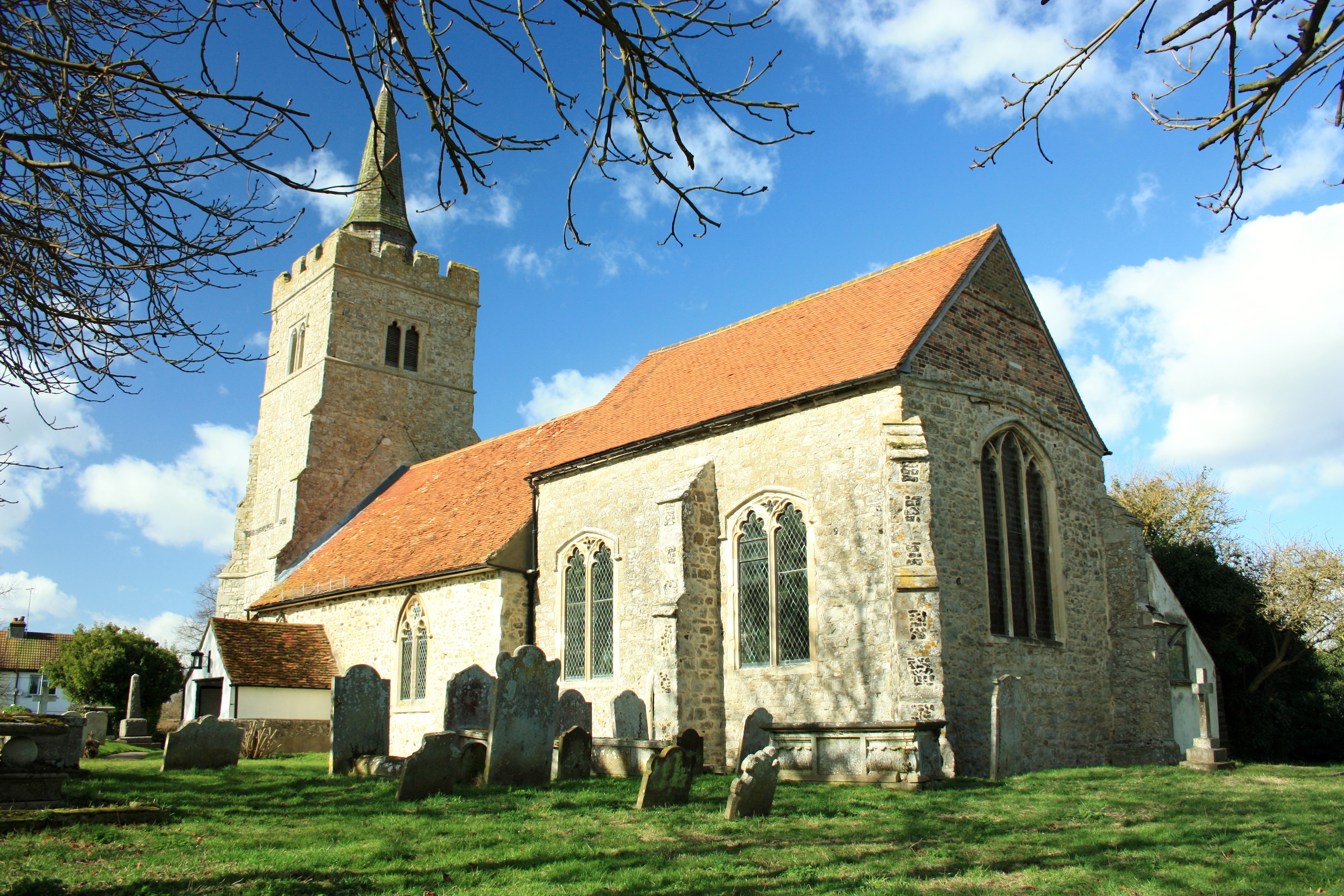
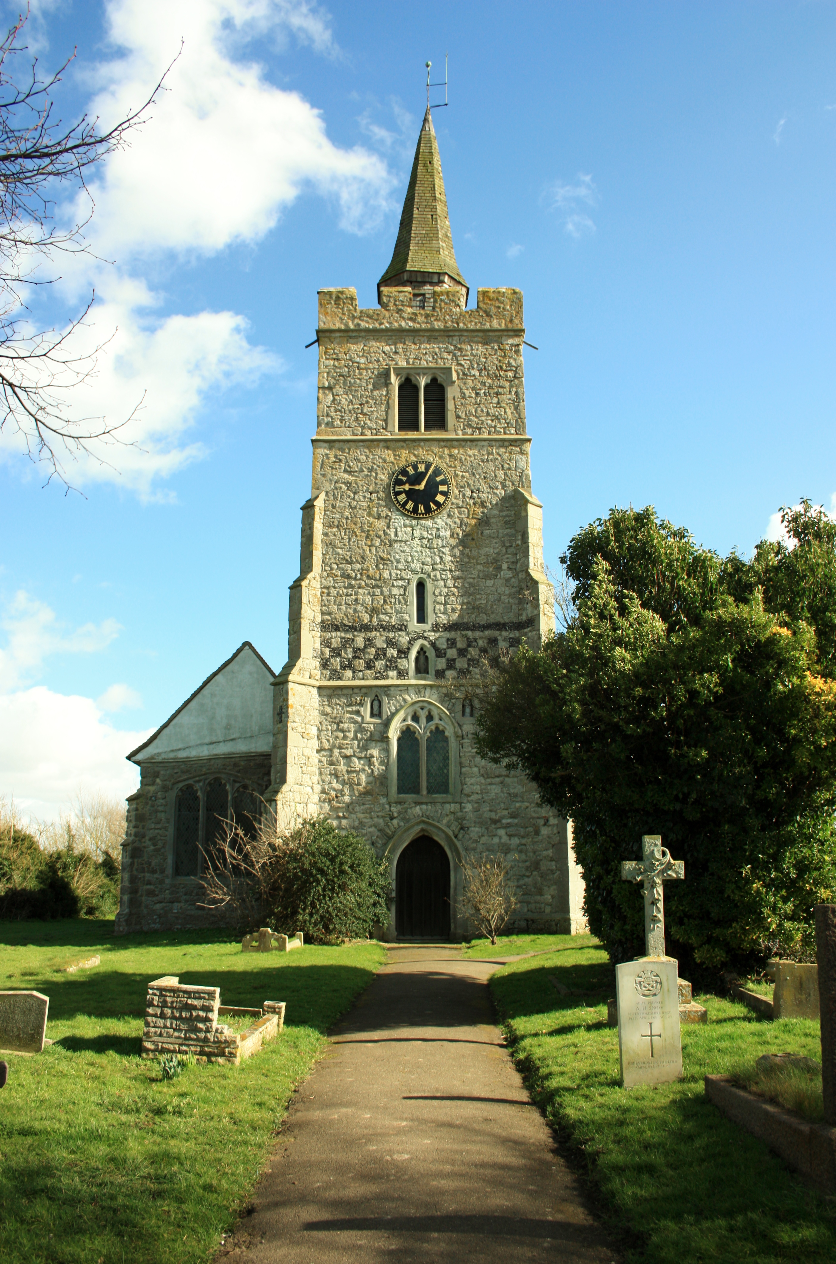
Where is All Saints Churchyard?
All Saints Churchyard is located at Church Road Barling Magna, Rochford District ,Essex ,England.
-
All Saints Churchyard cemetery's updated grave count on graveviews.com?
17 memorials
-
Where are the coordinates of the All Saints Churchyard?
Latitude: 51.5729840
Longitude: 0.7865930
Nearby Cemetories:
1. St Mary the Virgin Churchyard
Little Wakering, Southend-on-Sea Unitary Authority, England
Coordinate: 51.5606390, 0.7894770
2. St Nicholas Churchyard
Great Wakering, Rochford District, England
Coordinate: 51.5532070, 0.8106650
3. St. Peter's Churchyard
Paglesham, Rochford District, England
Coordinate: 51.6034280, 0.7799570
4. St Mary the Virgin
Shoeburyness, Southend-on-Sea Unitary Authority, England
Coordinate: 51.5411740, 0.7804210
5. St Mary the Virgin Churchyard
Sutton, Rochford District, England
Coordinate: 51.5617980, 0.7379720
6. St Mary and All Saints Churchyard
Stambridge, Rochford District, England
Coordinate: 51.5835790, 0.7331670
7. All Saints Churchyard
Sutton, Rochford District, England
Coordinate: 51.5703210, 0.7226620
8. Holy Trinity Churchyard
Southchurch, Southend-on-Sea Unitary Authority, England
Coordinate: 51.5417410, 0.7409850
9. St Mary Churchyard
Stambridge, Rochford District, England
Coordinate: 51.5948750, 0.7233380
10. Southend-On-Sea Crematorium
Southend-on-Sea, Southend-on-Sea Unitary Authority, England
Coordinate: 51.5579630, 0.7178090
11. St. Andrew the Apostle Churchyard
Shoeburyness, Southend-on-Sea Unitary Authority, England
Coordinate: 51.5273210, 0.7801570
12. Sutton Road Cemetery
Southend-on-Sea, Southend-on-Sea Unitary Authority, England
Coordinate: 51.5581980, 0.7160330
13. Stock Road Jewish Cemetery
Southend-on-Sea, Southend-on-Sea Unitary Authority, England
Coordinate: 51.5571444, 0.7055500
14. St Nicholas Churchyard
Canewdon, Rochford District, England
Coordinate: 51.6177030, 0.7383670
15. St. Andrew's Churchyard
Rochford, Rochford District, England
Coordinate: 51.5803090, 0.7002030
16. St. Mary the Virgin Churchyard
Prittlewell, Southend-on-Sea Unitary Authority, England
Coordinate: 51.5490570, 0.7054530
17. St. John the Baptist Churchyard
Southend-on-Sea, Southend-on-Sea Unitary Authority, England
Coordinate: 51.5344770, 0.7139610
18. North Road Burial Ground
Westcliff-on-Sea, Southend-on-Sea Unitary Authority, England
Coordinate: 51.5428130, 0.7024620
19. St Laurence and All Saints Churchyard
Eastwood, Southend-on-Sea Unitary Authority, England
Coordinate: 51.5677030, 0.6847360
20. All Saints Churchyard
Creeksea, Maldon District, England
Coordinate: 51.6376640, 0.7882050
21. St. Mary the Virgin Churchyard
Burnham-on-Crouch, Maldon District, England
Coordinate: 51.6383030, 0.8147260
22. Thornton Meadows Wildflower Cemetery
Ashingdon, Rochford District, England
Coordinate: 51.6131670, 0.6983290
23. St Andrew Churchyard
Ashingdon, Rochford District, England
Coordinate: 51.6103050, 0.6933730
24. Rochford Lawn Cemetery
Rochford, Rochford District, England
Coordinate: 51.5829870, 0.6759490