
| Memorials | : | 0 |
| Location | : | Ashingdon, Rochford District, England |
| Coordinate | : | 51.6131670, 0.6983290 |
frequently asked questions (FAQ):
-
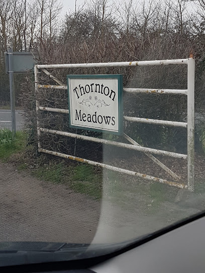
Where is Thornton Meadows Wildflower Cemetery?
Thornton Meadows Wildflower Cemetery is located at Canewdon Road Ashingdon, Rochford District ,Essex , SS4 3JLEngland.
-
Thornton Meadows Wildflower Cemetery cemetery's updated grave count on graveviews.com?
0 memorials
-
Where are the coordinates of the Thornton Meadows Wildflower Cemetery?
Latitude: 51.6131670
Longitude: 0.6983290
Nearby Cemetories:
1. St Andrew Churchyard
Ashingdon, Rochford District, England
Coordinate: 51.6103050, 0.6933730
2. All Saints Churchyard
South Fambridge, Rochford District, England
Coordinate: 51.6232020, 0.6879920
3. St Mary Churchyard
Stambridge, Rochford District, England
Coordinate: 51.5948750, 0.7233380
4. St Nicholas Churchyard
Canewdon, Rochford District, England
Coordinate: 51.6177030, 0.7383670
5. Hall Road Cemetery
Rochford, Rochford District, England
Coordinate: 51.5842870, 0.6749670
6. St. Andrew's Churchyard
Rochford, Rochford District, England
Coordinate: 51.5803090, 0.7002030
7. Rochford Lawn Cemetery
Rochford, Rochford District, England
Coordinate: 51.5829870, 0.6759490
8. Holy Trinity Churchyard
North Fambridge, Maldon District, England
Coordinate: 51.6425440, 0.6721570
9. St Mary and All Saints Churchyard
Stambridge, Rochford District, England
Coordinate: 51.5835790, 0.7331670
10. St Peter and St Paul Churchyard
Hockley, Rochford District, England
Coordinate: 51.6098370, 0.6356820
11. All Saints Churchyard
Sutton, Rochford District, England
Coordinate: 51.5703210, 0.7226620
12. Saint Michaels Churchyard
Latchingdon, Maldon District, England
Coordinate: 51.6552730, 0.7267950
13. St Laurence and All Saints Churchyard
Eastwood, Southend-on-Sea Unitary Authority, England
Coordinate: 51.5677030, 0.6847360
14. St. Peter's Churchyard
Paglesham, Rochford District, England
Coordinate: 51.6034280, 0.7799570
15. Crouch Valley Meadow
Althorne, Maldon District, England
Coordinate: 51.6538315, 0.7552450
16. St. Stephen's Churchyard
Cold Norton, Maldon District, England
Coordinate: 51.6670870, 0.6764950
17. Sutton Road Cemetery
Southend-on-Sea, Southend-on-Sea Unitary Authority, England
Coordinate: 51.5581980, 0.7160330
18. Rochford District Council Cemetery
Rayleigh, Rochford District, England
Coordinate: 51.5936500, 0.6135600
19. Stock Road Jewish Cemetery
Southend-on-Sea, Southend-on-Sea Unitary Authority, England
Coordinate: 51.5571444, 0.7055500
20. Southend-On-Sea Crematorium
Southend-on-Sea, Southend-on-Sea Unitary Authority, England
Coordinate: 51.5579630, 0.7178090
21. St Mary the Virgin Churchyard
Sutton, Rochford District, England
Coordinate: 51.5617980, 0.7379720
22. St Andrew Churchyard
Althorne, Maldon District, England
Coordinate: 51.6566690, 0.7585130
23. Ss. Mary and Margaret Churchyard
Stow Maries, Maldon District, England
Coordinate: 51.6633220, 0.6498190
24. All Saints Churchyard
Creeksea, Maldon District, England
Coordinate: 51.6376640, 0.7882050