
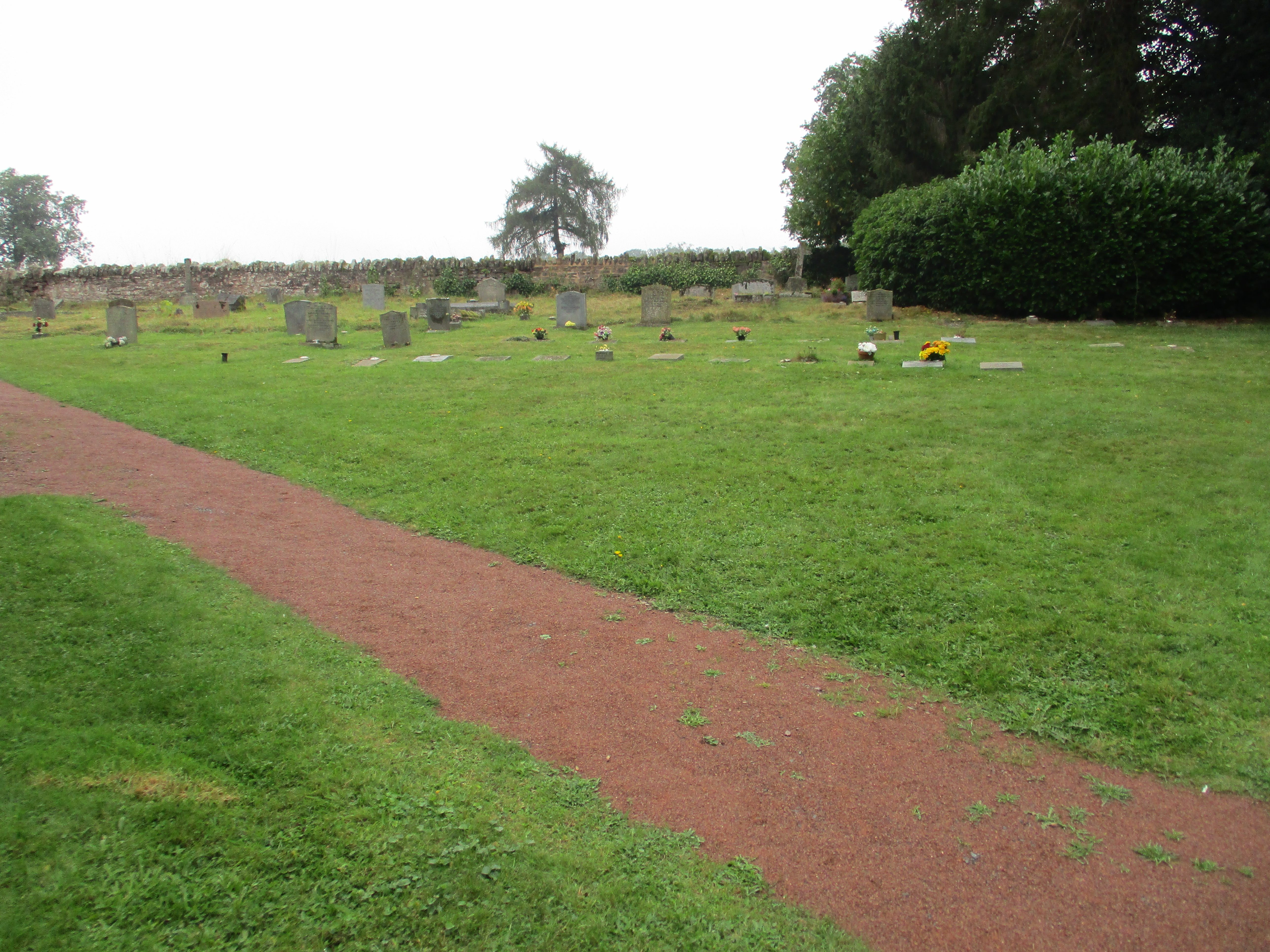
| Memorials | : | 35 |
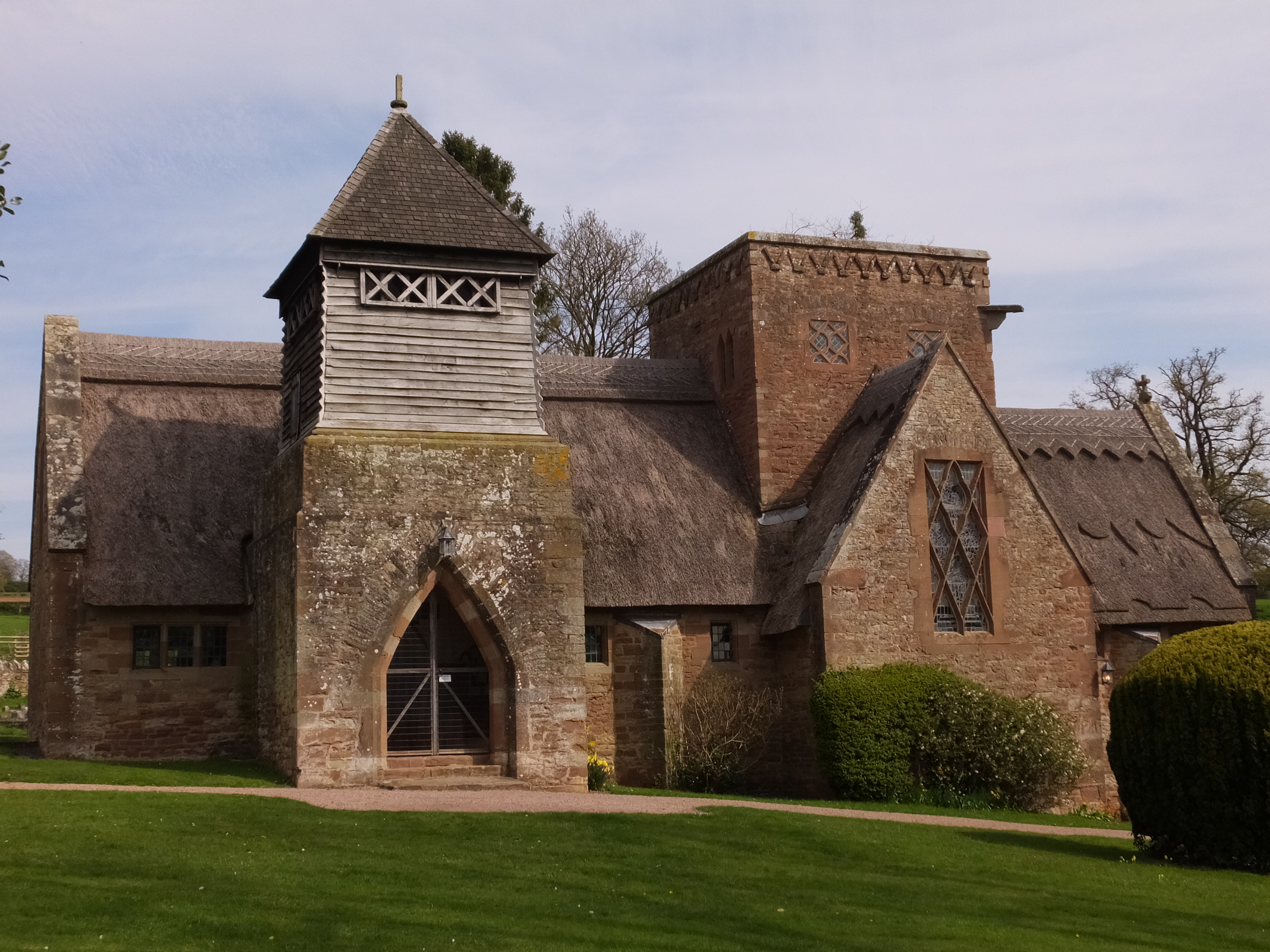
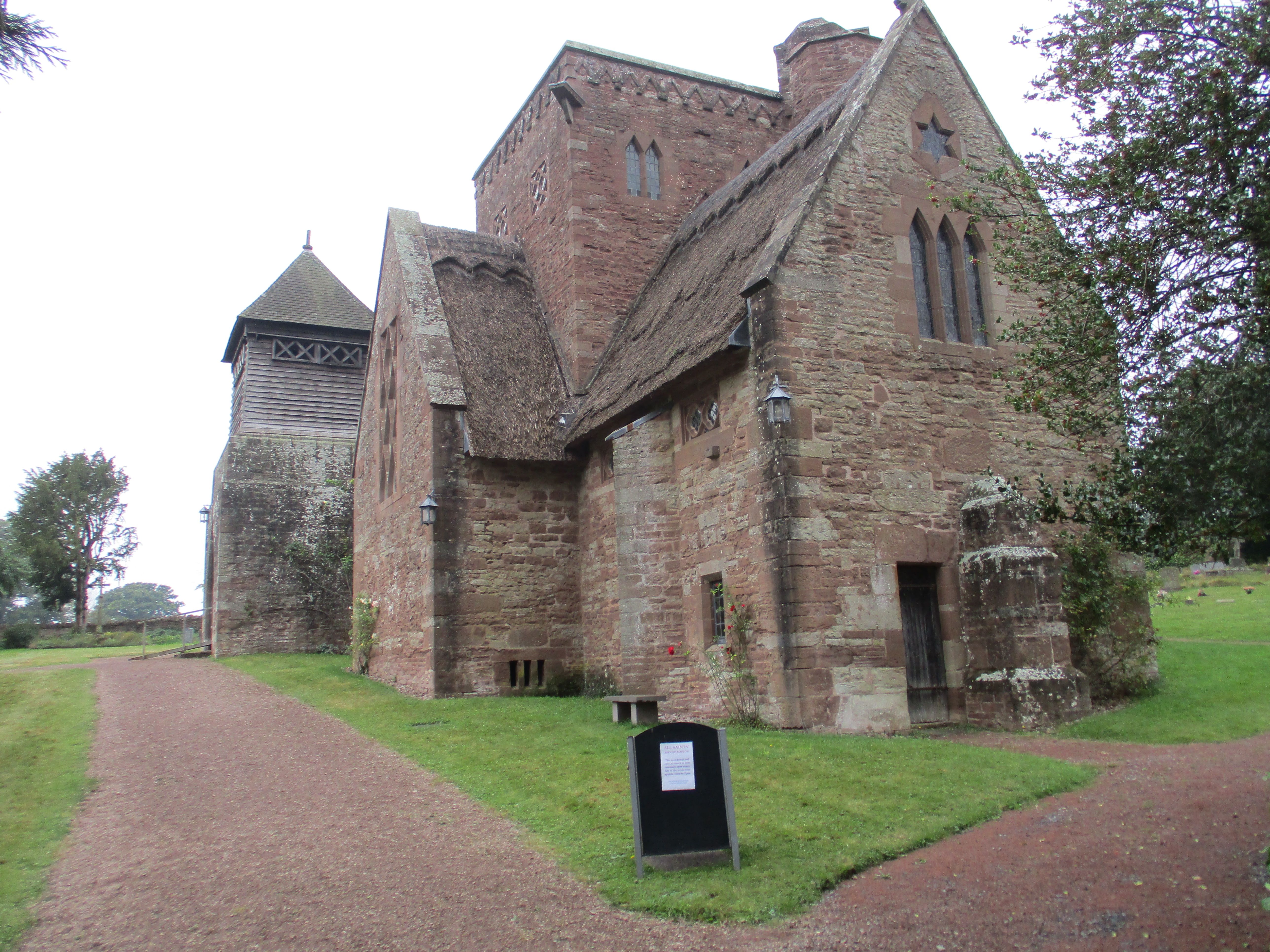
| Location | : | Brockhampton, Herefordshire Unitary Authority, England |
| Website | : | www.allsaintsbrockhampton.org/ |
| Coordinate | : | 51.9863200, -2.5924500 |
frequently asked questions (FAQ):
-
Where is All Saints Churchyard?
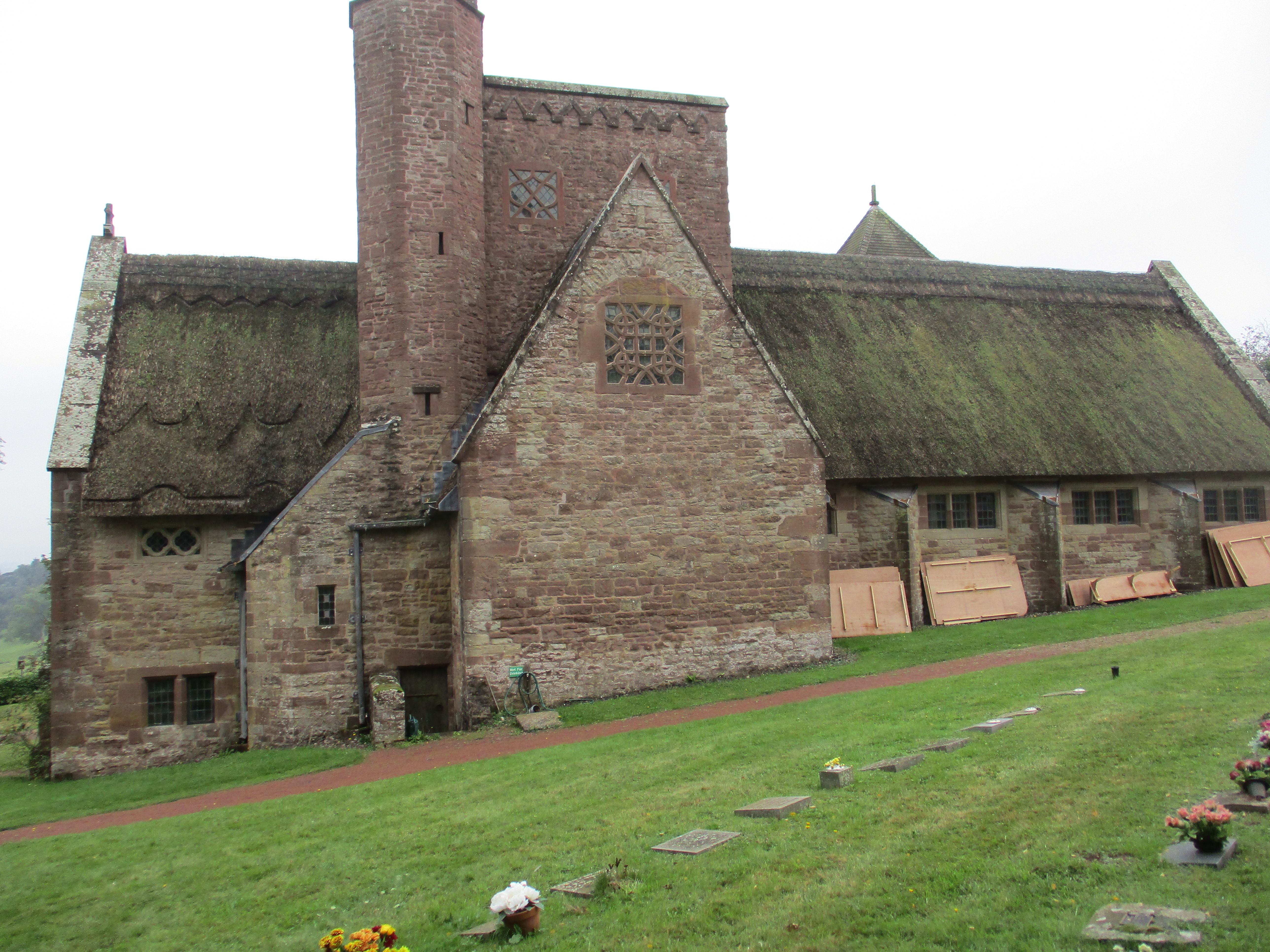
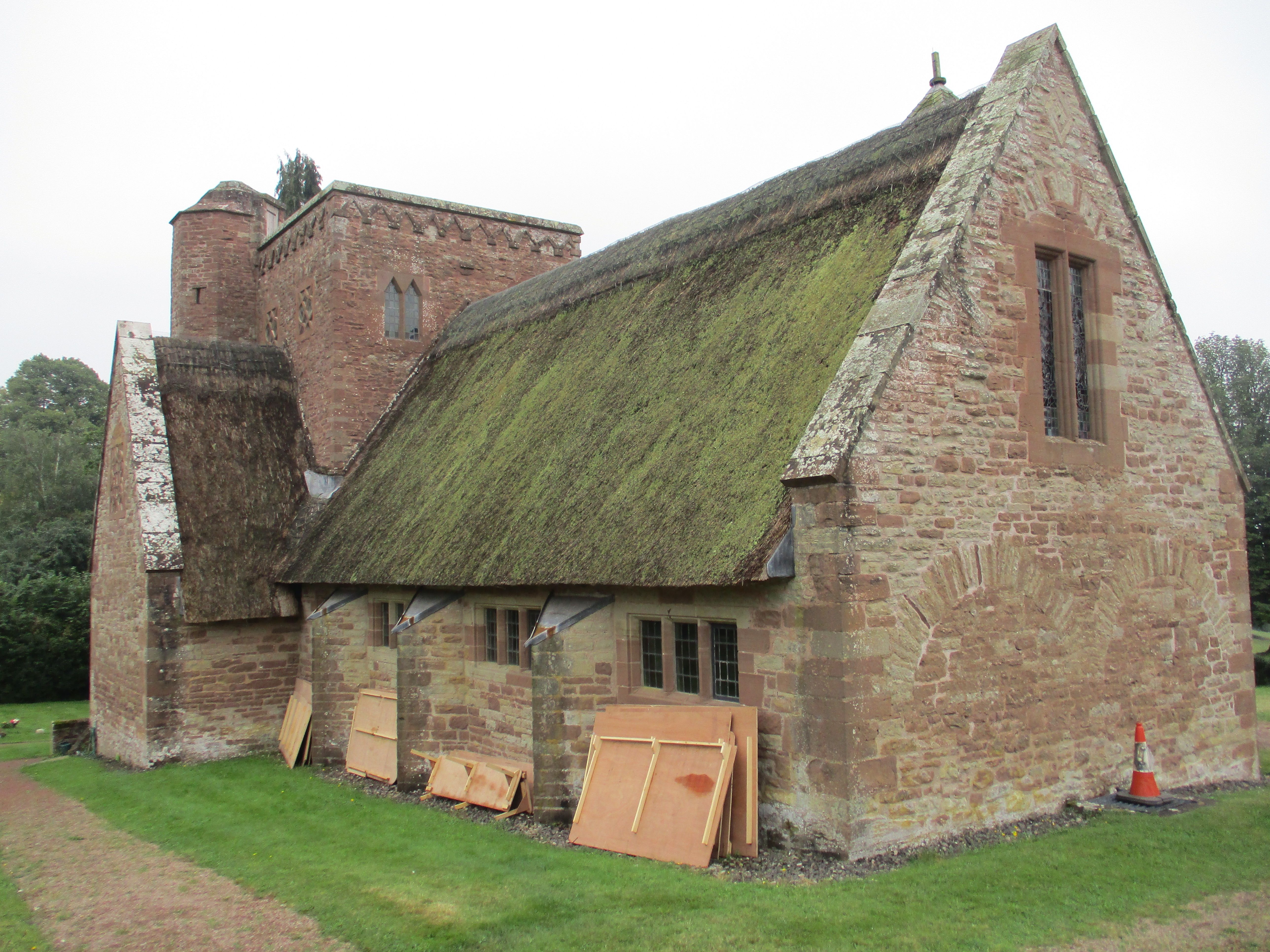
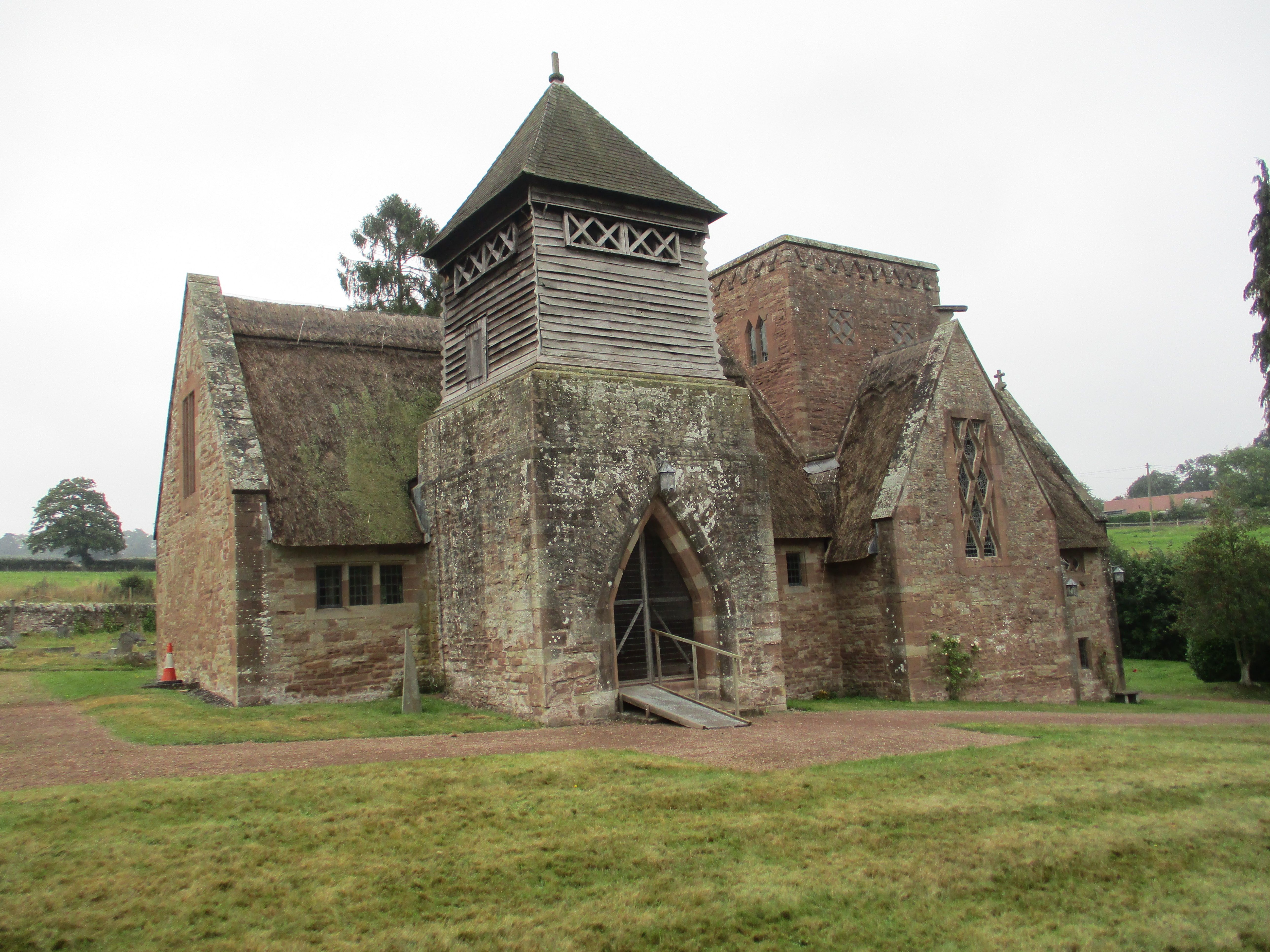
All Saints Churchyard is located at The Parks Brockhampton, Herefordshire Unitary Authority ,Herefordshire , HR1 4SDEngland.
-
All Saints Churchyard cemetery's updated grave count on graveviews.com?
35 memorials
-
Where are the coordinates of the All Saints Churchyard?
Latitude: 51.9863200
Longitude: -2.5924500
Nearby Cemetories:
1. St Dubricius' Church
Ballingham, Herefordshire Unitary Authority, England
Coordinate: 51.9818590, -2.6186990
2. St Andrew and St Mary Churchyard
How Caple, Herefordshire Unitary Authority, England
Coordinate: 51.9719160, -2.5666430
3. St Cuthbert Churchyard
Holme Lacy, Herefordshire Unitary Authority, England
Coordinate: 52.0099440, -2.6293610
4. St Mary's Churchyard
Foy, Herefordshire Unitary Authority, England
Coordinate: 51.9520402, -2.5866687
5. Church of St John of Jerusalem
Herefordshire Unitary Authority, England
Coordinate: 51.9914740, -2.6542940
6. St John The Baptist Churchyard
Kings Caple, Herefordshire Unitary Authority, England
Coordinate: 51.9562740, -2.6433720
7. Hoarwithy Church of England
Hentland, Herefordshire Unitary Authority, England
Coordinate: 51.9612740, -2.6625310
8. St. Michael and All Angels Churchyard
Brampton Abbots, Herefordshire Unitary Authority, England
Coordinate: 51.9347980, -2.5817590
9. St. David's Churchyard
Little Dewchurch, Herefordshire Unitary Authority, England
Coordinate: 51.9822934, -2.6865234
10. St. Andrew's Churchyard
Hampton Bishop, Herefordshire Unitary Authority, England
Coordinate: 52.0387800, -2.6440900
11. St Bridget Churchyard
Bridstow, Herefordshire Unitary Authority, England
Coordinate: 51.9204600, -2.6055410
12. St. Dubricius Churchyard
Hentland, Herefordshire Unitary Authority, England
Coordinate: 51.9342080, -2.6660250
13. Priory Churchyard
Aconbury, Herefordshire Unitary Authority, England
Coordinate: 51.9978900, -2.7052160
14. St Peter's Churchyard
Dormington, Herefordshire Unitary Authority, England
Coordinate: 52.0586605, -2.6094343
15. Little Birch Churchyard
Little Birch, Herefordshire Unitary Authority, England
Coordinate: 51.9770250, -2.7126530
16. St. Michael Churchyard
Little Marcle, Herefordshire Unitary Authority, England
Coordinate: 52.0265561, -2.4820253
17. Aconbury Hill
Aconbury, Herefordshire Unitary Authority, England
Coordinate: 51.9932540, -2.7212790
18. St. Mary's Churchyard
Linton, Herefordshire Unitary Authority, England
Coordinate: 51.9254120, -2.4957470
19. St. John the Baptist Churchyard
Llanwarne, Herefordshire Unitary Authority, England
Coordinate: 51.9501676, -2.7203512
20. St Bartholomew Churchyard
Ashperton, Herefordshire Unitary Authority, England
Coordinate: 52.0706810, -2.5228220
21. St Mary's Churchyard
Dymock, Forest of Dean District, England
Coordinate: 51.9793264, -2.4376889
22. St Martin Churchyard
Hereford, Herefordshire Unitary Authority, England
Coordinate: 52.0450100, -2.7202700
23. Christ Church Churchyard
Gorsley, Forest of Dean District, England
Coordinate: 51.9291294, -2.4559924
24. St Peter with St Owen Churchyard
Hereford, Herefordshire Unitary Authority, England
Coordinate: 52.0561280, -2.7126470