
| Memorials | : | 27 |
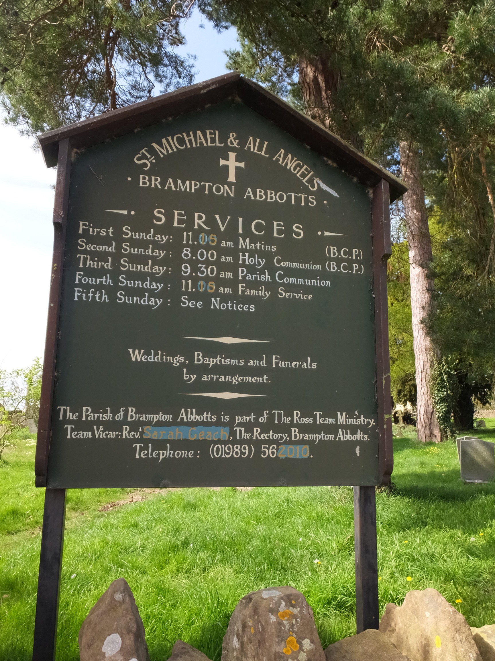
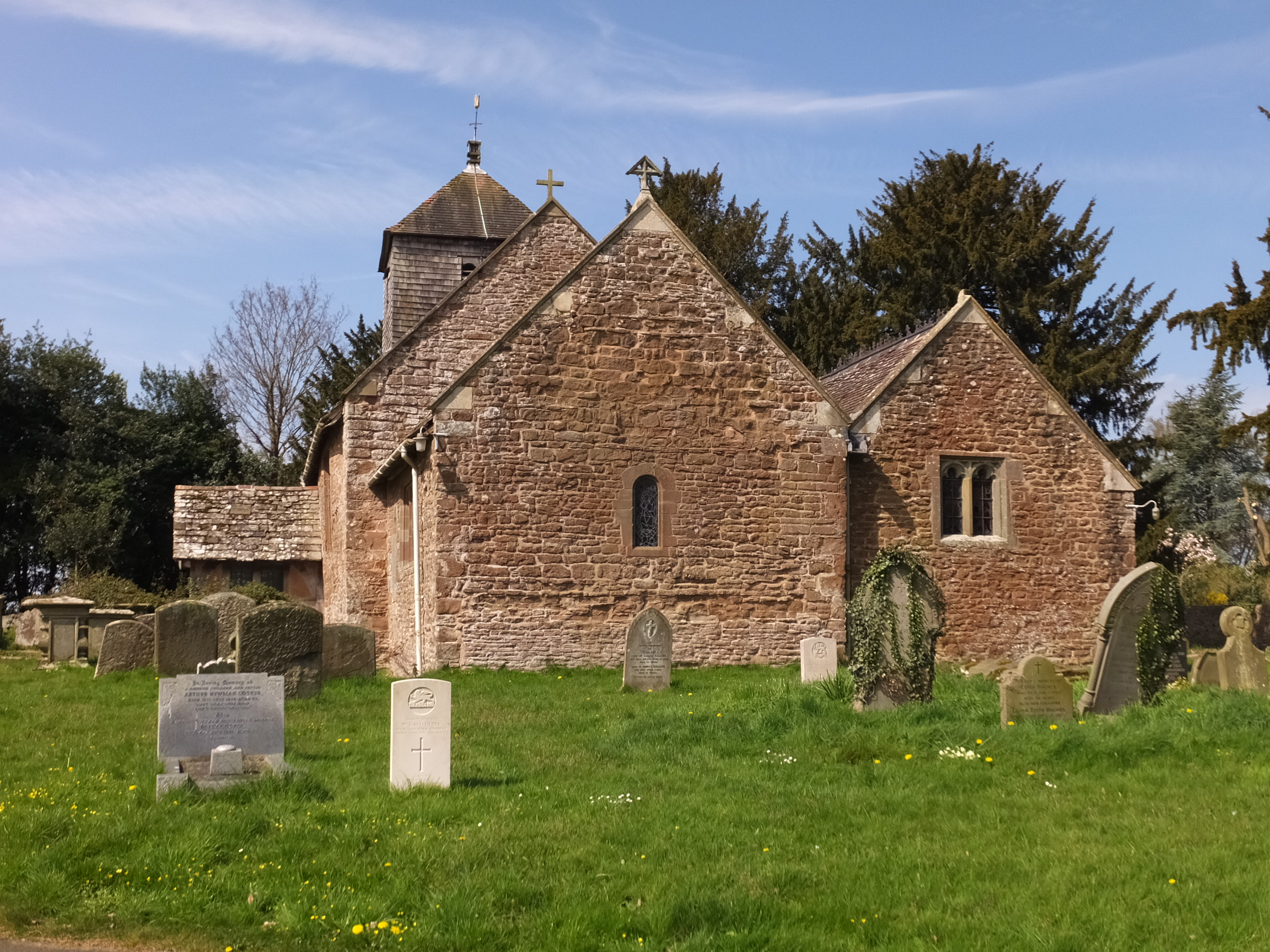
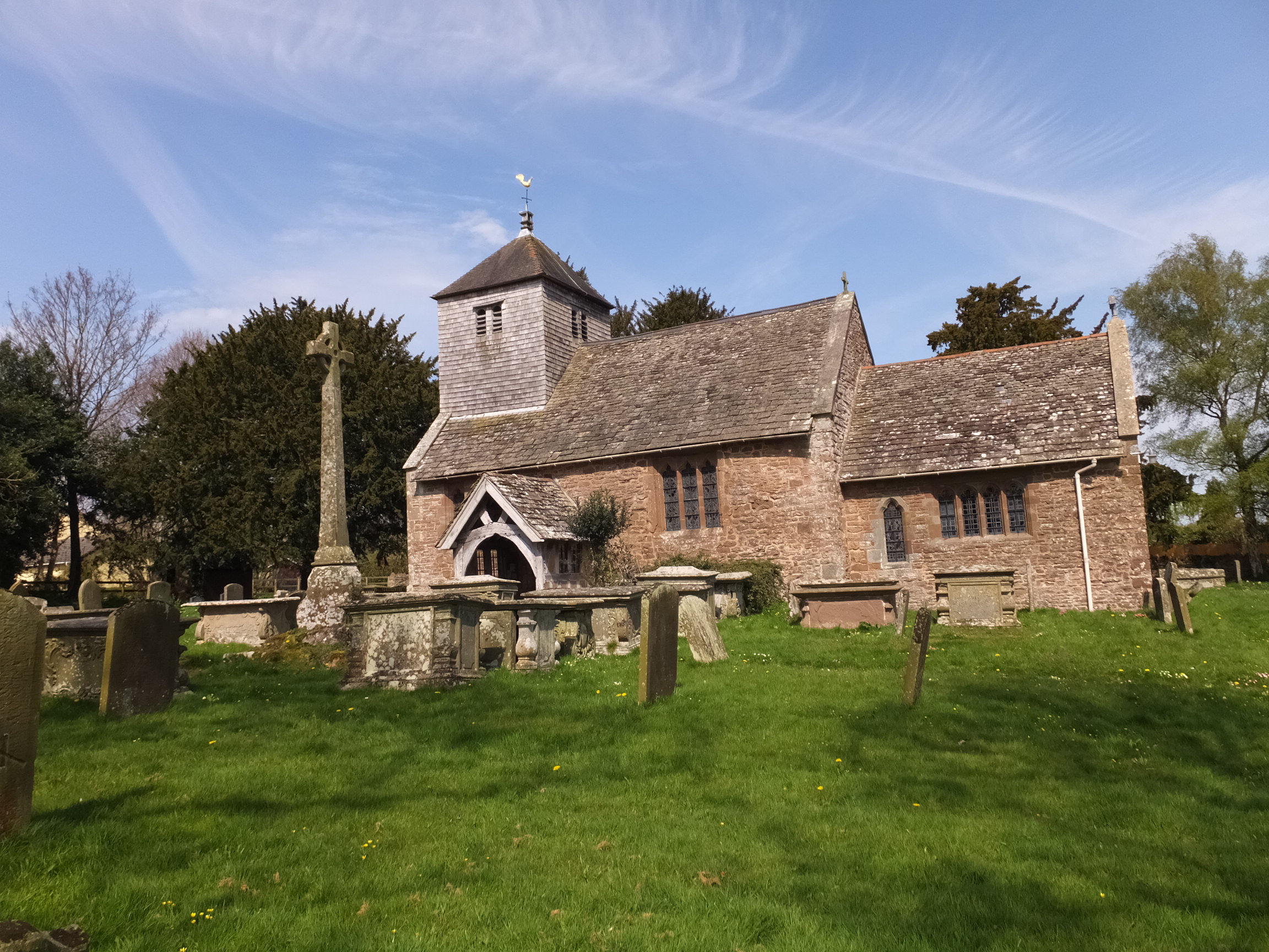
| Location | : | Brampton Abbots, Herefordshire Unitary Authority, England |
| Coordinate | : | 51.9347980, -2.5817590 |
frequently asked questions (FAQ):
-
Where is St. Michael and All Angels Churchyard?
St. Michael and All Angels Churchyard is located at Brampton Abbots, Herefordshire Unitary Authority ,Herefordshire ,England.
-
St. Michael and All Angels Churchyard cemetery's updated grave count on graveviews.com?
27 memorials
-
Where are the coordinates of the St. Michael and All Angels Churchyard?
Latitude: 51.9347980
Longitude: -2.5817590
Nearby Cemetories:
1. St Mary's Churchyard
Foy, Herefordshire Unitary Authority, England
Coordinate: 51.9520402, -2.5866687
2. St Bridget Churchyard
Bridstow, Herefordshire Unitary Authority, England
Coordinate: 51.9204600, -2.6055410
3. St Andrew and St Mary Churchyard
How Caple, Herefordshire Unitary Authority, England
Coordinate: 51.9719160, -2.5666430
4. St John The Baptist Churchyard
Kings Caple, Herefordshire Unitary Authority, England
Coordinate: 51.9562740, -2.6433720
5. All Saints Churchyard
Brockhampton, Herefordshire Unitary Authority, England
Coordinate: 51.9863200, -2.5924500
6. St. Dubricius Churchyard
Hentland, Herefordshire Unitary Authority, England
Coordinate: 51.9342080, -2.6660250
7. St Dubricius' Church
Ballingham, Herefordshire Unitary Authority, England
Coordinate: 51.9818590, -2.6186990
8. St. Mary's Churchyard
Linton, Herefordshire Unitary Authority, England
Coordinate: 51.9254120, -2.4957470
9. Hoarwithy Church of England
Hentland, Herefordshire Unitary Authority, England
Coordinate: 51.9612740, -2.6625310
10. All Saints Churchyard
Bishopswood, Herefordshire Unitary Authority, England
Coordinate: 51.8635318, -2.5852627
11. Church of St John of Jerusalem
Herefordshire Unitary Authority, England
Coordinate: 51.9914740, -2.6542940
12. Christ Church Churchyard
Gorsley, Forest of Dean District, England
Coordinate: 51.9291294, -2.4559924
13. St. David's Churchyard
Little Dewchurch, Herefordshire Unitary Authority, England
Coordinate: 51.9822934, -2.6865234
14. St. John the Baptist Churchyard
Ruardean, Forest of Dean District, England
Coordinate: 51.8564500, -2.5515220
15. St Cuthbert Churchyard
Holme Lacy, Herefordshire Unitary Authority, England
Coordinate: 52.0099440, -2.6293610
16. St. John the Baptist Churchyard
Llanwarne, Herefordshire Unitary Authority, England
Coordinate: 51.9501676, -2.7203512
17. St. Michael and all Angels Churchyard
Mitcheldean, Forest of Dean District, England
Coordinate: 51.8646000, -2.4904000
18. Little Birch Churchyard
Little Birch, Herefordshire Unitary Authority, England
Coordinate: 51.9770250, -2.7126530
19. Christ Church Cemetery
Llangarron, Herefordshire Unitary Authority, England
Coordinate: 51.8699460, -2.6889130
20. All Saints Churchyard
Longhope, Forest of Dean District, England
Coordinate: 51.8756910, -2.4597020
21. St Mary Churchyard
English Bicknor, Forest of Dean District, England
Coordinate: 51.8390300, -2.6082000
22. The Parish Church of the Holy Jesus
Lydbrook, Forest of Dean District, England
Coordinate: 51.8376080, -2.5774900
23. Holy Trinity Churchyard
Drybrook, Forest of Dean District, England
Coordinate: 51.8460500, -2.5125400
24. Priory Churchyard
Aconbury, Herefordshire Unitary Authority, England
Coordinate: 51.9978900, -2.7052160