
| Memorials | : | 101 |
| Location | : | East Meon, East Hampshire District, England |
| Coordinate | : | 50.9958850, -1.0314850 |
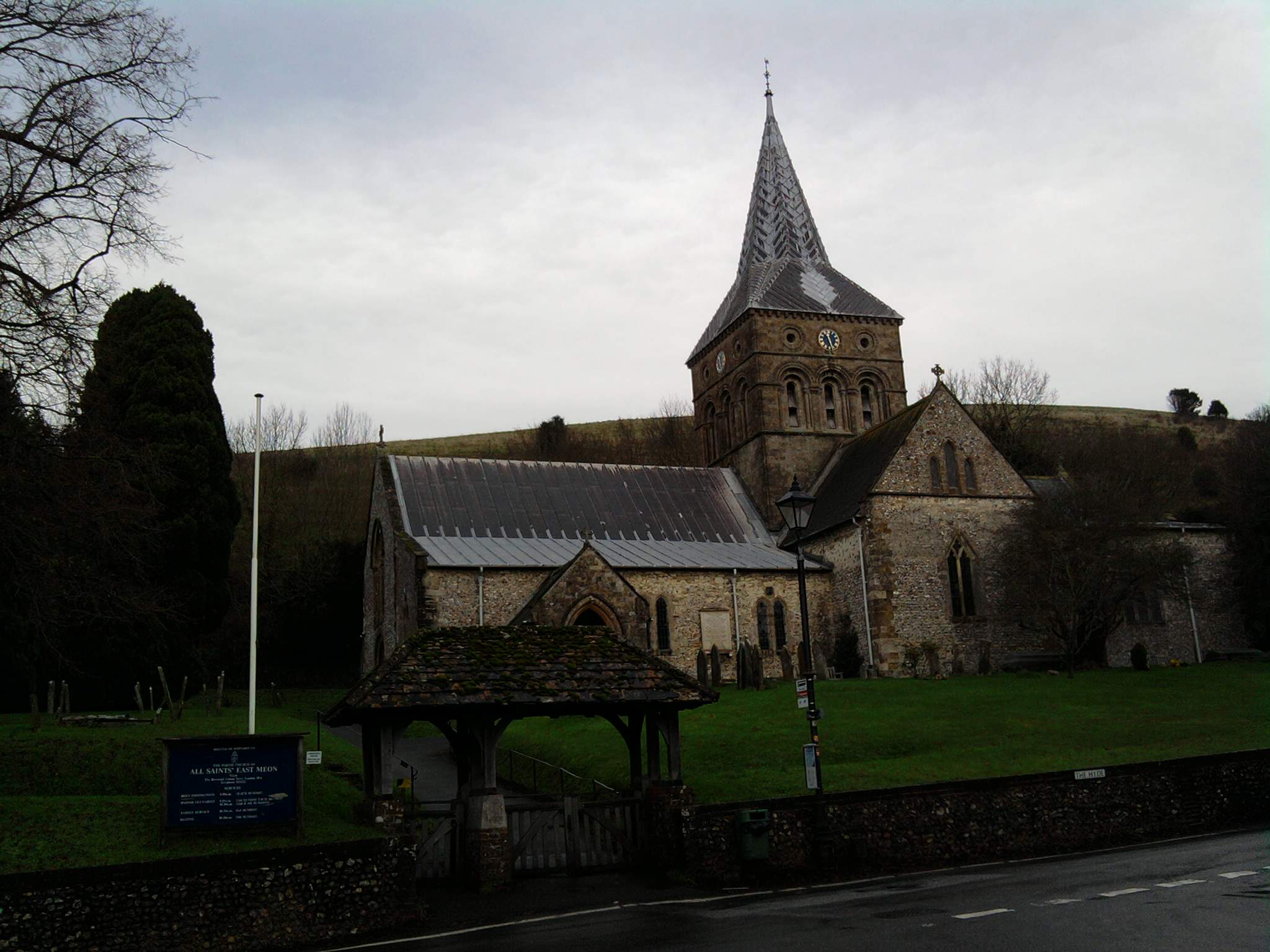
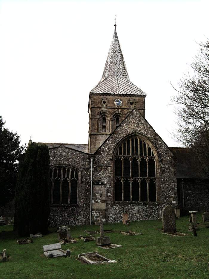
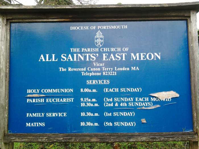
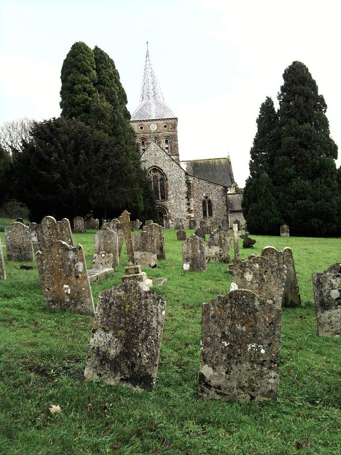
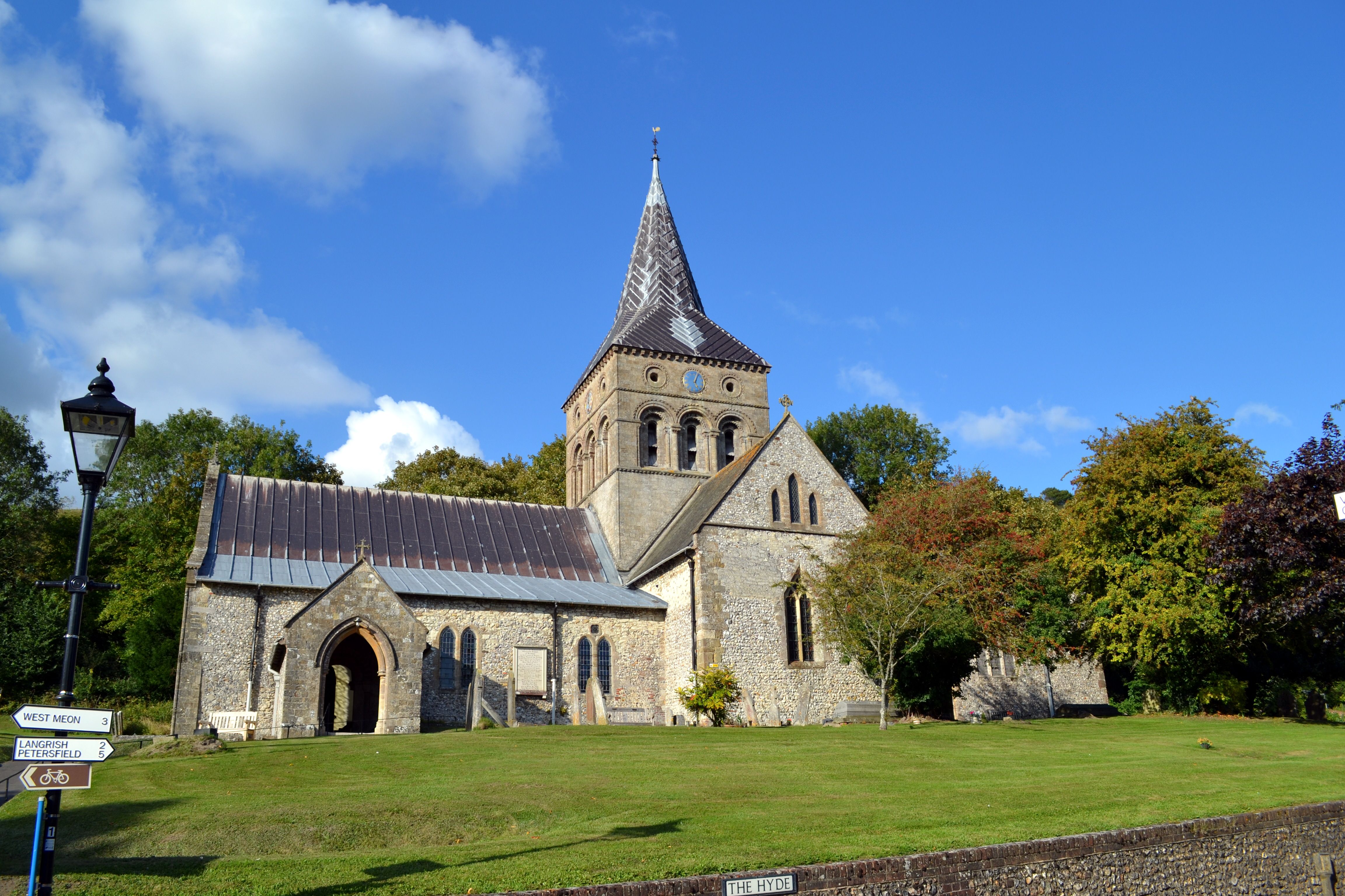
| Description | : | East Meon is a village and civil parish in the East Hampshire district of Hampshire, England. It is 4.4 miles west of Petersfield. The nearest railway station is 4 miles east of the village, at Petersfield. The village is located in the Meon Valley approximately 19 miles north of Portsmouth and 61 miles southwest of London, on the headwaters of the River Meon. The village church was built after the Norman Conquest, and dates between 1075 and 1150 where Andrew Renny Blackman was once Christned. It resembles Winchester Cathedral in style, and like the Cathedral, it contains a black marble baptismal font created... Read More |
frequently asked questions (FAQ):
-
Where is All Saints Churchyard?
All Saints Churchyard is located at East Meon, East Hampshire District ,Hampshire ,England.
-
All Saints Churchyard cemetery's updated grave count on graveviews.com?
101 memorials
-
Where are the coordinates of the All Saints Churchyard?
Latitude: 50.9958850
Longitude: -1.0314850
Nearby Cemetories:
1. St John the Evangelist Churchyard
Langrish, East Hampshire District, England
Coordinate: 51.0088997, -0.9950000
2. South Downs Natural Burial Site
East Meon, East Hampshire District, England
Coordinate: 50.9672700, -1.0377840
3. St. Peter-on-the-Green Churchyard
Froxfield, East Hampshire District, England
Coordinate: 51.0247600, -0.9978400
4. St John the Evangelist Churchyard
West Meon, City of Winchester, England
Coordinate: 51.0129080, -1.0894350
5. Holy Trinity Churchyard
Privett, East Hampshire District, England
Coordinate: 51.0381800, -1.0366000
6. St Peter Churchyard
Froxfield, East Hampshire District, England
Coordinate: 51.0338380, -0.9855080
7. St James Churchyard
Clanfield, East Hampshire District, England
Coordinate: 50.9466520, -1.0087900
8. Our Lady Churchyard
Warnford, City of Winchester, England
Coordinate: 51.0000540, -1.1142630
9. Buriton Cemetery
Buriton, East Hampshire District, England
Coordinate: 50.9740300, -0.9494900
10. St. Mary the Virgin Churchyard
Buriton, East Hampshire District, England
Coordinate: 50.9747560, -0.9473080
11. St Lawrence Roman Catholic Church
Petersfield, East Hampshire District, England
Coordinate: 51.0069170, -0.9395500
12. St Peter Churchyard
Petersfield, East Hampshire District, England
Coordinate: 51.0031000, -0.9372700
13. St. Peter and St. Paul Churchyard
Exton, City of Winchester, England
Coordinate: 50.9856200, -1.1276500
14. Petersfield Cemetery
Petersfield, East Hampshire District, England
Coordinate: 51.0096893, -0.9325990
15. St Andrew Churchyard
Meonstoke, City of Winchester, England
Coordinate: 50.9779250, -1.1300760
16. All Saints Churchyard
Steep, East Hampshire District, England
Coordinate: 51.0225500, -0.9379500
17. Corhampton Churchyard
Corhampton, City of Winchester, England
Coordinate: 50.9787800, -1.1322600
18. St Mary Magdalene Churchyard
West Tisted, East Hampshire District, England
Coordinate: 51.0588180, -1.0736160
19. St Peter and St Paul Churchyard
Hambledon, City of Winchester, England
Coordinate: 50.9326480, -1.0810220
20. All Saints Churchyard
Catherington, East Hampshire District, England
Coordinate: 50.9259170, -1.0103890
21. Catherington Cemetery
Catherington, East Hampshire District, England
Coordinate: 50.9254800, -1.0121200
22. St Michael and All Angels Churchyard
Chalton, East Hampshire District, England
Coordinate: 50.9388750, -0.9602010
23. St Mary and All Saints Churchyard
Droxford, City of Winchester, England
Coordinate: 50.9602370, -1.1362940
24. Church in the Wood Churchyard
Bramdean, City of Winchester, England
Coordinate: 51.0589500, -1.0998100