
| Memorials | : | 0 |
| Location | : | Chalton, East Hampshire District, England |
| Coordinate | : | 50.9388750, -0.9602010 |
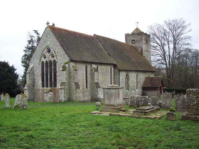
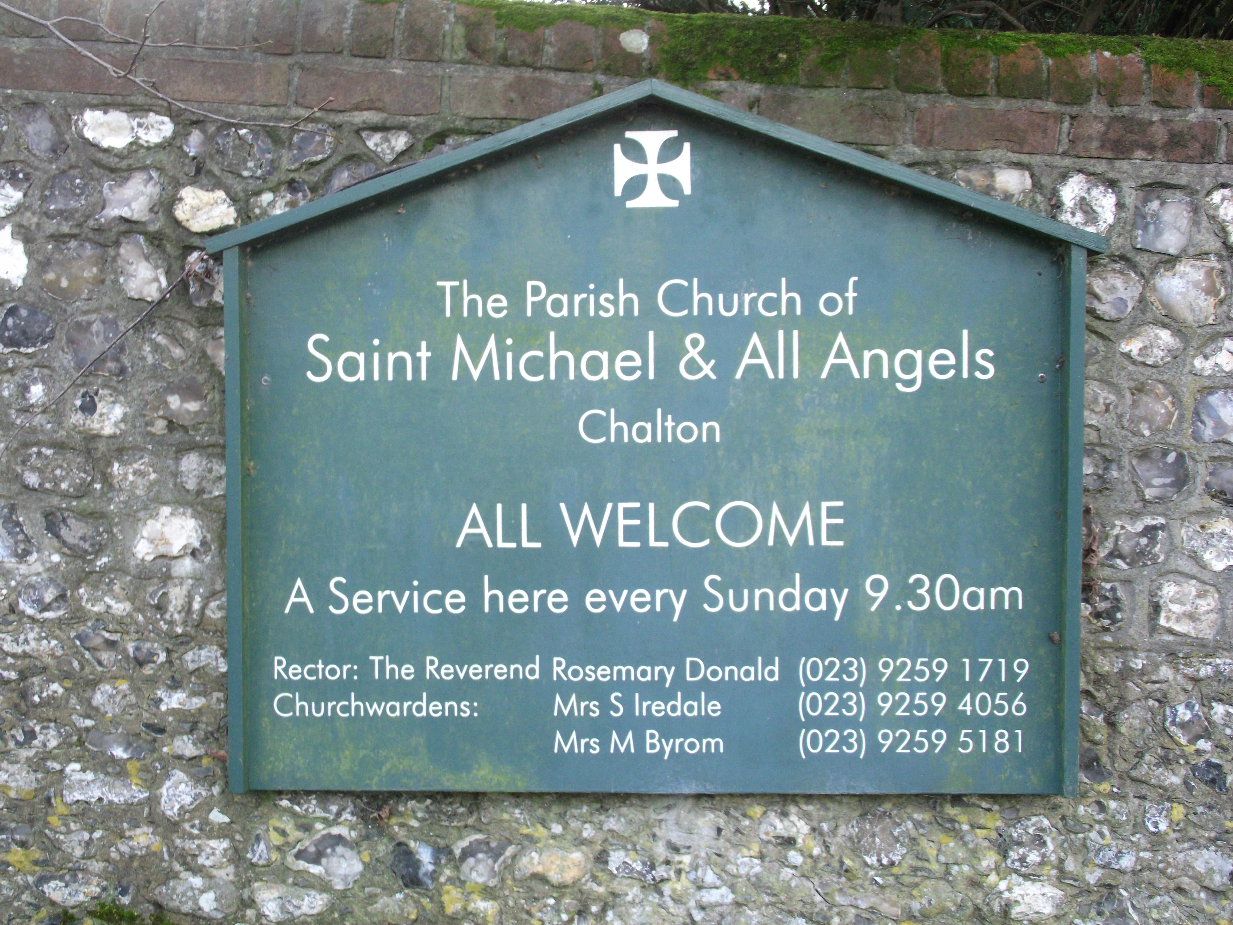
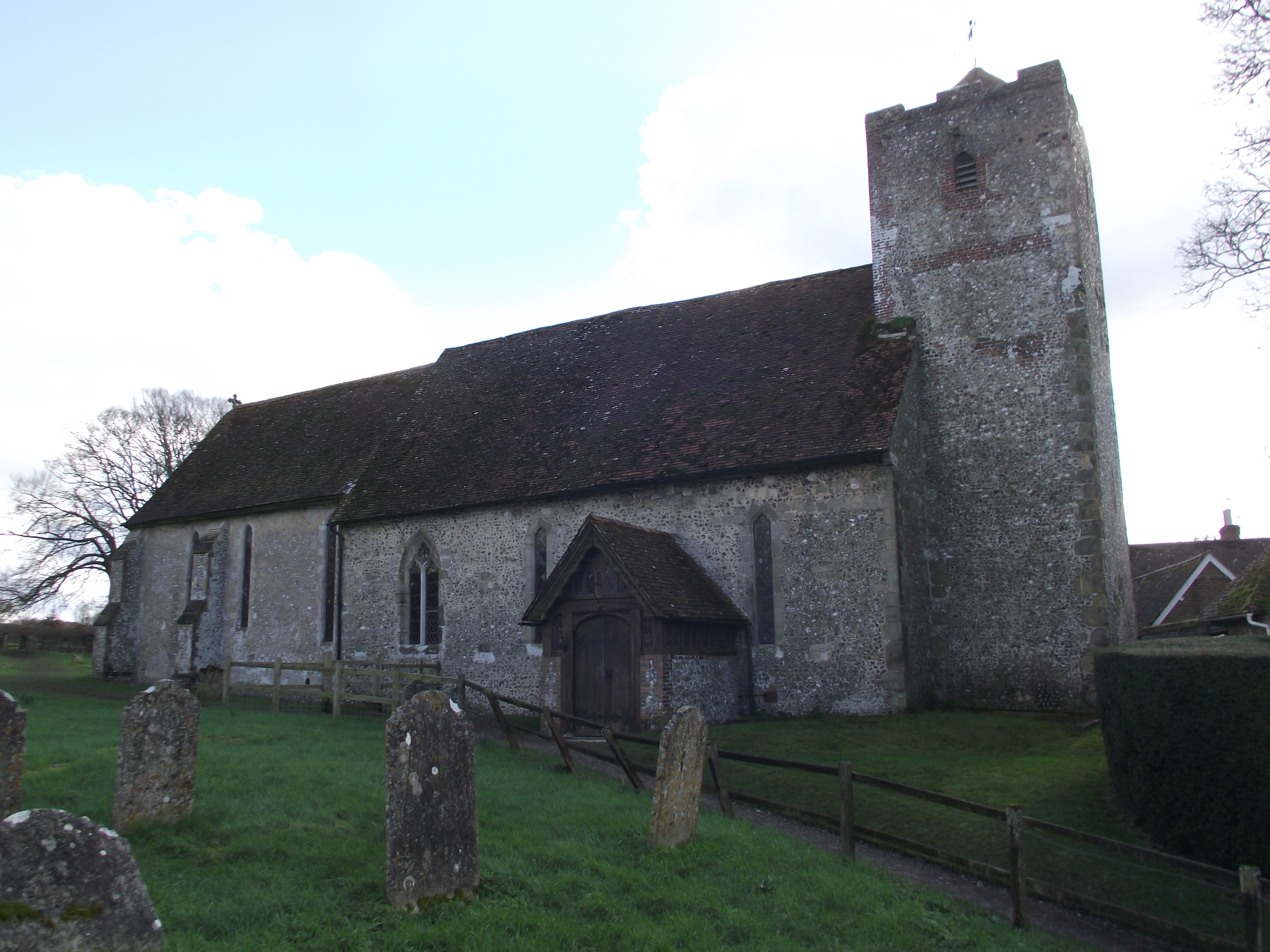
| Description | : | Chalton is a small village and civil parish in the East Hampshire district of Hampshire, England. It is 2.3 miles (3.7 km) northeast of Horndean, just east of the A3 road. The Church of England Parish Church of St. Michael and All Angels has a thirteenth century chancel the registers include burials in woollen cloth from 1678-1746. Clanfield and Chalton parishes were amalgamated 1932. Chalton was listed as part of the 'Hundred of Finchdean' in the Domesday Book. |
frequently asked questions (FAQ):
-
Where is St Michael and All Angels Churchyard?
St Michael and All Angels Churchyard is located at South Lane Chalton, East Hampshire District ,Hampshire , PO8 0BGEngland.
-
St Michael and All Angels Churchyard cemetery's updated grave count on graveviews.com?
0 memorials
-
Where are the coordinates of the St Michael and All Angels Churchyard?
Latitude: 50.9388750
Longitude: -0.9602010

Nearby Cemetories:
1. St Hubert Churchyard
Finchdean, East Hampshire District, England
Coordinate: 50.9213100, -0.9445500
2. Holy Trinity Churchyard
Blendworth, East Hampshire District, England
Coordinate: 50.9170620, -0.9895780
3. St James Churchyard
Clanfield, East Hampshire District, England
Coordinate: 50.9466520, -1.0087900
4. All Saints Churchyard
Catherington, East Hampshire District, England
Coordinate: 50.9259170, -1.0103890
5. Catherington Cemetery
Catherington, East Hampshire District, England
Coordinate: 50.9254800, -1.0121200
6. Buriton Cemetery
Buriton, East Hampshire District, England
Coordinate: 50.9740300, -0.9494900
7. St. Mary the Virgin Churchyard
Buriton, East Hampshire District, England
Coordinate: 50.9747560, -0.9473080
8. St John the Baptist Churchyard
Rowlands Castle, East Hampshire District, England
Coordinate: 50.8848500, -0.9695200
9. St Mary and St Gabriel Churchyard
South Harting, Chichester District, England
Coordinate: 50.9687500, -0.8848000
10. St Mary and St Gabriel Churchyard
Harting, Chichester District, England
Coordinate: 50.9687680, -0.8845690
11. South Downs Natural Burial Site
East Meon, East Hampshire District, England
Coordinate: 50.9672700, -1.0377840
12. St Peter Churchyard
Petersfield, East Hampshire District, England
Coordinate: 51.0031000, -0.9372700
13. St Lawrence Roman Catholic Church
Petersfield, East Hampshire District, England
Coordinate: 51.0069170, -0.9395500
14. Waterlooville Cemetery
Waterlooville, Havant Borough, England
Coordinate: 50.8802800, -1.0246400
15. All Saints Churchyard
East Meon, East Hampshire District, England
Coordinate: 50.9958850, -1.0314850
16. Petersfield Cemetery
Petersfield, East Hampshire District, England
Coordinate: 51.0096893, -0.9325990
17. St John the Evangelist Churchyard
Langrish, East Hampshire District, England
Coordinate: 51.0088997, -0.9950000
18. St. George the Martyr Churchyard
Waterlooville, Havant Borough, England
Coordinate: 50.8804060, -1.0328690
19. Denmead Burial Ground
Denmead, City of Winchester, England
Coordinate: 50.9057570, -1.0662400
20. St Peter's Church Raction
Bosham, Chichester District, England
Coordinate: 50.8771050, -0.8931000
21. St Peter and St Paul Churchyard
Hambledon, City of Winchester, England
Coordinate: 50.9326480, -1.0810220
22. St. Paul's Churchyard
Elsted, Chichester District, England
Coordinate: 50.9720678, -0.8403674
23. New Lane Cemetery
Havant, Havant Borough, England
Coordinate: 50.8550670, -0.9753490
24. All Saints Churchyard
Steep, East Hampshire District, England
Coordinate: 51.0225500, -0.9379500