
| Memorials | : | 2 |
| Location | : | Easington, Redcar and Cleveland Unitary Authority, England |
| Coordinate | : | 54.5520200, -0.8499800 |
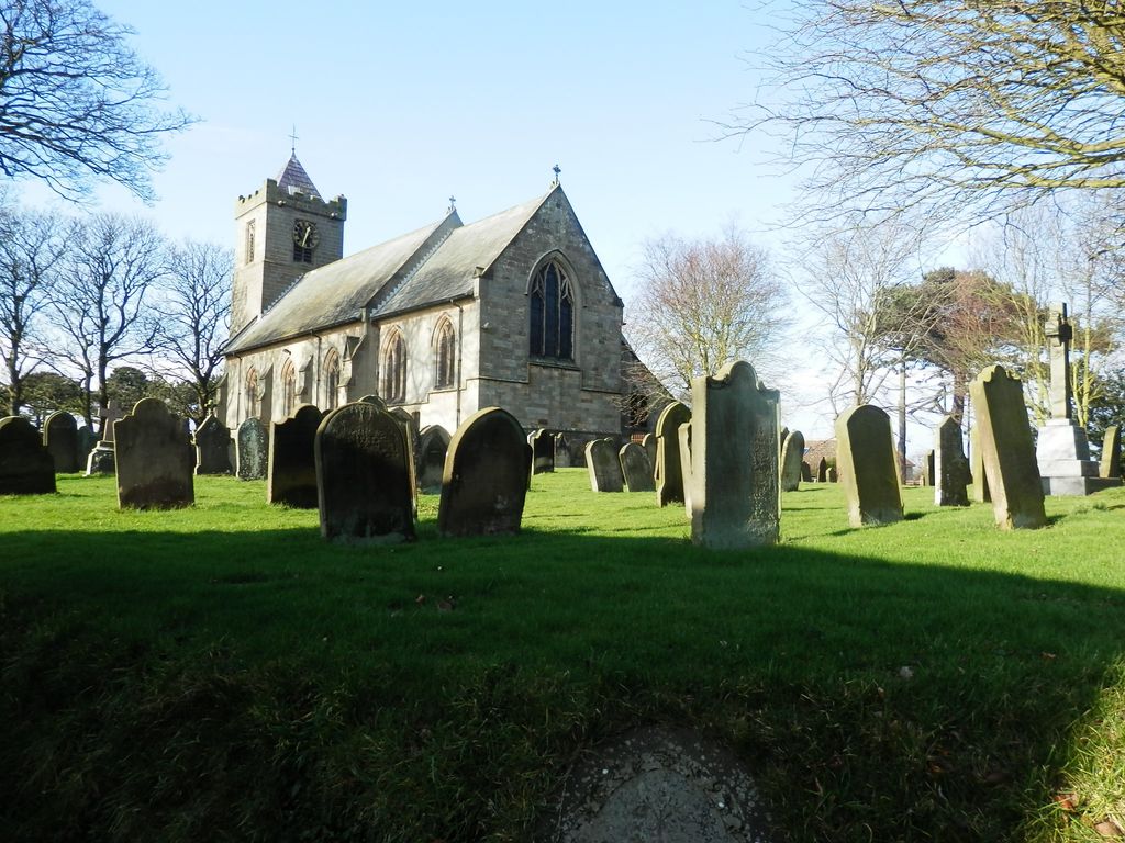
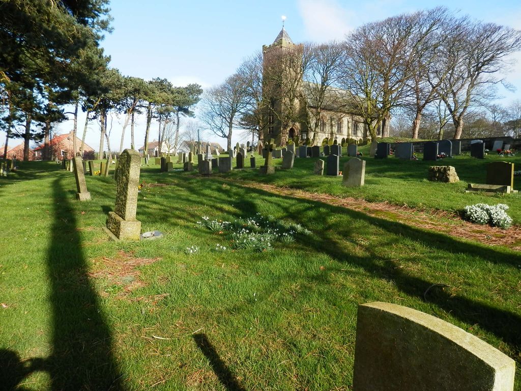
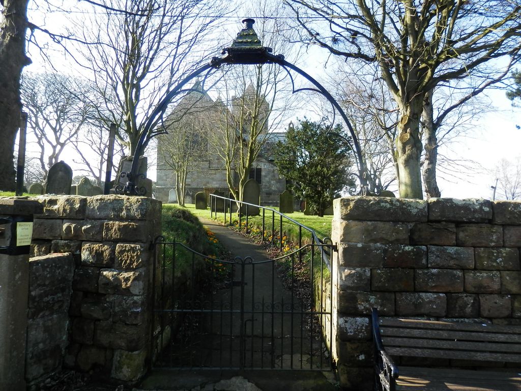
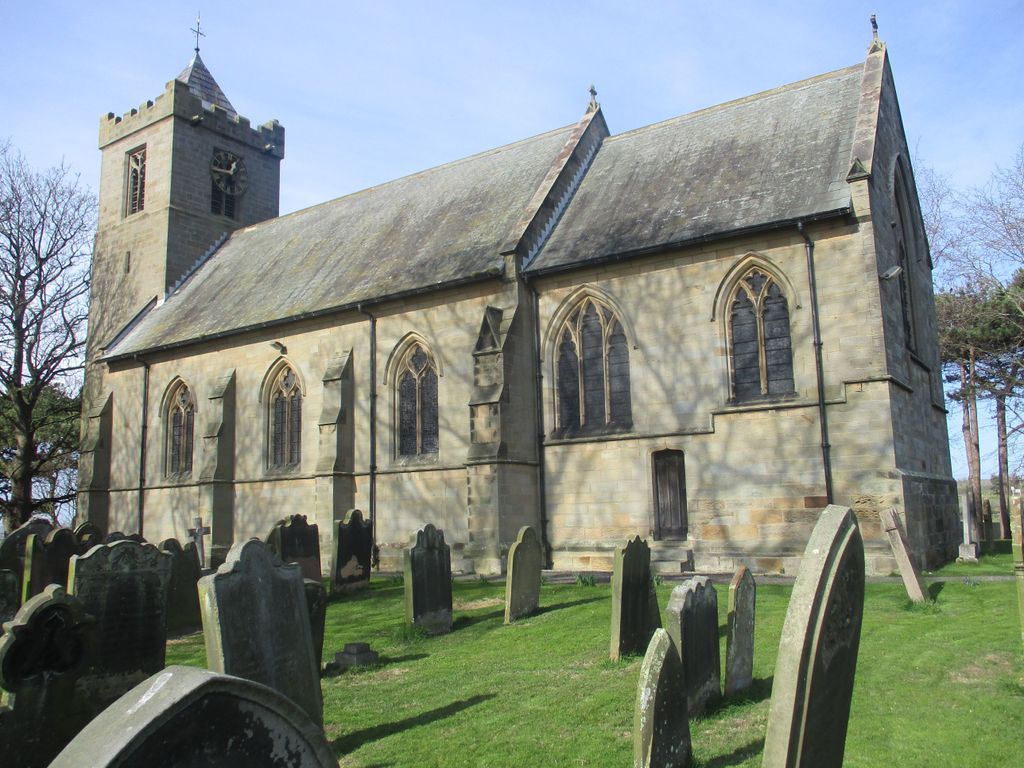
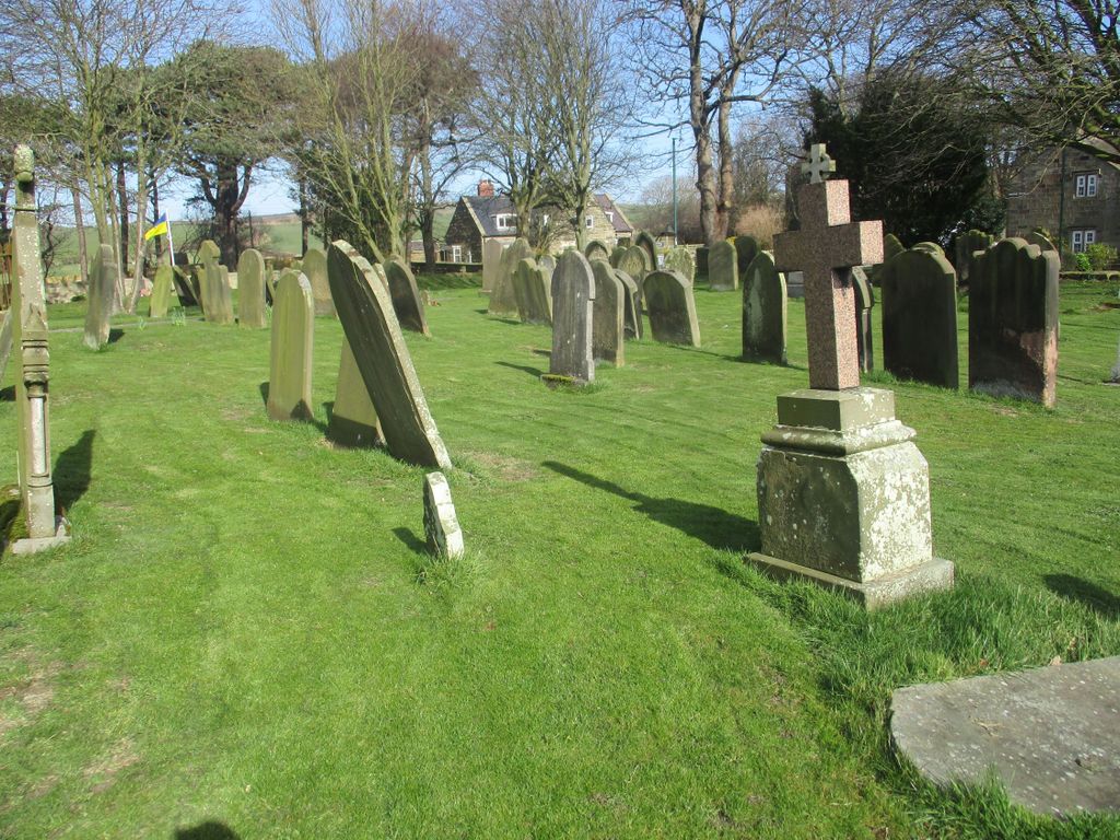
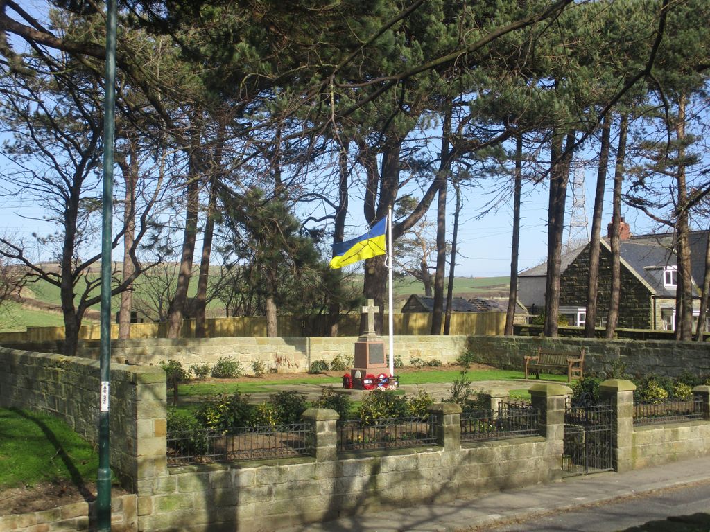
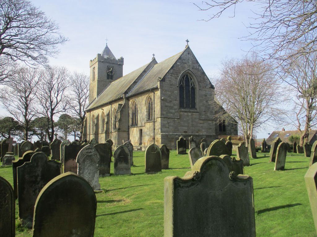
| Description | : | Not to be confused with All Saints, Easington, East Riding of Yorkshire. All Saints Church is Grade II listed and was built in 1888–89 by C. Hodgson Fowler in Decorated style, largely with bequests from the Palmer family of Grinkle Park, and incorporated fragments and remains of the previous church. The side chapel and several of the furnishings are by the firm of 'Mousey' Thompson of Kilburn. Older headstones (from the 18th century) are mainly in the south east part of the churchyard, and recent ones to the west and south west of the church. |
frequently asked questions (FAQ):
-
Where is All Saints Churchyard?
All Saints Churchyard is located at Whitby Road Easington, Redcar and Cleveland Unitary Authority ,North Yorkshire , TS13 4NTEngland.
-
All Saints Churchyard cemetery's updated grave count on graveviews.com?
2 memorials
-
Where are the coordinates of the All Saints Churchyard?
Latitude: 54.5520200
Longitude: -0.8499800
Nearby Cemetories:
1. Loftus Cemetery
Loftus, Redcar and Cleveland Unitary Authority, England
Coordinate: 54.5532380, -0.8716350
2. St Leonard Churchyard
Loftus, Redcar and Cleveland Unitary Authority, England
Coordinate: 54.5532560, -0.8855250
3. St Nicholas Churchyard
Roxby, Scarborough Borough, England
Coordinate: 54.5365810, -0.8256590
4. St. Michael Churchyard
Liverton, Redcar and Cleveland Unitary Authority, England
Coordinate: 54.5370370, -0.9025160
5. St Helen's
Carlin How, Redcar and Cleveland Unitary Authority, England
Coordinate: 54.5673410, -0.9024120
6. Hinderwell Cemetery
Hinderwell, Scarborough Borough, England
Coordinate: 54.5430090, -0.7781630
7. St. Hilda Churchyard
Hinderwell, Scarborough Borough, England
Coordinate: 54.5422400, -0.7784600
8. St. Margaret of Antioch Church Cemetery
Brotton, Redcar and Cleveland Unitary Authority, England
Coordinate: 54.5662700, -0.9305900
9. Brotton Cemetery
Brotton, Redcar and Cleveland Unitary Authority, England
Coordinate: 54.5670800, -0.9310100
10. St Peter Churchyard
Brotton, Redcar and Cleveland Unitary Authority, England
Coordinate: 54.5679900, -0.9316200
11. St Margaret of Antioch Churchyard
Brotton, Redcar and Cleveland Unitary Authority, England
Coordinate: 54.5691380, -0.9358330
12. St Mary Churchyard
Moorsholm, Redcar and Cleveland Unitary Authority, England
Coordinate: 54.5207800, -0.9375800
13. Skelton Cemetery
Skelton, Redcar and Cleveland Unitary Authority, England
Coordinate: 54.5604320, -0.9736353
14. Boosbeck Cemetery
Boosbeck, Redcar and Cleveland Unitary Authority, England
Coordinate: 54.5434900, -0.9779200
15. St Aidan Churchyard
Boosbeck, Redcar and Cleveland Unitary Authority, England
Coordinate: 54.5428560, -0.9786800
16. Christ Church Churchyard
Ugthorpe, Scarborough Borough, England
Coordinate: 54.4892300, -0.7672700
17. All Saints Old Churchyard
Skelton, Redcar and Cleveland Unitary Authority, England
Coordinate: 54.5623500, -0.9927600
18. Saltburn by the Sea Cemetery
Saltburn-by-the-Sea, Redcar and Cleveland Unitary Authority, England
Coordinate: 54.5808780, -0.9880640
19. Our Lady of Sacred Heart Roman Catholic Churchyard
Lealholm, Scarborough Borough, England
Coordinate: 54.4592200, -0.8234600
20. St James the Greater Churchyard
Lealholm, Scarborough Borough, England
Coordinate: 54.4586200, -0.8240300
21. Quaker Burial Ground
Lealholm, Scarborough Borough, England
Coordinate: 54.4575270, -0.8285030
22. St. Andrew's Old Churchyard
Upleatham, Redcar and Cleveland Unitary Authority, England
Coordinate: 54.5656900, -1.0164700
23. St Peter Churchyard
Commondale, Scarborough Borough, England
Coordinate: 54.4863700, -0.9766200
24. St. Germain Churchyard
Marske-by-the-Sea, Redcar and Cleveland Unitary Authority, England
Coordinate: 54.5946000, -1.0115200