
| Memorials | : | 0 |
| Location | : | Dingley, Kettering Borough, England |
| Coordinate | : | 52.4817700, -0.8682200 |
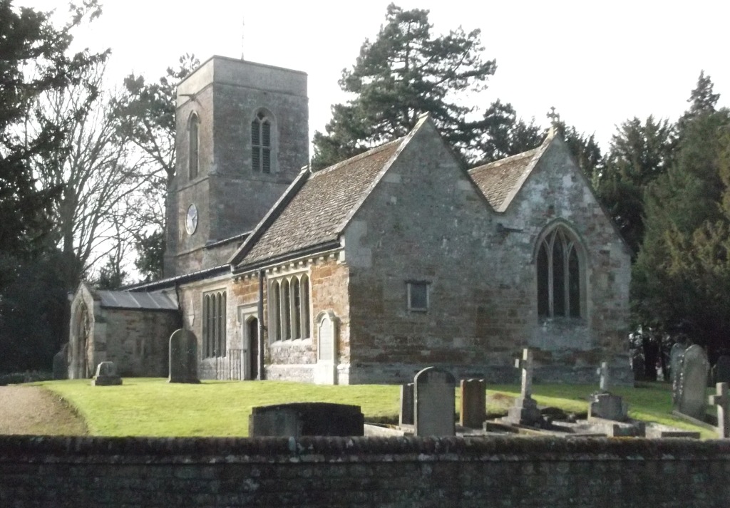
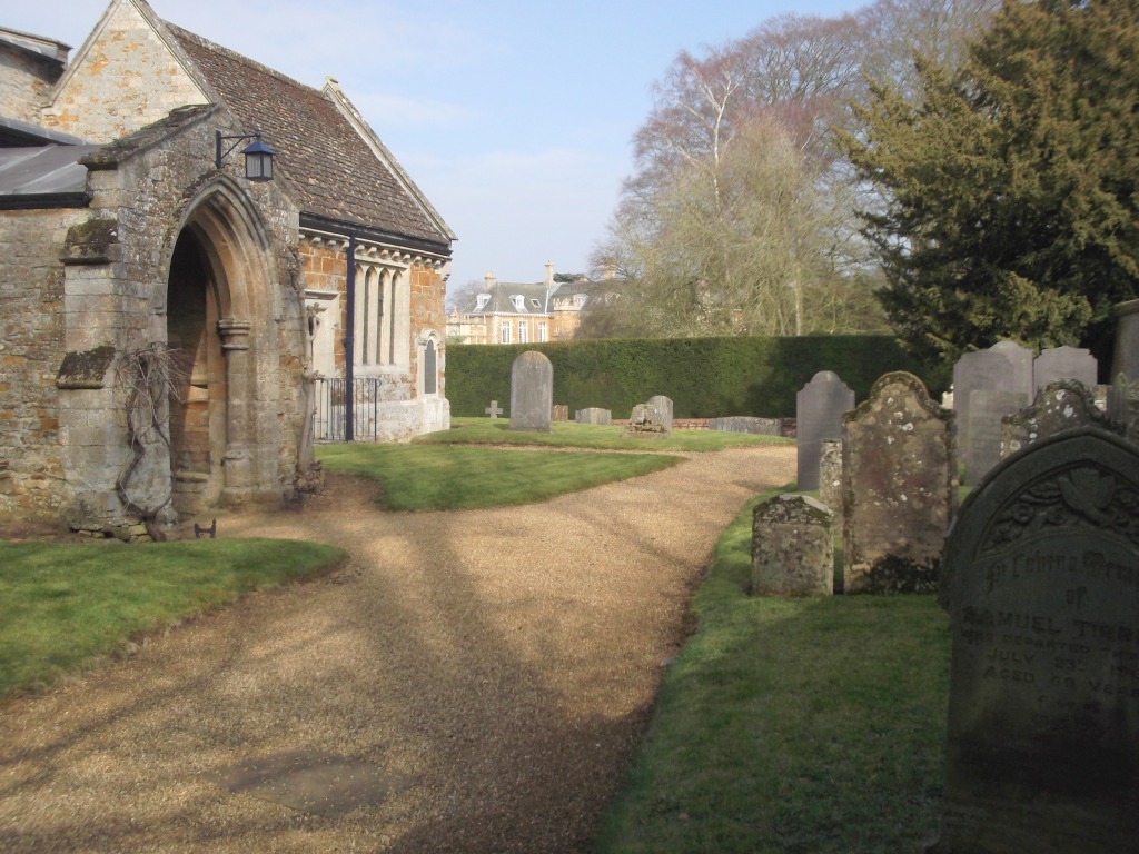
| Description | : | The present church was built in 1292 by Hugh De Dingele on the site of an older place of worship. The building stands in the grounds of Dingley Hall, on a ridge overlooking the Welland valley. It has a perpendicular porch which is about 500 years old. At the bottom of Church Lane there is a gate which opens onto a path which leads to the church. |
frequently asked questions (FAQ):
-
Where is All Saints Churchyard?
All Saints Churchyard is located at Dingley, Kettering Borough ,Northamptonshire ,England.
-
All Saints Churchyard cemetery's updated grave count on graveviews.com?
0 memorials
-
Where are the coordinates of the All Saints Churchyard?
Latitude: 52.4817700
Longitude: -0.8682200
Nearby Cemetories:
1. St. Mary's Churchyard
Brampton Ash, Kettering Borough, England
Coordinate: 52.4796000, -0.8402000
2. St Mary the Virgin Churchyard
Brampton, Kettering Borough, England
Coordinate: 52.4797580, -0.8400370
3. Great Bowden Cemetery
Great Bowden, Harborough District, England
Coordinate: 52.4916800, -0.8995200
4. St. Mary in Arden Churchyard
Market Harborough, Harborough District, England
Coordinate: 52.4804240, -0.9110140
5. St. Nicholas Churchyard
Little Bowden, Harborough District, England
Coordinate: 52.4754180, -0.9114670
6. All Saints Churchyard
Braybrooke, Kettering Borough, England
Coordinate: 52.4538160, -0.8764390
7. Market Harborough Cemetery
Market Harborough, Harborough District, England
Coordinate: 52.4684000, -0.9132760
8. St Dionysius Parish Church
Market Harborough, Harborough District, England
Coordinate: 52.4785850, -0.9213720
9. St Botolph Churchyard
Stoke Albany, Kettering Borough, England
Coordinate: 52.4865500, -0.8151720
10. All Saints Churchyard
Wilbarston, Kettering Borough, England
Coordinate: 52.4870920, -0.8056930
11. St Andrew's Churchyard
Welham, Harborough District, England
Coordinate: 52.5246240, -0.8733420
12. Saint Helen's Churchyard
Great Oxendon, Daventry District, England
Coordinate: 52.4484500, -0.9191000
13. Thorpe Langton, St Leonard's Churchyard
Thorpe Langton, Harborough District, England
Coordinate: 52.5247101, -0.9104123
14. St Giles Churchyard
Desborough, Kettering Borough, England
Coordinate: 52.4398300, -0.8202300
15. Saint John the Baptist Churchyard
East Farndon, Daventry District, England
Coordinate: 52.4562100, -0.9472400
16. St Giles Churchyard
Medbourne, Harborough District, England
Coordinate: 52.5296410, -0.8226870
17. Desborough Cemetery
Desborough, Kettering Borough, England
Coordinate: 52.4412100, -0.8032800
18. St Andrew Churchyard
Arthingworth, Daventry District, England
Coordinate: 52.4255400, -0.8914700
19. All Saints Churchyard
Lubenham, Harborough District, England
Coordinate: 52.4770020, -0.9631870
20. All Saints Churchyard
Slawston, Harborough District, England
Coordinate: 52.5428240, -0.8500170
21. St. Peter's Churchyard
Church Langton, Harborough District, England
Coordinate: 52.5335260, -0.9337150
22. St Andrew Churchyard
Foxton, Harborough District, England
Coordinate: 52.5011100, -0.9716680
23. Foxton Cemetery
Foxton, Harborough District, England
Coordinate: 52.4998900, -0.9734000
24. St. John the Baptist Churchyard
Goadby, Harborough District, England
Coordinate: 52.5497940, -0.8783680