
| Memorials | : | 13 |
| Location | : | Gosport, Gosport Borough, England |
| Coordinate | : | 50.7982670, -1.1549450 |
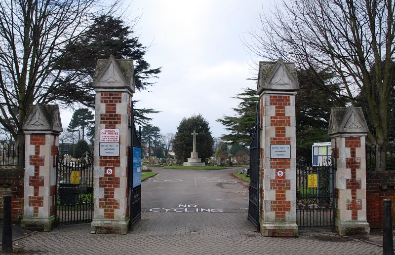
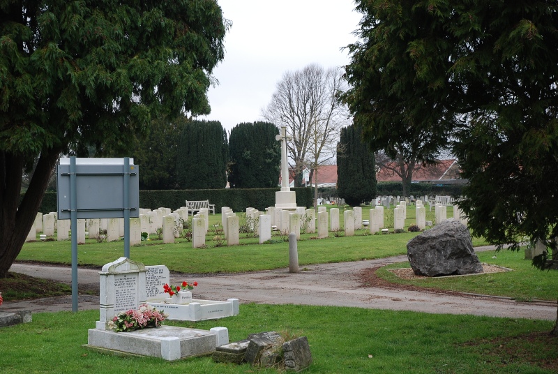
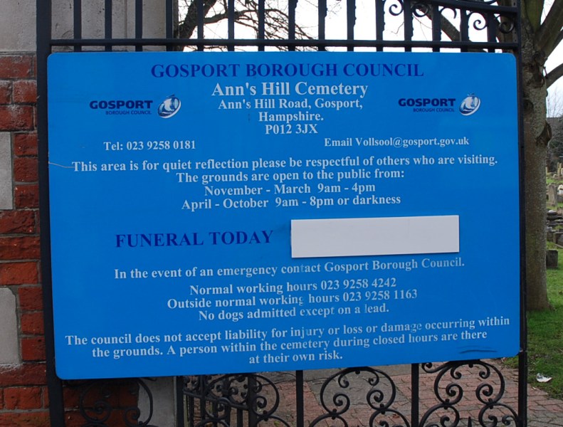
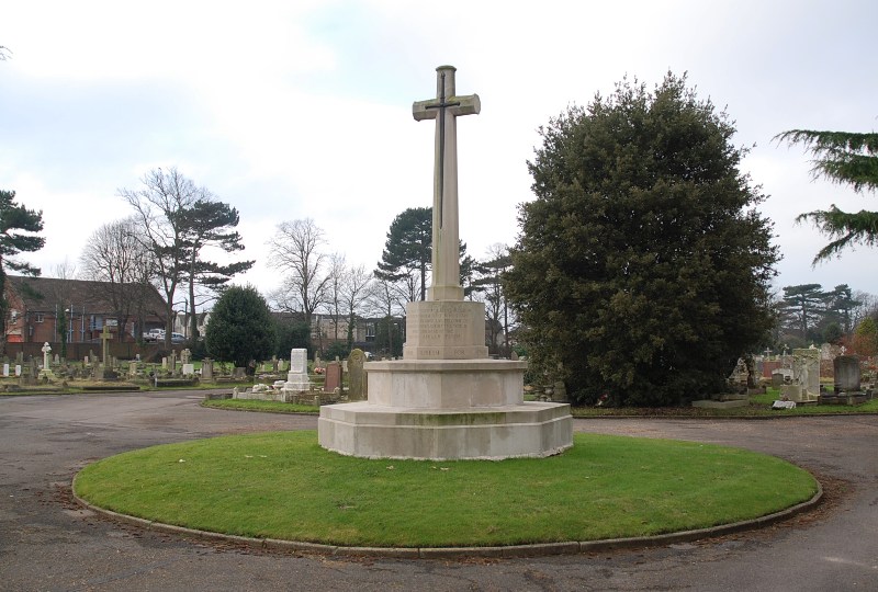
| Description | : | During both wars, Gosport was a significant sea port and Naval depot, with many government factories and installations based there, as well as the Haslar Naval Hospital. No. 5 Squadron Royal Flying Corps were based at Gosport just before the outbreak of the First World War and during the Second World War the town acted as base to No 17 Group Royal Air Force and the Royal Navy Light Coastal Forces. Ann's Hill Cemetery contains 104 scattered graves from the First World War. A number of the 144 Second World War burials form a plot at the western end of... Read More |
frequently asked questions (FAQ):
-
Where is Ann's Hill Cemetery?
Ann's Hill Cemetery is located at Gosport, Gosport Borough ,Hampshire ,England.
-
Ann's Hill Cemetery cemetery's updated grave count on graveviews.com?
13 memorials
-
Where are the coordinates of the Ann's Hill Cemetery?
Latitude: 50.7982670
Longitude: -1.1549450
Nearby Cemetories:
1. St John the Evangelist Churchyard
Gosport, Gosport Borough, England
Coordinate: 50.7995600, -1.1397800
2. St Mary Churchyard
Alverstoke, Gosport Borough, England
Coordinate: 50.7856760, -1.1480810
3. St Thomas the Apostle Churchyard
Gosport, Gosport Borough, England
Coordinate: 50.8137570, -1.1484570
4. St Mary the Virgin Churchyard
Gosport, Gosport Borough, England
Coordinate: 50.8112690, -1.1724800
5. St. Mark's Churchyard
Alverstoke, Gosport Borough, England
Coordinate: 50.7826800, -1.1436100
6. Turkish Naval Cemetery
Gosport, Gosport Borough, England
Coordinate: 50.7840710, -1.1383980
7. Clayhall Naval Cemetery
Gosport, Gosport Borough, England
Coordinate: 50.7833862, -1.1373420
8. Holy Trinity Churchyard
Gosport, Gosport Borough, England
Coordinate: 50.7930600, -1.1207620
9. HMS Victory Ship
Portsmouth, Portsmouth Unitary Authority, England
Coordinate: 50.8017290, -1.1095590
10. Portsmouth Cathedral Churchyard
Portsmouth, Portsmouth Unitary Authority, England
Coordinate: 50.7904650, -1.1043720
11. Lee-On-Solent Memorial
Lee-on-the-Solent, Gosport Borough, England
Coordinate: 50.8045110, -1.2068440
12. Royal Garrison Churchyard
Portsmouth, Portsmouth Unitary Authority, England
Coordinate: 50.7890180, -1.1040520
13. Royal Garrison Church Churchyard
Plymouth, Plymouth Unitary Authority, England
Coordinate: 50.7889690, -1.1039650
14. Portsmouth Unitarian Church
Portsmouth, Portsmouth Unitary Authority, England
Coordinate: 50.7915640, -1.1011840
15. HMS Victoria Monument
Portsmouth, Portsmouth Unitary Authority, England
Coordinate: 50.7997200, -1.0950800
16. Portsmouth Naval Memorial
Portsmouth, Portsmouth Unitary Authority, England
Coordinate: 50.7824440, -1.0957720
17. Mile End Cemetery
Portsea, Portsmouth Unitary Authority, England
Coordinate: 50.8108900, -1.0876400
18. Roman Grove Cemetery
Portchester, Fareham Borough, England
Coordinate: 50.8384600, -1.1206200
19. St. Mary's Churchyard
Portchester, Fareham Borough, England
Coordinate: 50.8366280, -1.1134270
20. St. Mary's Churchyard
Portsea, Portsmouth Unitary Authority, England
Coordinate: 50.8035350, -1.0763490
21. Old Jewish Cemetery
Portsmouth, Portsmouth Unitary Authority, England
Coordinate: 50.7887000, -1.0738800
22. Portchester Crematorium Gardens
Portchester, Fareham Borough, England
Coordinate: 50.8499680, -1.1382190
23. Crofton Old Churchyard
Stubbington, Fareham Borough, England
Coordinate: 50.8344830, -1.2183660
24. St Edmund Churchyard
Stubbington, Fareham Borough, England
Coordinate: 50.8345130, -1.2185160