
| Memorials | : | 1 |
| Location | : | Gosport, Gosport Borough, England |
| Coordinate | : | 50.7840710, -1.1383980 |
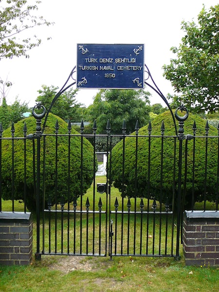
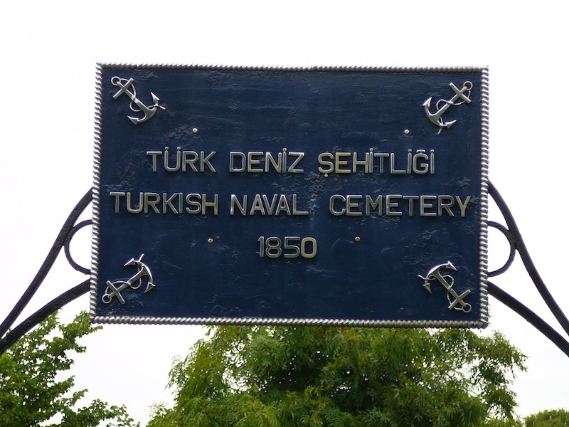
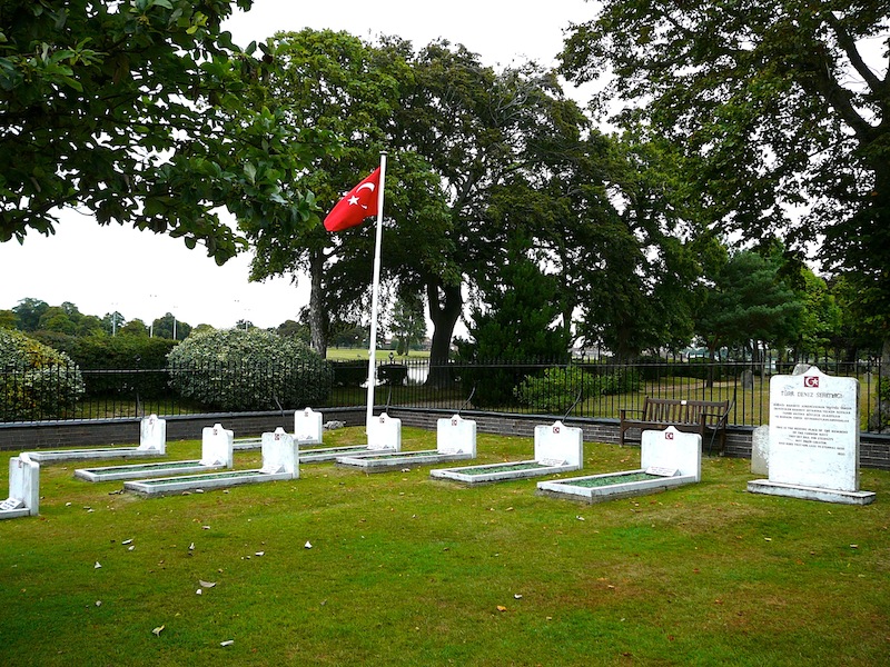
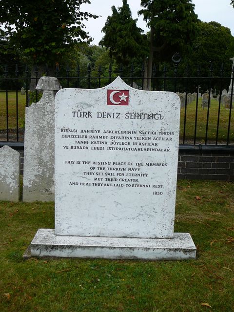
| Description | : | In November 1850, two ships of the Turkish Navy, the Mirat-ý Zafer and Sirag-i Bahrý anchored off the Hardway at Gosport. The visit lasted several months and during this time most of the members of the crew contracted Cholera and were admitted to Haslar Royal Naval Hospital for treatment. Of those who were admitted most died; other sailors died because of training accidents. In total 26 died and were laid to rest in the grounds of Haslar Hospital. At the turn of the 19th Century the bodies were exhumed and transferred to a distinct, separate area within Haslar Royal Naval... Read More |
frequently asked questions (FAQ):
-
Where is Turkish Naval Cemetery?
Turkish Naval Cemetery is located at Clayhall Cemetery, Clayhall Road Gosport, Gosport Borough ,Hampshire ,England.
-
Turkish Naval Cemetery cemetery's updated grave count on graveviews.com?
0 memorials
-
Where are the coordinates of the Turkish Naval Cemetery?
Latitude: 50.7840710
Longitude: -1.1383980
Nearby Cemetories:
1. Clayhall Naval Cemetery
Gosport, Gosport Borough, England
Coordinate: 50.7833862, -1.1373420
2. St. Mark's Churchyard
Alverstoke, Gosport Borough, England
Coordinate: 50.7826800, -1.1436100
3. St Mary Churchyard
Alverstoke, Gosport Borough, England
Coordinate: 50.7856760, -1.1480810
4. Holy Trinity Churchyard
Gosport, Gosport Borough, England
Coordinate: 50.7930600, -1.1207620
5. St John the Evangelist Churchyard
Gosport, Gosport Borough, England
Coordinate: 50.7995600, -1.1397800
6. Ann's Hill Cemetery
Gosport, Gosport Borough, England
Coordinate: 50.7982670, -1.1549450
7. Royal Garrison Churchyard
Portsmouth, Portsmouth Unitary Authority, England
Coordinate: 50.7890180, -1.1040520
8. Royal Garrison Church Churchyard
Plymouth, Plymouth Unitary Authority, England
Coordinate: 50.7889690, -1.1039650
9. Portsmouth Cathedral Churchyard
Portsmouth, Portsmouth Unitary Authority, England
Coordinate: 50.7904650, -1.1043720
10. Portsmouth Unitarian Church
Portsmouth, Portsmouth Unitary Authority, England
Coordinate: 50.7915640, -1.1011840
11. HMS Victory Ship
Portsmouth, Portsmouth Unitary Authority, England
Coordinate: 50.8017290, -1.1095590
12. Portsmouth Naval Memorial
Portsmouth, Portsmouth Unitary Authority, England
Coordinate: 50.7824440, -1.0957720
13. St Thomas the Apostle Churchyard
Gosport, Gosport Borough, England
Coordinate: 50.8137570, -1.1484570
14. HMS Victoria Monument
Portsmouth, Portsmouth Unitary Authority, England
Coordinate: 50.7997200, -1.0950800
15. St Mary the Virgin Churchyard
Gosport, Gosport Borough, England
Coordinate: 50.8112690, -1.1724800
16. Old Jewish Cemetery
Portsmouth, Portsmouth Unitary Authority, England
Coordinate: 50.7887000, -1.0738800
17. Mile End Cemetery
Portsea, Portsmouth Unitary Authority, England
Coordinate: 50.8108900, -1.0876400
18. St. Mary's Churchyard
Portsea, Portsmouth Unitary Authority, England
Coordinate: 50.8035350, -1.0763490
19. Highland Road Cemetery
Portsmouth, Portsmouth Unitary Authority, England
Coordinate: 50.7860500, -1.0671790
20. Lee-On-Solent Memorial
Lee-on-the-Solent, Gosport Borough, England
Coordinate: 50.8045110, -1.2068440
21. Kingston Cemetery
Portsmouth, Portsmouth Unitary Authority, England
Coordinate: 50.8031440, -1.0683260
22. Milton Cemetery
Portsmouth, Portsmouth Unitary Authority, England
Coordinate: 50.7988700, -1.0608030
23. St James Churchyard
Eastney, Portsmouth Unitary Authority, England
Coordinate: 50.7940650, -1.0581150
24. St. Mary's Churchyard
Portchester, Fareham Borough, England
Coordinate: 50.8366280, -1.1134270