
| Memorials | : | 100 |
| Location | : | Gosport, Gosport Borough, England |
| Coordinate | : | 50.7833862, -1.1373420 |
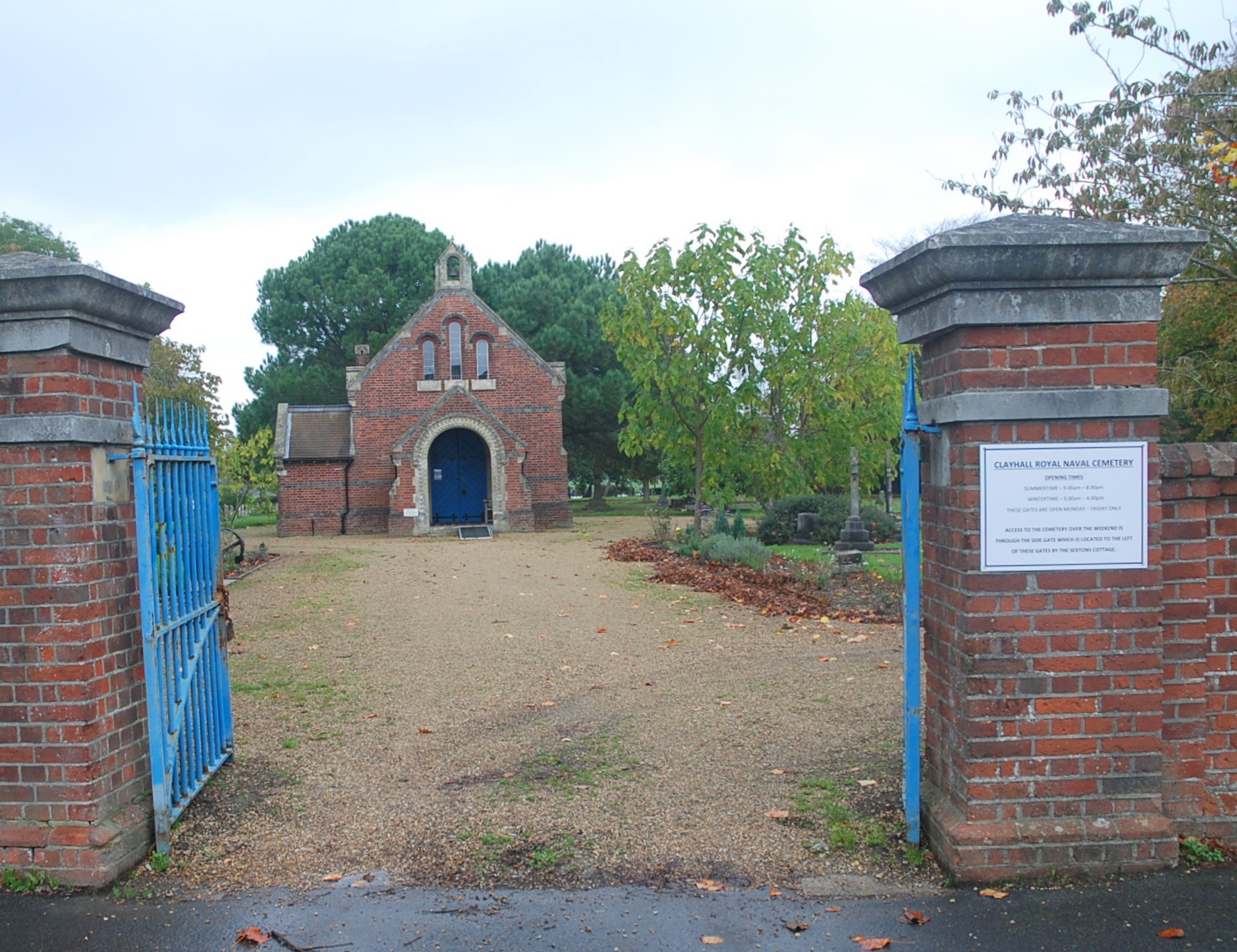
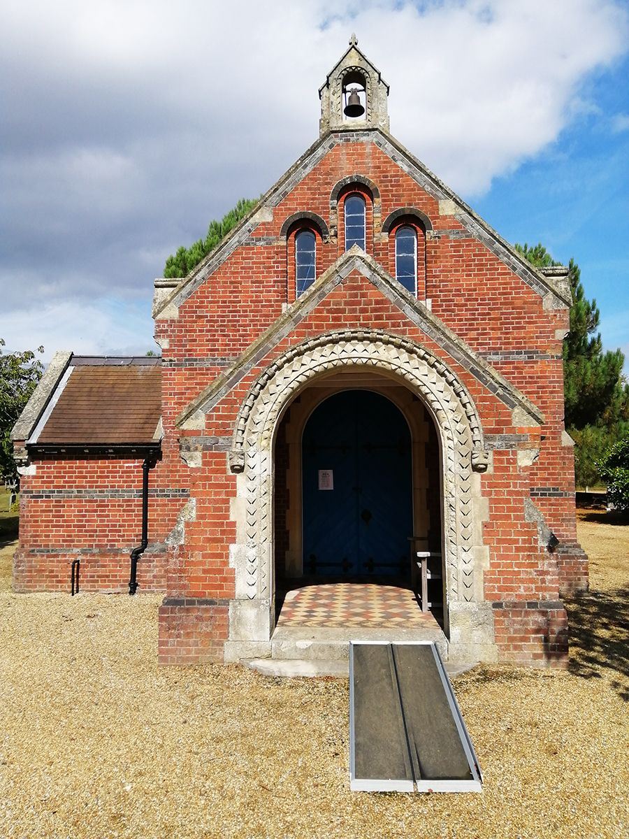
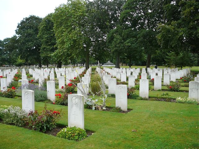
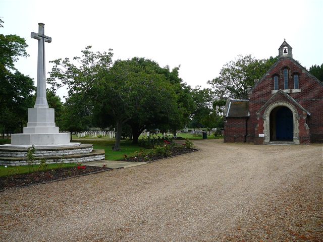
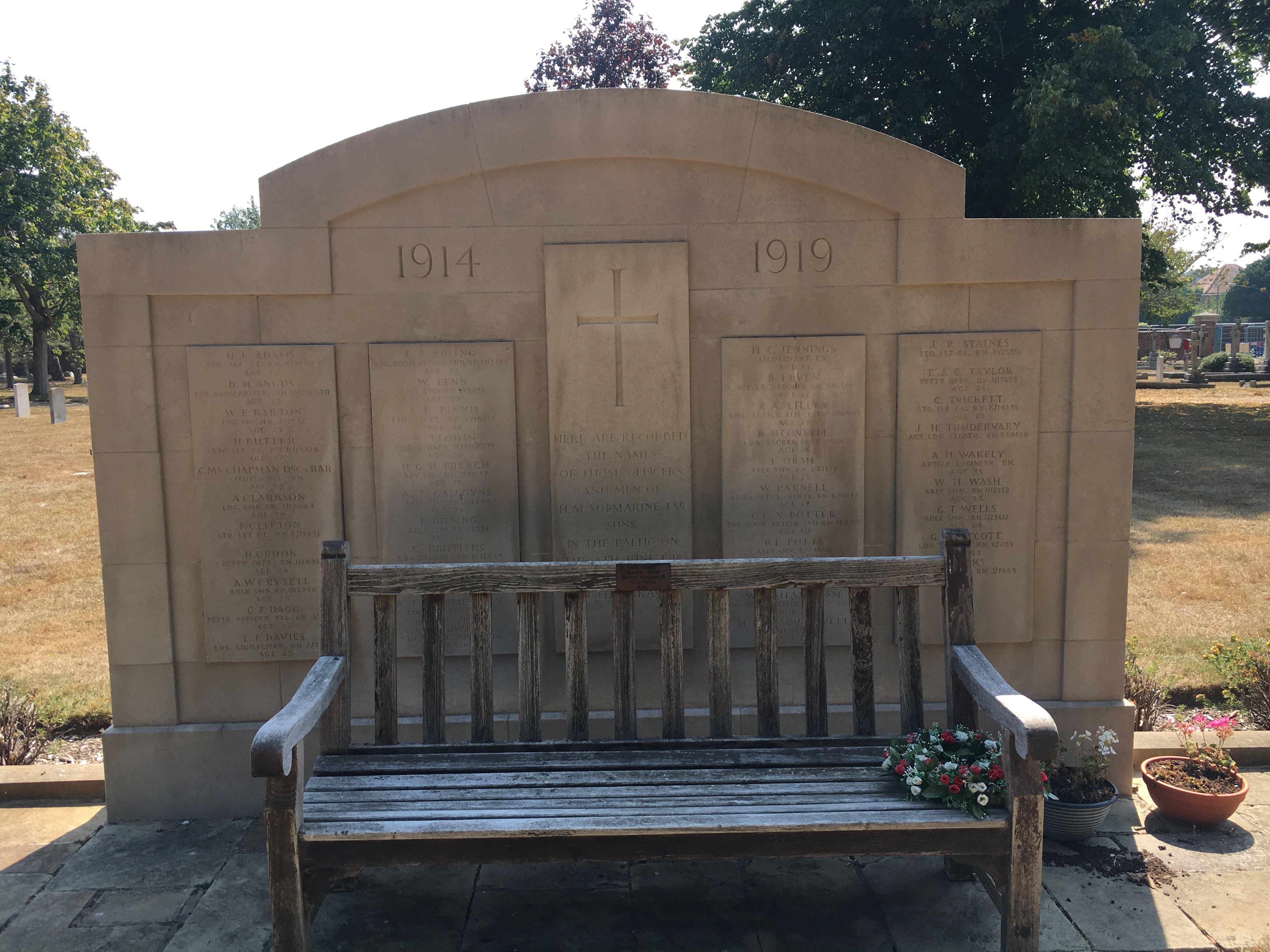
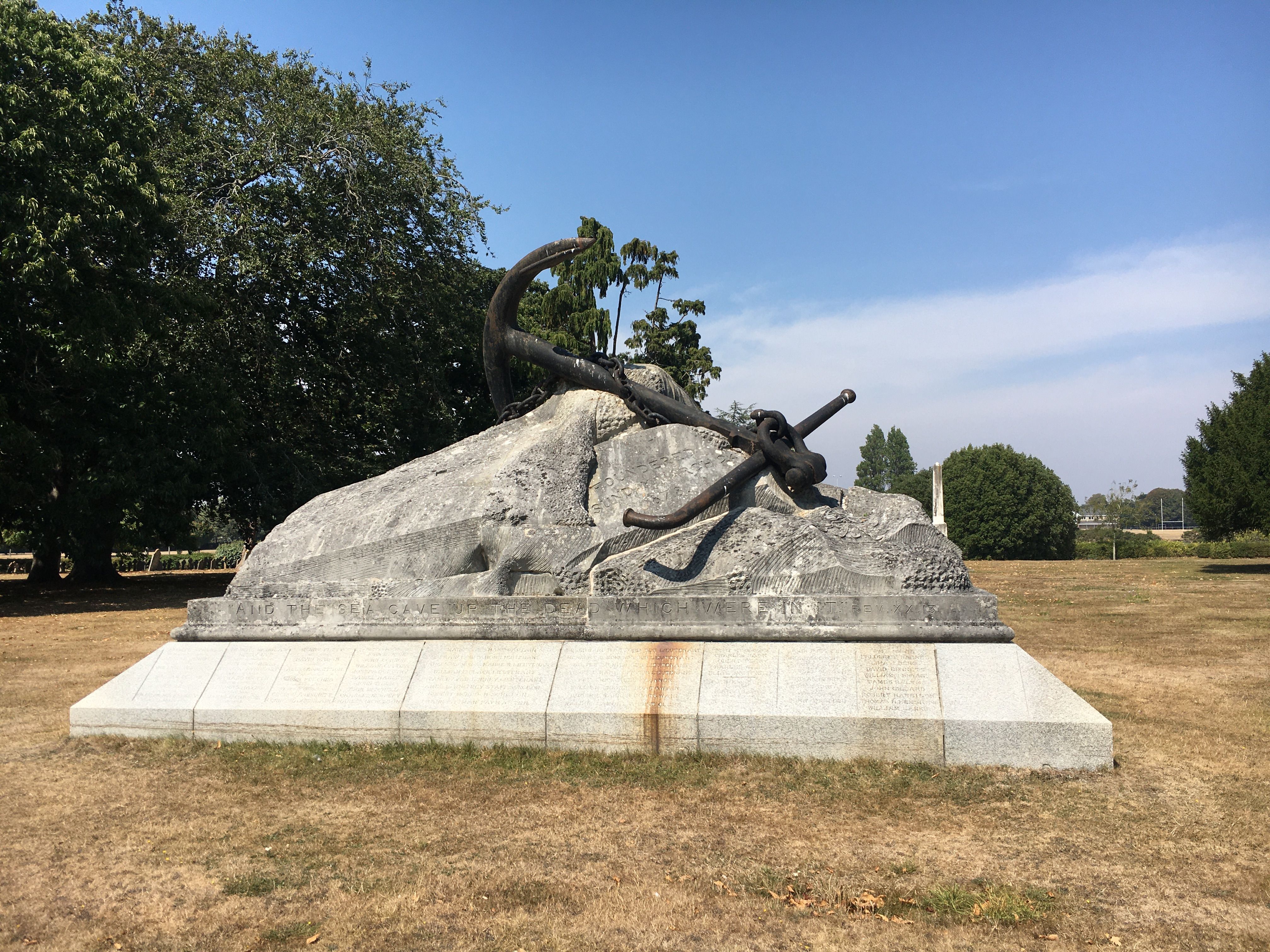
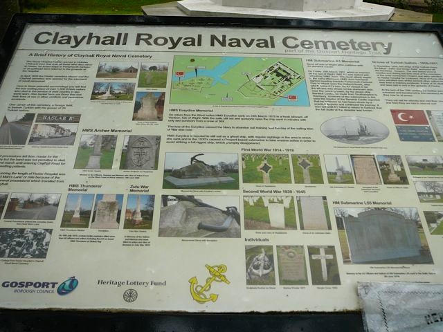
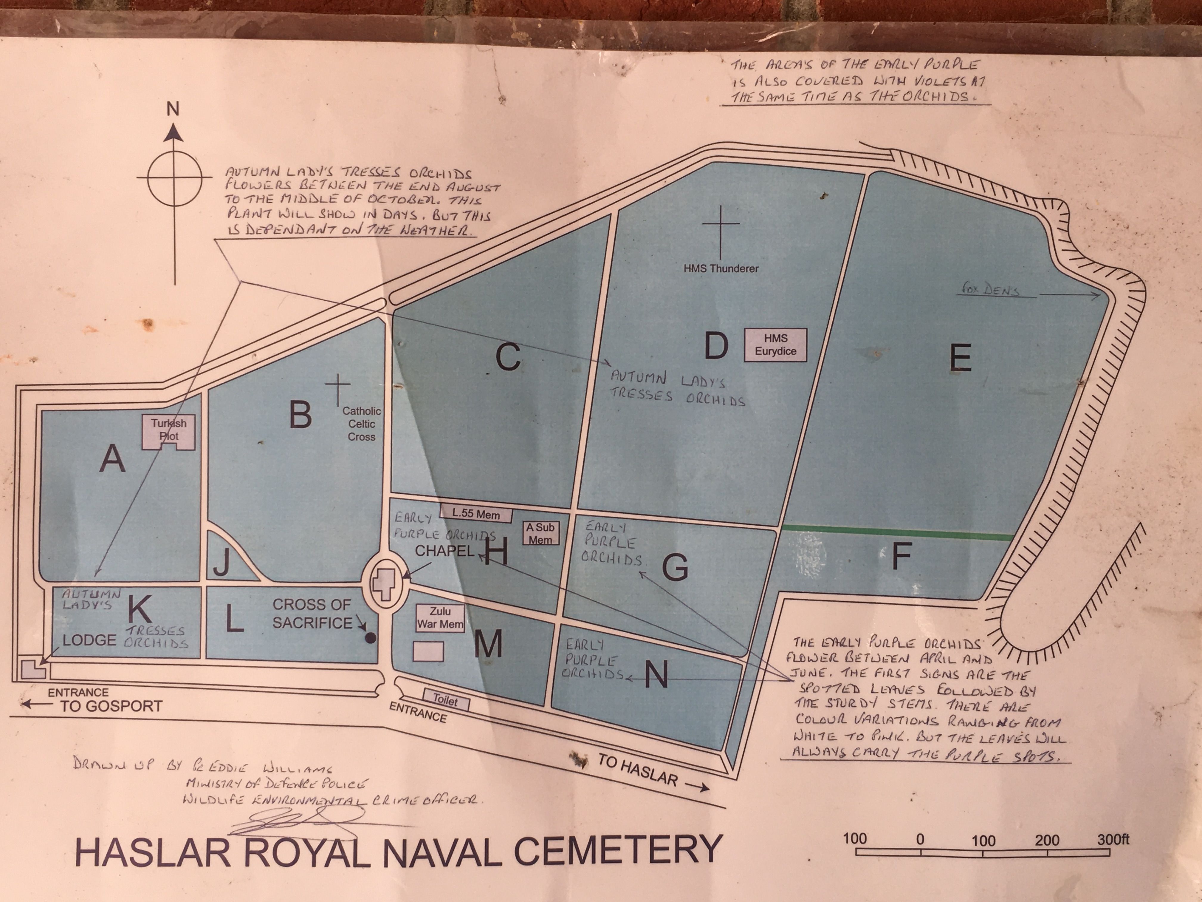
| Description | : | The old cemetery in Royal Hospital Haslar closed in 1859. Fourteen acres of land in Clayhall Road, on the edge of Stoke Lake, were developed as a new burial ground. Consecrated by the Bishop of Winchester, 1859, it was named 'Haslar Hospital Cemetery'. Haslar Royal Naval Cemetery is located in Gosport, a town on the western shore of Portsmouth Harbor. During both wars, Gosport was a significant sea port and naval depot, with many government factories and installations based there, as well as the Haslar Naval Hospital. No. 5 Squadron Royal Flying Corps were based at Gosport just before the... Read More |
frequently asked questions (FAQ):
-
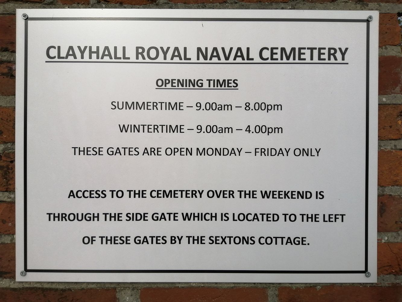
Where is Clayhall Naval Cemetery?
Clayhall Naval Cemetery is located at Clayhall Road Gosport, Gosport Borough ,Hampshire , PO12 2BB.England.
-
Clayhall Naval Cemetery cemetery's updated grave count on graveviews.com?
97 memorials
-
Where are the coordinates of the Clayhall Naval Cemetery?
Latitude: 50.7833862
Longitude: -1.1373420

Nearby Cemetories:
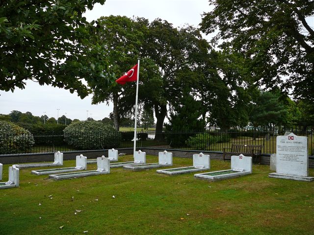
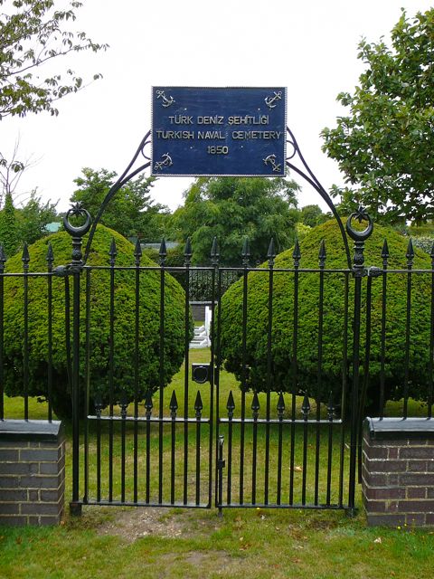
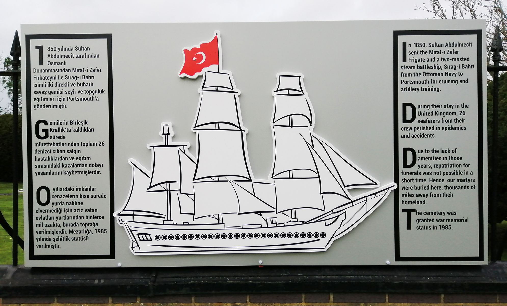
1. Turkish Naval Cemetery
Gosport, Gosport Borough, England
Coordinate: 50.7840710, -1.1383980
2. St. Mark's Churchyard
Alverstoke, Gosport Borough, England
Coordinate: 50.7826800, -1.1436100
3. St Mary Churchyard
Alverstoke, Gosport Borough, England
Coordinate: 50.7856760, -1.1480810
4. Holy Trinity Churchyard
Gosport, Gosport Borough, England
Coordinate: 50.7930600, -1.1207620
5. St John the Evangelist Churchyard
Gosport, Gosport Borough, England
Coordinate: 50.7995600, -1.1397800
6. Ann's Hill Cemetery
Gosport, Gosport Borough, England
Coordinate: 50.7982670, -1.1549450
7. Royal Garrison Churchyard
Portsmouth, Portsmouth Unitary Authority, England
Coordinate: 50.7890180, -1.1040520
8. Royal Garrison Church Churchyard
Plymouth, Plymouth Unitary Authority, England
Coordinate: 50.7889690, -1.1039650
9. Portsmouth Cathedral Churchyard
Portsmouth, Portsmouth Unitary Authority, England
Coordinate: 50.7904650, -1.1043720
10. Portsmouth Unitarian Church
Portsmouth, Portsmouth Unitary Authority, England
Coordinate: 50.7915640, -1.1011840
11. HMS Victory Ship
Portsmouth, Portsmouth Unitary Authority, England
Coordinate: 50.8017290, -1.1095590
12. Portsmouth Naval Memorial
Portsmouth, Portsmouth Unitary Authority, England
Coordinate: 50.7824440, -1.0957720
13. St Thomas the Apostle Churchyard
Gosport, Gosport Borough, England
Coordinate: 50.8137570, -1.1484570
14. HMS Victoria Monument
Portsmouth, Portsmouth Unitary Authority, England
Coordinate: 50.7997200, -1.0950800
15. St Mary the Virgin Churchyard
Gosport, Gosport Borough, England
Coordinate: 50.8112690, -1.1724800
16. Old Jewish Cemetery
Portsmouth, Portsmouth Unitary Authority, England
Coordinate: 50.7887000, -1.0738800
17. Mile End Cemetery
Portsea, Portsmouth Unitary Authority, England
Coordinate: 50.8108900, -1.0876400
18. St. Mary's Churchyard
Portsea, Portsmouth Unitary Authority, England
Coordinate: 50.8035350, -1.0763490
19. Highland Road Cemetery
Portsmouth, Portsmouth Unitary Authority, England
Coordinate: 50.7860500, -1.0671790
20. Kingston Cemetery
Portsmouth, Portsmouth Unitary Authority, England
Coordinate: 50.8031440, -1.0683260
21. Lee-On-Solent Memorial
Lee-on-the-Solent, Gosport Borough, England
Coordinate: 50.8045110, -1.2068440
22. Milton Cemetery
Portsmouth, Portsmouth Unitary Authority, England
Coordinate: 50.7988700, -1.0608030
23. St James Churchyard
Eastney, Portsmouth Unitary Authority, England
Coordinate: 50.7940650, -1.0581150
24. St Thomas Churchyard
Ryde, Isle of Wight Unitary Authority, England
Coordinate: 50.7305600, -1.1632540