
| Memorials | : | 8 |
| Location | : | Pine Grove, Amador County, USA |
| Coordinate | : | 38.3978004, -120.6302872 |
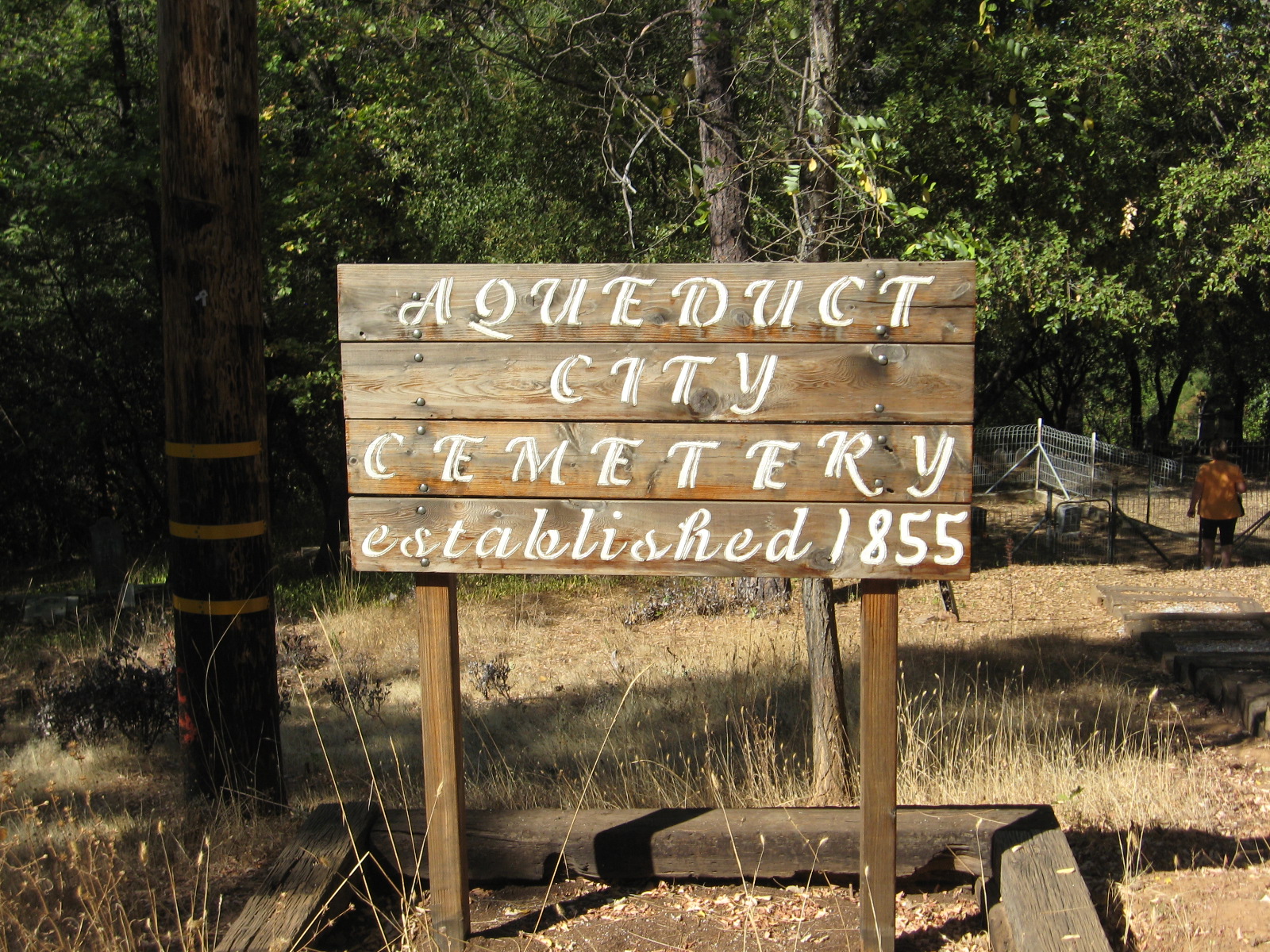
| Description | : | The Aqueduct City Cemetery is located on private property off Aqueduct Circle. Permission must be given to visit the cemetery by its owner. Aqueduct City was so named for the 130 foot high aqueduct that ran overhead from one ridge to another. The cemetery began service in 1855 with its earliest existing headstone of Nevada Lowry in 1855, age 1 year 2 months, and sister Mary S Lowry, 3 years, 6 months who died one month later. There could have been earlier burials and many since but are unmarked, probably from the wooden headstones disappearing over time. As with other... Read More |
frequently asked questions (FAQ):
-
Where is Aqueduct City Cemetery?
Aqueduct City Cemetery is located at Pine Grove, Amador County ,California ,USA.
-
Aqueduct City Cemetery cemetery's updated grave count on graveviews.com?
8 memorials
-
Where are the coordinates of the Aqueduct City Cemetery?
Latitude: 38.3978004
Longitude: -120.6302872
Nearby Cemetories:
1. Pine Grove Cemetery
Pine Grove, Amador County, USA
Coordinate: 38.4118780, -120.6596340
2. Saint Peter and Paul Catholic Cemetery
Clinton, Amador County, USA
Coordinate: 38.3750140, -120.6652150
3. Volcano Protestant Cemetery
Volcano, Amador County, USA
Coordinate: 38.4449997, -120.6269989
4. Volcano Catholic Cemetery
Volcano, Amador County, USA
Coordinate: 38.4459991, -120.6279984
5. Danielson Ranch Cemetery
Glencoe, Calaveras County, USA
Coordinate: 38.3578440, -120.5738220
6. Albers Ranch Family Cemetery
Glencoe, Calaveras County, USA
Coordinate: 38.3601000, -120.5673600
7. Baker Ranch Family Cemetery
Indian Creek, Calaveras County, USA
Coordinate: 38.3269500, -120.6208800
8. Sandy Gulch Cemetery
West Point, Calaveras County, USA
Coordinate: 38.3815700, -120.5377900
9. West Point Cemetery
West Point, Calaveras County, USA
Coordinate: 38.3999650, -120.5327220
10. Indian Cemetery
West Point, Calaveras County, USA
Coordinate: 38.3811400, -120.5348700
11. Amador Memorial Cemetery
Pioneer, Amador County, USA
Coordinate: 38.4398918, -120.5428314
12. Lockwood Station Cemetery
Volcano, Amador County, USA
Coordinate: 38.4882670, -120.5954040
13. Independence Cemetery
Rail Road Flat, Calaveras County, USA
Coordinate: 38.3564230, -120.5202020
14. Chinese Cemetery
Jackson, Amador County, USA
Coordinate: 38.3674680, -120.7655440
15. Saint Thomas Aquinas Cemetery
Mokelumne Hill, Calaveras County, USA
Coordinate: 38.3027344, -120.7031784
16. Mokelumne Hill Protestant Cemetery
Mokelumne Hill, Calaveras County, USA
Coordinate: 38.3023640, -120.7096420
17. Jesus Maria Cemetery
Jesus Maria, Calaveras County, USA
Coordinate: 38.2835970, -120.6405370
18. Pioneer Jewish Cemetery
Mokelumne Hill, Calaveras County, USA
Coordinate: 38.3034096, -120.7138214
19. Jackson Gate Perano Cemetery
Jackson, Amador County, USA
Coordinate: 38.3701640, -120.7778150
20. Pioneer Jewish Cemetery
Jackson, Amador County, USA
Coordinate: 38.3539790, -120.7724540
21. Jackson City Cemetery
Jackson, Amador County, USA
Coordinate: 38.3519640, -120.7731340
22. Saint Patrick Catholic Cemetery
Jackson, Amador County, USA
Coordinate: 38.3534780, -120.7742350
23. Amador County Museum
Jackson, Amador County, USA
Coordinate: 38.3507000, -120.7733900
24. Saint Sava Serbian Orthodox Cemetery
Jackson, Amador County, USA
Coordinate: 38.3560530, -120.7764530