
| Memorials | : | 0 |
| Location | : | Stock Township, Noble County, USA |
| Coordinate | : | 39.7548250, -81.3859140 |
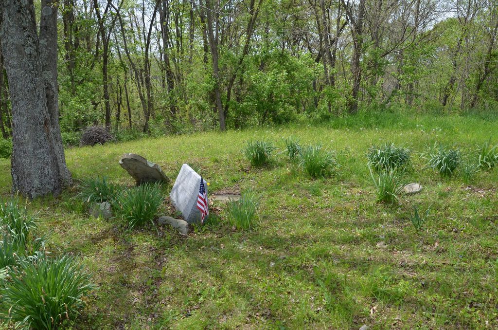
| Description | : | The cemetery is located on the east side of Gurewicz Road (Township Road 303A) about 0.1 miles south of its intersection with Road Fork Road (Ohio State Route 260). The cemetery is located in Stock Township, Noble County, Ohio, and is # 9146 (Archer Cemetery / Dovenbarger Cemetery) in “Ohio Cemeteries 1803-2003”, compiled by the Ohio Genealogical Society. The U.S. Geological Survey (USGS) Geographic Names Information System (GNIS) feature ID for the cemetery is 1037470 (Archer Cemetery / Dovenbarger Cemetery). |
frequently asked questions (FAQ):
-
Where is Archer Cemetery?
Archer Cemetery is located at Gurewicz Road (Township 303A) Stock Township, Noble County ,Ohio , 43779USA.
-
Archer Cemetery cemetery's updated grave count on graveviews.com?
0 memorials
-
Where are the coordinates of the Archer Cemetery?
Latitude: 39.7548250
Longitude: -81.3859140
Nearby Cemetories:
1. Old Saint Michaels Cemetery
Noble County, USA
Coordinate: 39.7549800, -81.3853300
2. East Union Cemetery
East Union, Noble County, USA
Coordinate: 39.7689600, -81.3973400
3. Saint Michaels Catholic Church Cemetery
Carlisle, Noble County, USA
Coordinate: 39.7450870, -81.3673140
4. Carlisle Methodist Cemetery
Carlisle, Noble County, USA
Coordinate: 39.7459490, -81.3660950
5. Archers Ridge Methodist Church Cemetery
Fulda, Noble County, USA
Coordinate: 39.7534100, -81.4267900
6. Crow Cemetery
Carlisle, Noble County, USA
Coordinate: 39.7651500, -81.3469770
7. Curtis Ridge Cemetery
Noble County, USA
Coordinate: 39.7546997, -81.3419037
8. Allens Chapel Cemetery
Summerfield, Noble County, USA
Coordinate: 39.7922900, -81.3765100
9. Saint Marys Cemetery
Fulda, Noble County, USA
Coordinate: 39.7232780, -81.4151840
10. Rado Cemetery
Noble County, USA
Coordinate: 39.7019005, -81.3818970
11. Summerfield Methodist Church Cemetery
Summerfield, Noble County, USA
Coordinate: 39.7967339, -81.3358231
12. Mount Tabor Cemetery
Carlisle, Noble County, USA
Coordinate: 39.7220001, -81.3229980
13. Fredericksdale Cemetery
Fredericksdale, Noble County, USA
Coordinate: 39.8060870, -81.4271060
14. Eastern Cemetery
Summerfield, Noble County, USA
Coordinate: 39.8015100, -81.3316920
15. Merry Cemetery
Duvall, Noble County, USA
Coordinate: 39.7474280, -81.4675860
16. Manifold Cemetery
Ashton, Noble County, USA
Coordinate: 39.7254300, -81.4621600
17. Rouse Merry Cemetery
Caldwell, Noble County, USA
Coordinate: 39.7521430, -81.4714510
18. Perryopolis Cemetery
Caldwell, Noble County, USA
Coordinate: 39.7764560, -81.4705390
19. Hesson Family Cemetery
Noble County, USA
Coordinate: 39.6847000, -81.4068985
20. Whigville Cemetery
Whigville, Noble County, USA
Coordinate: 39.8270200, -81.3751200
21. Craig Cemetery
Center Township, Noble County, USA
Coordinate: 39.8252270, -81.4120930
22. Harris Cemetery
Caldwell, Noble County, USA
Coordinate: 39.7249985, -81.4741974
23. Harris Cemetery
Ashton, Noble County, USA
Coordinate: 39.7155840, -81.4688800
24. Center Free Methodist Church Cemetery
Sarahsville, Noble County, USA
Coordinate: 39.7994590, -81.4642190