
| Memorials | : | 0 |
| Location | : | Ashland, Franklin County, USA |
| Coordinate | : | 34.3216230, -83.3637430 |
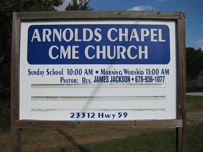
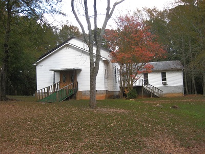
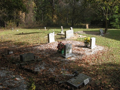
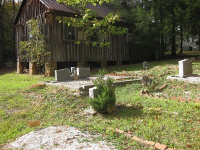
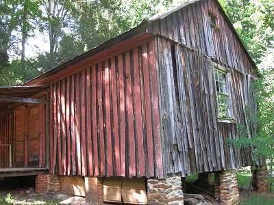
| Description | : | Located on Georgia Highway 59 #23312 in Franklin County at Ashland, Georgia. The cemetery is located behind the church and historic schoolhouse. The property is marked with a sign at the driveway, which is across Highway 59 from the original Ashland Store and U.S. Post Office (now removed). A commonly known belief is that the property for this church and cemetery was donated by the Arendall-Ashe families who were early settlers. Some of the memorials in this cemetery are unmarked and may have been lost along the fence/wood line. Please help me locate the remaining gravestones... Read More |
frequently asked questions (FAQ):
-
Where is Arnolds Chapel C.M.E. Church Cemetery?
Arnolds Chapel C.M.E. Church Cemetery is located at Georgia Hwy. 59 Ashland, Franklin County ,Georgia , 30530USA.
-
Arnolds Chapel C.M.E. Church Cemetery cemetery's updated grave count on graveviews.com?
0 memorials
-
Where are the coordinates of the Arnolds Chapel C.M.E. Church Cemetery?
Latitude: 34.3216230
Longitude: -83.3637430
Nearby Cemetories:
1. Neal-Adams Family Cemetery
Ashland, Franklin County, USA
Coordinate: 34.3192700, -83.3585100
2. Ebenezer Cemetery
Franklin County, USA
Coordinate: 34.3236008, -83.3572006
3. Westbrook Family Cemetery
Franklin County, USA
Coordinate: 34.3319020, -83.3717910
4. Shannon Family Cemetery
Ashland, Franklin County, USA
Coordinate: 34.3134670, -83.3495670
5. Goss Family Cemetery
Ashland, Franklin County, USA
Coordinate: 34.3064000, -83.3683800
6. Carson Road Family Cemetery
Carnesville, Franklin County, USA
Coordinate: 34.3284210, -83.3418420
7. Arendall Family Cemetery
Franklin County, USA
Coordinate: 34.3319950, -83.3433360
8. Adam's Place Cemetery
Banks County, USA
Coordinate: 34.3166830, -83.3901750
9. Tucker Family Cemetery
Ashland, Franklin County, USA
Coordinate: 34.3350900, -83.3402250
10. Bold Springs Methodist Church Cemetery
Carnesville, Franklin County, USA
Coordinate: 34.2953050, -83.3346660
11. Hebron Presbyterian Cemetery
Hebron, Banks County, USA
Coordinate: 34.2855988, -83.3644028
12. Carlan Family Cemetery
Homer, Banks County, USA
Coordinate: 34.3338430, -83.4048960
13. Dailey Family Cemetery
Ashland, Franklin County, USA
Coordinate: 34.3464340, -83.3955250
14. Old Salem Methodist Church Cemetery
Arp, Banks County, USA
Coordinate: 34.3157000, -83.4081000
15. Indian Creek Baptist Church Cemetery
Franklin County, USA
Coordinate: 34.3509720, -83.3350270
16. Hebron Presbyterian Church Original Cemetery
Carnesville, Franklin County, USA
Coordinate: 34.2859920, -83.3465770
17. Bush River Church Cemetery
Carlan, Banks County, USA
Coordinate: 34.3171730, -83.4108960
18. Bellamy-Brawner-Jones Cemetery
Plainview, Franklin County, USA
Coordinate: 34.3608680, -83.3626700
19. Bush River Church Cemetery South
Homer, Banks County, USA
Coordinate: 34.3155190, -83.4117360
20. Harber Family Cemetery
Carnesville, Franklin County, USA
Coordinate: 34.3334760, -83.3065940
21. Strange Family Cemetery
Ashland, Franklin County, USA
Coordinate: 34.3710757, -83.3807366
22. Neals Grove Baptist Church Cemetery
Hebron, Banks County, USA
Coordinate: 34.2754820, -83.3945780
23. Norris Cemetery
Franklin County, USA
Coordinate: 34.3734940, -83.3487390
24. Wilmot Cemetery
Banks County, USA
Coordinate: 34.3708000, -83.3944016