
| Memorials | : | 0 |
| Location | : | Ashland, Franklin County, USA |
| Coordinate | : | 34.3350900, -83.3402250 |
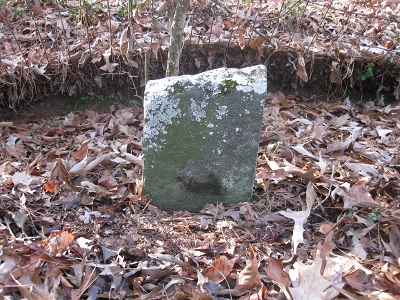
| Description | : | This grave for Elizabeth Tucker has a three foot tall marker at the north end of a straight line of ten or twelve fieldstone marked graves. This marker was erected by W.E. Vickery. All of the graves are enclosed by a decorative heavy gauge wire fence approximately 3 to 4 feet in height. The fence, supported by wooden posts, has sagged and fallen over, on one side. The Tucker Family Cemetery is located 300 to 400 feet north of the "Rock Pillars", in the woods, across Georgia Highway 59. |
frequently asked questions (FAQ):
-
Where is Tucker Family Cemetery?
Tucker Family Cemetery is located at Georgia Hwy. 59 Ashland, Franklin County ,Georgia ,USA.
-
Tucker Family Cemetery cemetery's updated grave count on graveviews.com?
0 memorials
-
Where are the coordinates of the Tucker Family Cemetery?
Latitude: 34.3350900
Longitude: -83.3402250
Nearby Cemetories:
1. Arendall Family Cemetery
Franklin County, USA
Coordinate: 34.3319950, -83.3433360
2. Carson Road Family Cemetery
Carnesville, Franklin County, USA
Coordinate: 34.3284210, -83.3418420
3. Indian Creek Baptist Church Cemetery
Franklin County, USA
Coordinate: 34.3509720, -83.3350270
4. Ebenezer Cemetery
Franklin County, USA
Coordinate: 34.3236008, -83.3572006
5. Neal-Adams Family Cemetery
Ashland, Franklin County, USA
Coordinate: 34.3192700, -83.3585100
6. Shannon Family Cemetery
Ashland, Franklin County, USA
Coordinate: 34.3134670, -83.3495670
7. Arnolds Chapel C.M.E. Church Cemetery
Ashland, Franklin County, USA
Coordinate: 34.3216230, -83.3637430
8. Westbrook Family Cemetery
Franklin County, USA
Coordinate: 34.3319020, -83.3717910
9. Harber Family Cemetery
Carnesville, Franklin County, USA
Coordinate: 34.3334760, -83.3065940
10. Bellamy-Brawner-Jones Cemetery
Plainview, Franklin County, USA
Coordinate: 34.3608680, -83.3626700
11. Goss Family Cemetery
Ashland, Franklin County, USA
Coordinate: 34.3064000, -83.3683800
12. Norris Cemetery
Franklin County, USA
Coordinate: 34.3734940, -83.3487390
13. Bold Springs Methodist Church Cemetery
Carnesville, Franklin County, USA
Coordinate: 34.2953050, -83.3346660
14. Holbrook Cemetery
Cromers, Franklin County, USA
Coordinate: 34.3216667, -83.2925000
15. Adam's Place Cemetery
Banks County, USA
Coordinate: 34.3166830, -83.3901750
16. Dailey Family Cemetery
Ashland, Franklin County, USA
Coordinate: 34.3464340, -83.3955250
17. Strange Family Cemetery
Ashland, Franklin County, USA
Coordinate: 34.3710757, -83.3807366
18. Hebron Presbyterian Church Original Cemetery
Carnesville, Franklin County, USA
Coordinate: 34.2859920, -83.3465770
19. Payne-Culpepper Cemetery
Franklin County, USA
Coordinate: 34.3849983, -83.3371964
20. Hebron Presbyterian Cemetery
Hebron, Banks County, USA
Coordinate: 34.2855988, -83.3644028
21. Carlan Family Cemetery
Homer, Banks County, USA
Coordinate: 34.3338430, -83.4048960
22. Mount Zion Methodist Cemetery
Franklin County, USA
Coordinate: 34.3882480, -83.3476070
23. Union Ground Christian Church Cemetery
Franklin County, USA
Coordinate: 34.3892240, -83.3491350
24. Little Family Cemetery
Carnesville, Franklin County, USA
Coordinate: 34.2959410, -83.2898860