
| Memorials | : | 0 |
| Location | : | York, York Unitary Authority, England |
| Coordinate | : | 53.9606360, -1.0860970 |
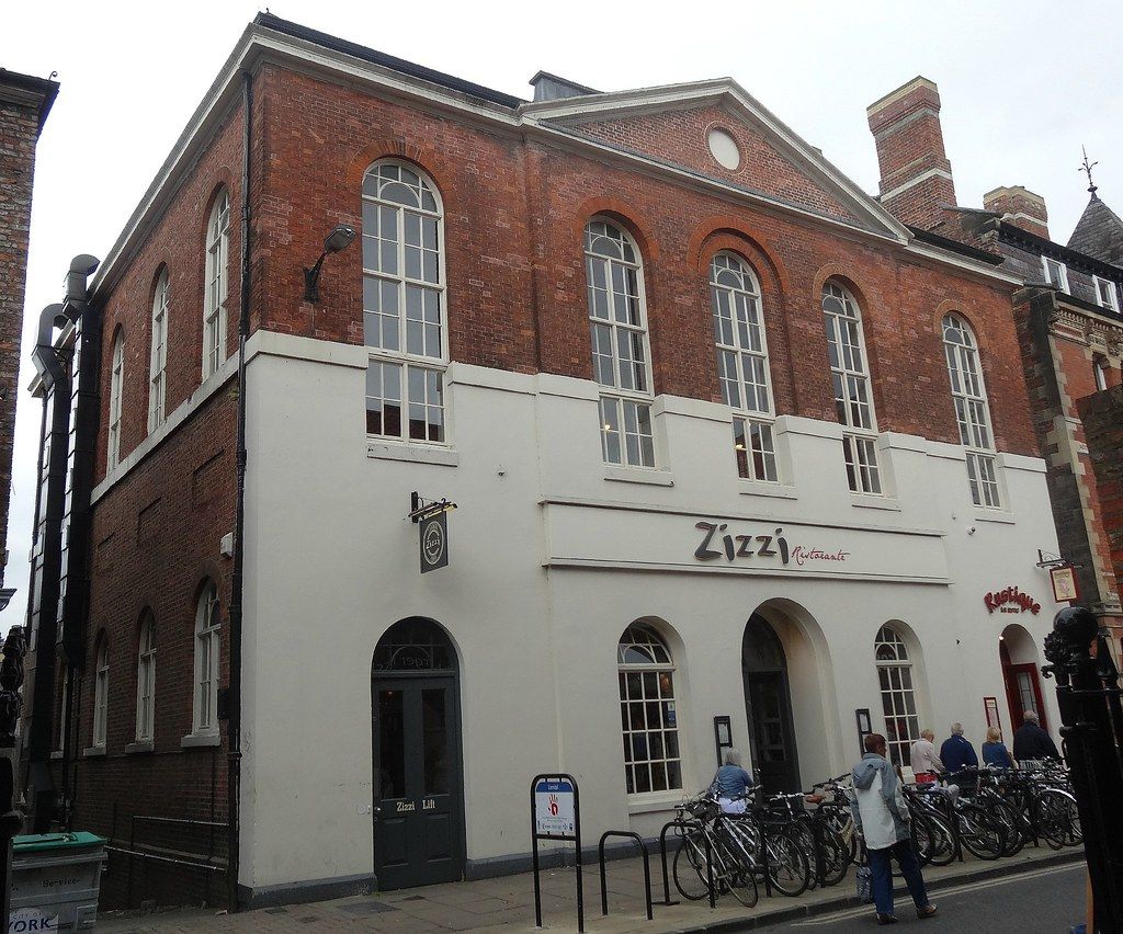
| Description | : | "Zizzi's" (from VCH): In September 1815 a site was purchased on the south side of Lendal almost opposite the Judges' Lodgings; LENDAL CHAPEL was opened in November of the following year. It provided accommodation for 950 persons and in the basement there was a room for a Sunday school. The building was designed by Watson and Pritchett, architects of York, and the cost, with the site, was more than £3,000. Lendal Chapel was the first in York to be lighted by gas. The congregation appears to have increased rapidly and although a new Congregational chapel was opened in 1839, 80... Read More |
frequently asked questions (FAQ):
-
Where is Lendal Congregational Chapel?
Lendal Congregational Chapel is located at 2 Lendal York, York Unitary Authority ,North Yorkshire , YO1 8AAEngland.
-
Lendal Congregational Chapel cemetery's updated grave count on graveviews.com?
0 memorials
-
Where are the coordinates of the Lendal Congregational Chapel?
Latitude: 53.9606360
Longitude: -1.0860970
Nearby Cemetories:
1. Augustinian Friary, York (Nonextant)
York, York Unitary Authority, England
Coordinate: 53.9601683, -1.0860521
2. St Wilfred Churchyard
York, York Unitary Authority, England
Coordinate: 53.9610550, -1.0848990
3. St Helen Churchyard
York, York Unitary Authority, England
Coordinate: 53.9603030, -1.0841970
4. St Martin le Grand Churchyard
York, York Unitary Authority, England
Coordinate: 53.9593870, -1.0843800
5. Blackfriars Abbey Church (Defunct)
York, York Unitary Authority, England
Coordinate: 53.9594100, -1.0880900
6. Abbey of St Mary (defunct)
York, York Unitary Authority, England
Coordinate: 53.9620290, -1.0883600
7. St Helen Davygate Church Cemetery
York, York Unitary Authority, England
Coordinate: 53.9596460, -1.0830390
8. All Saints North Street Churchyard
York, York Unitary Authority, England
Coordinate: 53.9584400, -1.0862400
9. St Michael le Belfrey Churchyard
York, York Unitary Authority, England
Coordinate: 53.9618620, -1.0829730
10. St Olave Churchyard
York, York Unitary Authority, England
Coordinate: 53.9622570, -1.0891560
11. York Minster
York, York Unitary Authority, England
Coordinate: 53.9619440, -1.0819440
12. St Sampson Churchyard
York, York Unitary Authority, England
Coordinate: 53.9597440, -1.0813060
13. St Peter the Little (Defunct)
York, York Unitary Authority, England
Coordinate: 53.9585310, -1.0821170
14. St John Churchyard
York, York Unitary Authority, England
Coordinate: 53.9574440, -1.0854510
15. Holy Trinity Goodramgate Churchyard
York, York Unitary Authority, England
Coordinate: 53.9609810, -1.0804640
16. York Cholera Burial Ground
York, York Unitary Authority, England
Coordinate: 53.9586930, -1.0908420
17. St Martin cum Gregory Churchyard
York, York Unitary Authority, England
Coordinate: 53.9572500, -1.0871400
18. St Giles Churchyard
York, York Unitary Authority, England
Coordinate: 53.9640010, -1.0843930
19. St Michael Churchyard
York, York Unitary Authority, England
Coordinate: 53.9577900, -1.0825600
20. Holy Trinity Kings Court Churchyard
York, York Unitary Authority, England
Coordinate: 53.9599760, -1.0800800
21. Saint Peter's
York, York Unitary Authority, England
Coordinate: 53.9577400, -1.0822600
22. Carmelite Friary of York (Defunct)
York, York Unitary Authority, England
Coordinate: 53.9577020, -1.0822860
23. All Saints Pavement Churchyard
York, York Unitary Authority, England
Coordinate: 53.9581090, -1.0808820
24. St Crux Churchyard
York, York Unitary Authority, England
Coordinate: 53.9589890, -1.0795460