
| Memorials | : | 1 |
| Location | : | York, York Unitary Authority, England |
| Coordinate | : | 53.9640010, -1.0843930 |
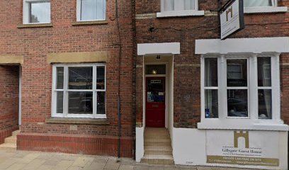
| Description | : | St Giles, the church of the Skinners Guild, was situated at the north end of Gillygate, on the west side of the road near where the Salvation Army building is now. The first known mention of it was in the twelfth century. In 1586, the parish was amalgamated with that of St Olave, but when it was demolished is not known. The churchyard was still in use for the burial of plague victims in 1605, and it is possible that executed criminals were also buried there until 1693. Nothing remains of this church or its graveyard - there are no gave... Read More |
frequently asked questions (FAQ):
-
Where is St Giles Churchyard?
St Giles Churchyard is located at Gillygate York, York Unitary Authority ,North Yorkshire , YO31 7EAEngland.
-
St Giles Churchyard cemetery's updated grave count on graveviews.com?
1 memorials
-
Where are the coordinates of the St Giles Churchyard?
Latitude: 53.9640010
Longitude: -1.0843930
Nearby Cemetories:
1. St Michael le Belfrey Churchyard
York, York Unitary Authority, England
Coordinate: 53.9618620, -1.0829730
2. York Minster
York, York Unitary Authority, England
Coordinate: 53.9619440, -1.0819440
3. St Wilfred Churchyard
York, York Unitary Authority, England
Coordinate: 53.9610550, -1.0848990
4. Abbey of St Mary (defunct)
York, York Unitary Authority, England
Coordinate: 53.9620290, -1.0883600
5. St Olave Churchyard
York, York Unitary Authority, England
Coordinate: 53.9622570, -1.0891560
6. Lendal Congregational Chapel
York, York Unitary Authority, England
Coordinate: 53.9606360, -1.0860970
7. St Helen Churchyard
York, York Unitary Authority, England
Coordinate: 53.9603030, -1.0841970
8. St Maurice Churchyard
York, York Unitary Authority, England
Coordinate: 53.9633340, -1.0782010
9. Holy Trinity Goodramgate Churchyard
York, York Unitary Authority, England
Coordinate: 53.9609810, -1.0804640
10. Augustinian Friary, York (Nonextant)
York, York Unitary Authority, England
Coordinate: 53.9601683, -1.0860521
11. St Helen Davygate Church Cemetery
York, York Unitary Authority, England
Coordinate: 53.9596460, -1.0830390
12. St Martin le Grand Churchyard
York, York Unitary Authority, England
Coordinate: 53.9593870, -1.0843800
13. St Sampson Churchyard
York, York Unitary Authority, England
Coordinate: 53.9597440, -1.0813060
14. St Andrew Churchyard
York, York Unitary Authority, England
Coordinate: 53.9609180, -1.0784710
15. Holy Trinity Kings Court Churchyard
York, York Unitary Authority, England
Coordinate: 53.9599760, -1.0800800
16. Blackfriars Abbey Church (Defunct)
York, York Unitary Authority, England
Coordinate: 53.9594100, -1.0880900
17. York Unitarian Chapelyard
York, York Unitary Authority, England
Coordinate: 53.9602950, -1.0775710
18. St Peter the Little (Defunct)
York, York Unitary Authority, England
Coordinate: 53.9585310, -1.0821170
19. Central Methodist Hall
York, York Unitary Authority, England
Coordinate: 53.9594090, -1.0788330
20. All Saints North Street Churchyard
York, York Unitary Authority, England
Coordinate: 53.9584400, -1.0862400
21. St Crux Churchyard
York, York Unitary Authority, England
Coordinate: 53.9589890, -1.0795460
22. St Saviour Churchyard
York, York Unitary Authority, England
Coordinate: 53.9596100, -1.0780000
23. St Crux Hungate Burial Ground
York, York Unitary Authority, England
Coordinate: 53.9593540, -1.0774470
24. St Cuthbert Churchyard
York, York Unitary Authority, England
Coordinate: 53.9609180, -1.0752310