
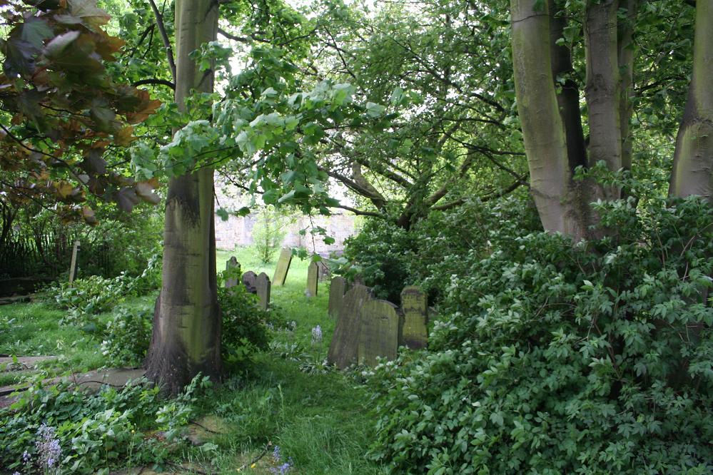
| Memorials | : | 32 |
| Location | : | York, York Unitary Authority, England |
| Coordinate | : | 53.9622570, -1.0891560 |
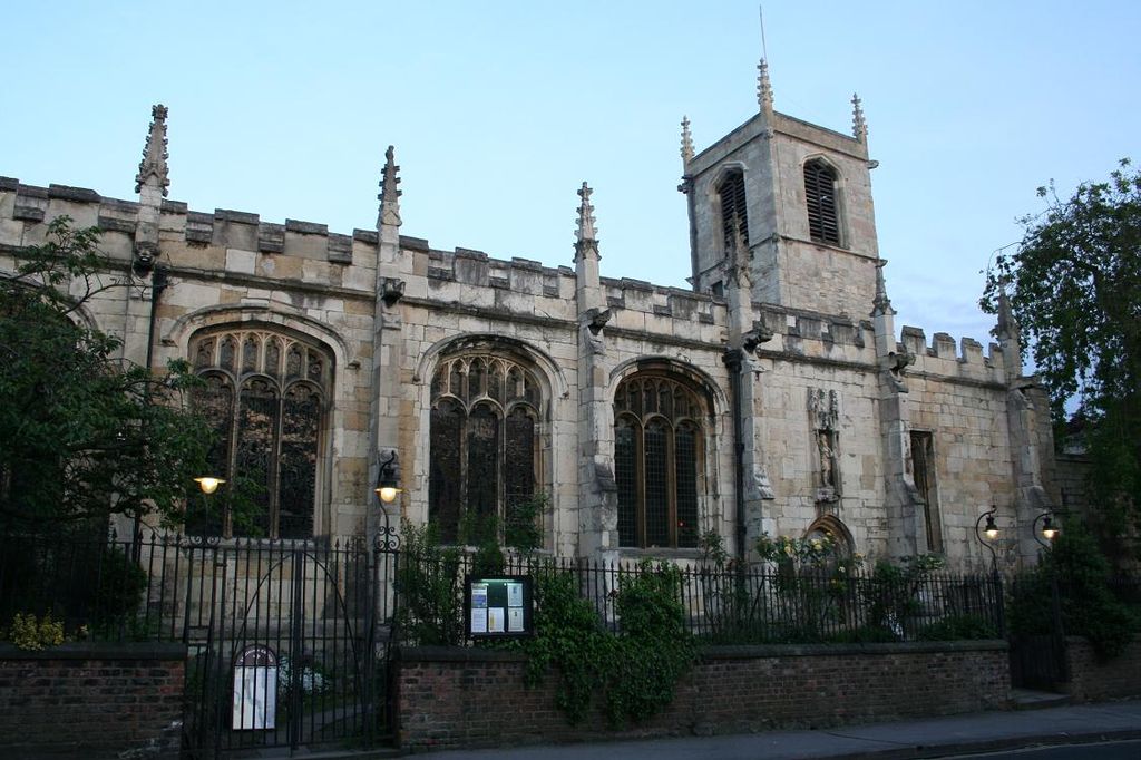
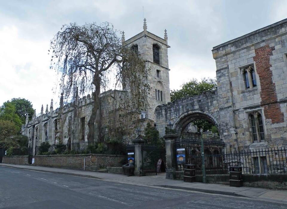
| Description | : | St Olave's (pronounced Olive) is an Anglican church in York, England. It is situated on Marygate by St Mary's Abbey. The church is situated within St Mary's Abbey walls, which was ruined in the Dissolution of the Monasteries. It is dedicated to St Olaf, patron saint of Norway. The Anglo-Saxon Chronicle for 1055 records that ‘This year died Earl Siward at York; and his body lies in the minster at Galmanho, which he had himself ordered to be built and consecrated, in the name of God and St. Olave, to the honour of God and to all his saints.' Galmanho is a... Read More |
frequently asked questions (FAQ):
-
Where is St Olave Churchyard?
St Olave Churchyard is located at Marygate York, York Unitary Authority ,North Yorkshire ,England.
-
St Olave Churchyard cemetery's updated grave count on graveviews.com?
32 memorials
-
Where are the coordinates of the St Olave Churchyard?
Latitude: 53.9622570
Longitude: -1.0891560
Nearby Cemetories:
1. Abbey of St Mary (defunct)
York, York Unitary Authority, England
Coordinate: 53.9620290, -1.0883600
2. Lendal Congregational Chapel
York, York Unitary Authority, England
Coordinate: 53.9606360, -1.0860970
3. Augustinian Friary, York (Nonextant)
York, York Unitary Authority, England
Coordinate: 53.9601683, -1.0860521
4. St Wilfred Churchyard
York, York Unitary Authority, England
Coordinate: 53.9610550, -1.0848990
5. Blackfriars Abbey Church (Defunct)
York, York Unitary Authority, England
Coordinate: 53.9594100, -1.0880900
6. St Giles Churchyard
York, York Unitary Authority, England
Coordinate: 53.9640010, -1.0843930
7. St Helen Churchyard
York, York Unitary Authority, England
Coordinate: 53.9603030, -1.0841970
8. St Michael le Belfrey Churchyard
York, York Unitary Authority, England
Coordinate: 53.9618620, -1.0829730
9. York Cholera Burial Ground
York, York Unitary Authority, England
Coordinate: 53.9586930, -1.0908420
10. St Martin le Grand Churchyard
York, York Unitary Authority, England
Coordinate: 53.9593870, -1.0843800
11. All Saints North Street Churchyard
York, York Unitary Authority, England
Coordinate: 53.9584400, -1.0862400
12. York Minster
York, York Unitary Authority, England
Coordinate: 53.9619440, -1.0819440
13. St Helen Davygate Church Cemetery
York, York Unitary Authority, England
Coordinate: 53.9596460, -1.0830390
14. St Martin cum Gregory Churchyard
York, York Unitary Authority, England
Coordinate: 53.9572500, -1.0871400
15. St Sampson Churchyard
York, York Unitary Authority, England
Coordinate: 53.9597440, -1.0813060
16. Holy Trinity Goodramgate Churchyard
York, York Unitary Authority, England
Coordinate: 53.9609810, -1.0804640
17. St John Churchyard
York, York Unitary Authority, England
Coordinate: 53.9574440, -1.0854510
18. St Peter the Little (Defunct)
York, York Unitary Authority, England
Coordinate: 53.9585310, -1.0821170
19. Holy Trinity Priory Churchyard
York, York Unitary Authority, England
Coordinate: 53.9565340, -1.0892450
20. Holy Trinity Kings Court Churchyard
York, York Unitary Authority, England
Coordinate: 53.9599760, -1.0800800
21. St Michael Churchyard
York, York Unitary Authority, England
Coordinate: 53.9577900, -1.0825600
22. Saint Peter's
York, York Unitary Authority, England
Coordinate: 53.9577400, -1.0822600
23. Carmelite Friary of York (Defunct)
York, York Unitary Authority, England
Coordinate: 53.9577020, -1.0822860
24. All Saints Pavement Churchyard
York, York Unitary Authority, England
Coordinate: 53.9581090, -1.0808820