
| Memorials | : | 0 |
| Location | : | Pleasant Hill, DeSoto County, USA |
| Coordinate | : | 34.8940840, -89.8864740 |
| Description | : | From the intersection of W Sandidge Rd. & Church Rd., N of Pleasant Hill, travel south on Sandidge Rd. for 0.6 mi.; continuing south (slightly left) onto Pleasant Hill Rd., going 0.9 mi.; turning southeast (left) onto Bridgeforth Rd., going 1.4 mi.; turning west (right) into the parking area of this 'deeded' cemetery, as notated on USGS topo maps. |
frequently asked questions (FAQ):
-
Where is Saint Matthews Cemetery?
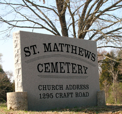
Saint Matthews Cemetery is located at 1200 Bridgeforth Road Pleasant Hill, DeSoto County ,Mississippi , 38564USA.
-
Saint Matthews Cemetery cemetery's updated grave count on graveviews.com?
0 memorials
-
Where are the coordinates of the Saint Matthews Cemetery?
Latitude: 34.8940840
Longitude: -89.8864740
Nearby Cemetories:
1. New Jeremiah #2 Memorial Garden
Pleasant Hill (Frees Corners), DeSoto County, USA
Coordinate: 34.9182330, -89.8841640
2. Pleasant Hill Community Cemetery
Pleasant Hill, DeSoto County, USA
Coordinate: 34.9184340, -89.8873670
3. Baker Family Cemetery
Pleasant Hill, DeSoto County, USA
Coordinate: 34.8793600, -89.9146300
4. Johnston Family Cemetery
Nesbit, DeSoto County, USA
Coordinate: 34.8726210, -89.9128810
5. Shiloh MB Church Cemetery
Southhaven, DeSoto County, USA
Coordinate: 34.9203610, -89.9195120
6. Kelsey Cemetery
Olive Branch, DeSoto County, USA
Coordinate: 34.8936430, -89.8399090
7. Bridgforth Family Cemetery #1
Southhaven, DeSoto County, USA
Coordinate: 34.9106680, -89.9289170
8. Lebanon Cemetery
Olive Branch, DeSoto County, USA
Coordinate: 34.8891120, -89.8355590
9. Mount Olive CME Church Cemetery
Nesbit, DeSoto County, USA
Coordinate: 34.8889750, -89.9375850
10. Boggan Cemetery
Lewisburg, DeSoto County, USA
Coordinate: 34.8603280, -89.8496000
11. Wiggins Church Cemetery
Olive Branch, DeSoto County, USA
Coordinate: 34.8891260, -89.8299690
12. Bridgforth Cemetery #2
Pleasant Hill, DeSoto County, USA
Coordinate: 34.8828770, -89.9420470
13. Enon Springs Church Cemetery
DeSoto County, USA
Coordinate: 34.8456860, -89.9091190
14. Ebenezer Cemetery
Lewisburg, DeSoto County, USA
Coordinate: 34.8455810, -89.8612100
15. Christian Church Cemetery
Hernando, DeSoto County, USA
Coordinate: 34.8608930, -89.9374030
16. Autumn Woods Memorial Park
Olive Branch, DeSoto County, USA
Coordinate: 34.9502460, -89.8824450
17. Bass Family Cemetery
Olive Branch, DeSoto County, USA
Coordinate: 34.9398520, -89.8456470
18. Kyleton Cemetery
Hernando, DeSoto County, USA
Coordinate: 34.8401380, -89.8629910
19. Hannaford Cemetery
Olive Branch, DeSoto County, USA
Coordinate: 34.8661980, -89.8242320
20. Beal - Long - Cherry Cemetery
Olive Branch, DeSoto County, USA
Coordinate: 34.8742540, -89.8170730
21. James Owen Gravesite
Olive Branch, DeSoto County, USA
Coordinate: 34.9580000, -89.8794000
22. Bakers Chapel Cemetery
Hernando, DeSoto County, USA
Coordinate: 34.8320430, -89.9114140
23. Jeremiah Church Cemetery
Olive Branch, DeSoto County, USA
Coordinate: 34.9619870, -89.9006690
24. Center Chapel Cemetery
Shelby County, USA
Coordinate: 34.9590000, -89.8580000