
| Memorials | : | 1 |
| Location | : | Pleasant Hill, DeSoto County, USA |
| Coordinate | : | 34.9184340, -89.8873670 |
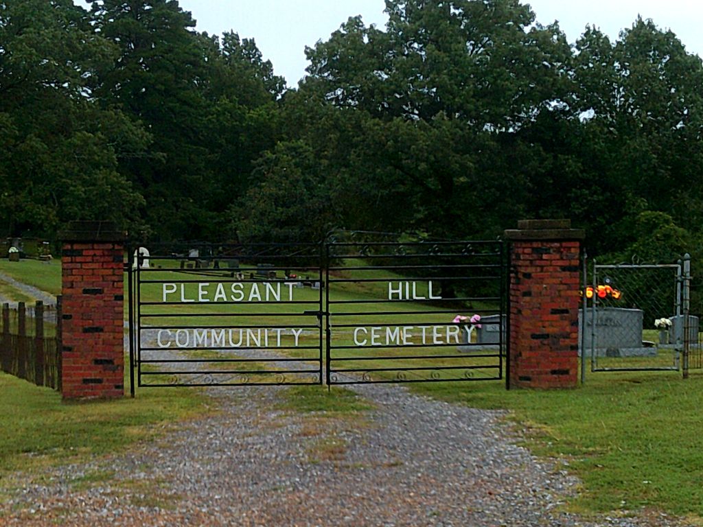
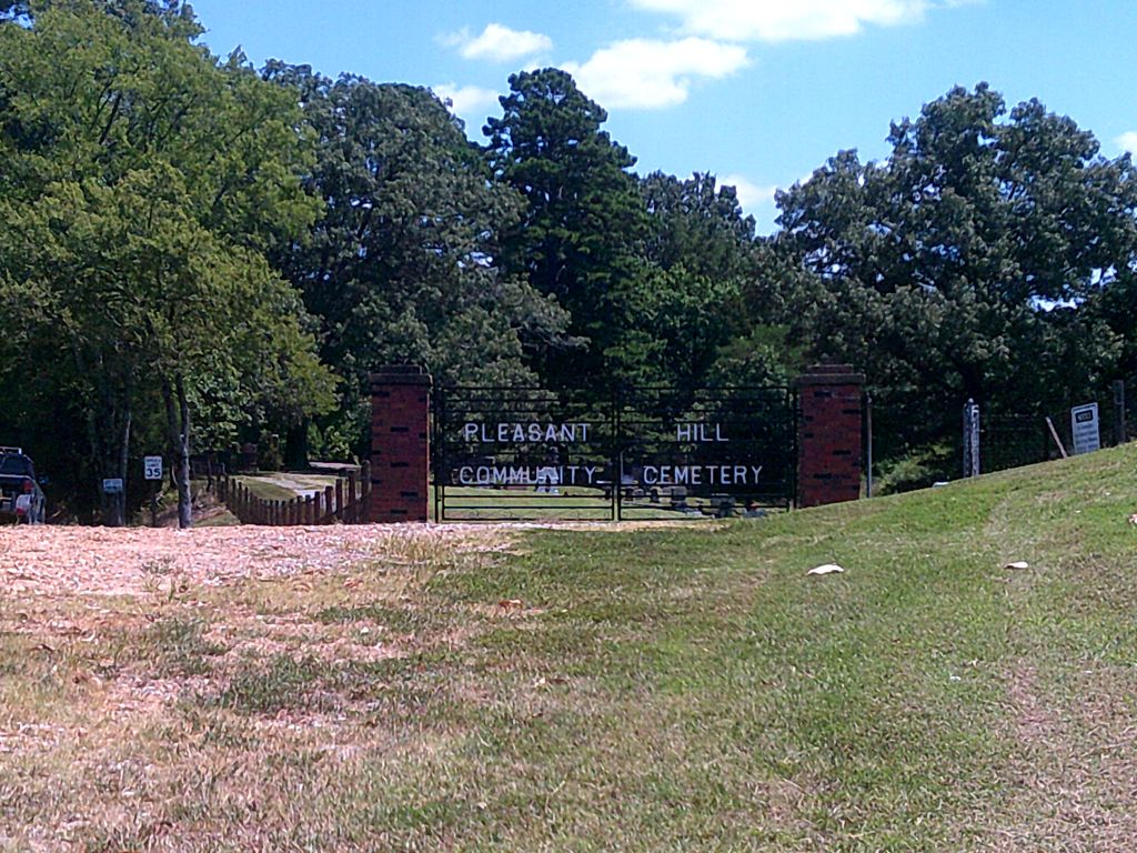
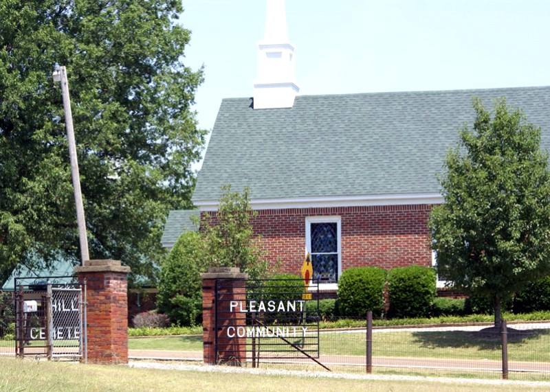
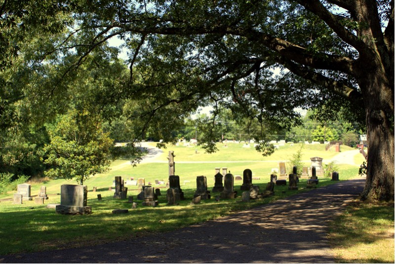
| Description | : | From the intersection of MS-302 & US-78, in Olive Branch, travel west on MS-302/Goodman Rd. for 0.7 mi.; turning south onto Craft Rd., going 3.0 mi.; turning west onto College Rd., going 1.2 mi.; turning south (left) into the driveway of the large & well maintained Pleasant Hill Community Cemetery, across the road from the Pleasant Hill Baptist Church. |
frequently asked questions (FAQ):
-
Where is Pleasant Hill Community Cemetery?
Pleasant Hill Community Cemetery is located at 5886 College Road Pleasant Hill, DeSoto County ,Mississippi ,USA.
-
Pleasant Hill Community Cemetery cemetery's updated grave count on graveviews.com?
1 memorials
-
Where are the coordinates of the Pleasant Hill Community Cemetery?
Latitude: 34.9184340
Longitude: -89.8873670
Nearby Cemetories:
1. New Jeremiah #2 Memorial Garden
Pleasant Hill (Frees Corners), DeSoto County, USA
Coordinate: 34.9182330, -89.8841640
2. Saint Matthews Cemetery
Pleasant Hill, DeSoto County, USA
Coordinate: 34.8940840, -89.8864740
3. Shiloh MB Church Cemetery
Southhaven, DeSoto County, USA
Coordinate: 34.9203610, -89.9195120
4. Autumn Woods Memorial Park
Olive Branch, DeSoto County, USA
Coordinate: 34.9502460, -89.8824450
5. Bridgforth Family Cemetery #1
Southhaven, DeSoto County, USA
Coordinate: 34.9106680, -89.9289170
6. James Owen Gravesite
Olive Branch, DeSoto County, USA
Coordinate: 34.9580000, -89.8794000
7. Bass Family Cemetery
Olive Branch, DeSoto County, USA
Coordinate: 34.9398520, -89.8456470
8. Jeremiah Church Cemetery
Olive Branch, DeSoto County, USA
Coordinate: 34.9619870, -89.9006690
9. Baker Family Cemetery
Pleasant Hill, DeSoto County, USA
Coordinate: 34.8793600, -89.9146300
10. Kelsey Cemetery
Olive Branch, DeSoto County, USA
Coordinate: 34.8936430, -89.8399090
11. Saint Paul Missionary Baptist Church Cemetery
Olive Branch, DeSoto County, USA
Coordinate: 34.9636130, -89.9017180
12. Center Chapel Cemetery
Shelby County, USA
Coordinate: 34.9590000, -89.8580000
13. Johnston Family Cemetery
Nesbit, DeSoto County, USA
Coordinate: 34.8726210, -89.9128810
14. Mount Olive CME Church Cemetery
Nesbit, DeSoto County, USA
Coordinate: 34.8889750, -89.9375850
15. Lebanon Cemetery
Olive Branch, DeSoto County, USA
Coordinate: 34.8891120, -89.8355590
16. Windstone Cemetery
Olive Branch, DeSoto County, USA
Coordinate: 34.9693360, -89.9086930
17. Wiggins Church Cemetery
Olive Branch, DeSoto County, USA
Coordinate: 34.8891260, -89.8299690
18. Bridgforth Cemetery #2
Pleasant Hill, DeSoto County, USA
Coordinate: 34.8828770, -89.9420470
19. Payne Cemetery
Olive Branch, DeSoto County, USA
Coordinate: 34.9625500, -89.8413910
20. Blocker Cemetery
Olive Branch, DeSoto County, USA
Coordinate: 34.9551680, -89.8226700
21. Boggan Cemetery
Lewisburg, DeSoto County, USA
Coordinate: 34.8603280, -89.8496000
22. New Hope Baptist Church Cemetery
Southaven, DeSoto County, USA
Coordinate: 34.9322450, -89.9663540
23. New Fellowship Christian Church Cemetery
Olive Branch, DeSoto County, USA
Coordinate: 34.9888240, -89.8929070
24. Christian Church Cemetery
Hernando, DeSoto County, USA
Coordinate: 34.8608930, -89.9374030