
| Memorials | : | 0 |
| Location | : | Bagn, Sør-Aurdal kommune, Norway |
| Coordinate | : | 60.8201360, 9.5629660 |
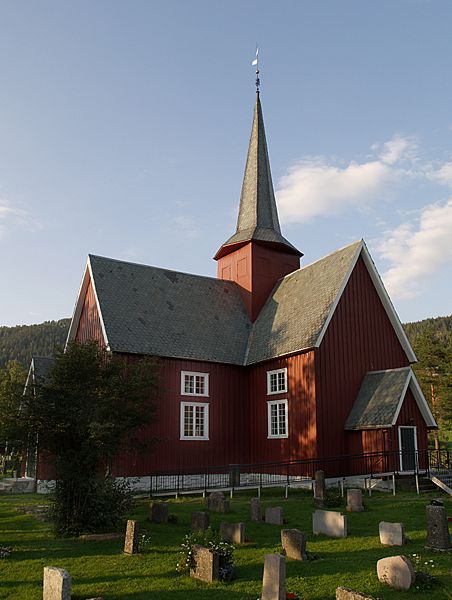
| Description | : | Also known as Lower Reinli Church or South Aurdal Church cemetery. Source: http://no.wikipedia.org/wiki/Bagn_kirke |
frequently asked questions (FAQ):
-
Where is Bagn Cemetery?
Bagn Cemetery is located at 250 Fylkesveg 219 Bagn, Sør-Aurdal kommune ,Oppland fylke , 2930Norway.
-
Bagn Cemetery cemetery's updated grave count on graveviews.com?
0 memorials
-
Where are the coordinates of the Bagn Cemetery?
Latitude: 60.8201360
Longitude: 9.5629660
Nearby Cemetories:
1. Leirskogen Cemetery
Begndal, Sør-Aurdal kommune, Norway
Coordinate: 60.7977150, 9.6832080
2. Bruflat Cemetery
Bruflat, Etnedal kommune, Norway
Coordinate: 60.8884550, 9.6389820
3. Aurdal
Aurdal, Nord-Aurdal kommune, Norway
Coordinate: 60.9248040, 9.4132630
4. Hedalen Cemetery
Hedalen, Sør-Aurdal kommune, Norway
Coordinate: 60.6226500, 9.6905850
5. Nord Etnedal Kirke
Etnedal kommune, Norway
Coordinate: 61.0253740, 9.5010940
6. Tingnes Kirke
Fagernes, Nord-Aurdal kommune, Norway
Coordinate: 60.9835994, 9.2585656
7. Ostsinni Church Cemetery
Dokka, Nordre Land kommune, Norway
Coordinate: 60.8490580, 10.0783310
8. Ulnes Church Cemetery
Aurdal, Nord-Aurdal kommune, Norway
Coordinate: 60.9949520, 9.1140090
9. Fluberg kirke
Fluberg, Søndre Land kommune, Norway
Coordinate: 60.7758230, 10.2467960
10. Røn Cemetery
Vestre Slidre kommune, Norway
Coordinate: 61.0469680, 9.0497780
11. Nes kirke
Nesbyen, Nes kommune, Norway
Coordinate: 60.5669920, 9.1034140
12. Rogne Cemetery
Rogne, Øystre Slidre kommune, Norway
Coordinate: 61.0874550, 9.1243580
13. Øyjar Cemetery
Vestre Slidre kommune, Norway
Coordinate: 61.0435370, 9.0139510
14. Nykirke kirkegård
Snertingdal, Gjøvik kommune, Norway
Coordinate: 60.8977830, 10.3388270
15. Slidredomen Church and Cemetery
Slidre, Vestre Slidre kommune, Norway
Coordinate: 61.0902780, 8.9800000
16. Vestre Slidre Cemetery
Vestre Slidre kommune, Norway
Coordinate: 61.0902130, 8.9797490
17. Flaa Cemetery
Ler, Melhus kommune, Norway
Coordinate: 60.4284681, 9.4662050
18. Viker Church Cemetery
Honefoss, Ringerike kommune, Norway
Coordinate: 60.4494390, 10.0396660
19. Seegård kirkegård
Snertingdal, Gjøvik kommune, Norway
Coordinate: 60.8803220, 10.4626220
20. Enger kirkegård
Enger, Søndre Land kommune, Norway
Coordinate: 60.5801000, 10.3338000
21. Vardal kirkegård
Bybrua, Gjøvik kommune, Norway
Coordinate: 60.8161530, 10.5234840
22. Vestre Gausdal Cemetery
Vestre Gausdal, Gausdal kommune, Norway
Coordinate: 61.2005670, 10.1470830
23. Hemsedal Church Cemetery
Hemsedal, Hemsedal kommune, Norway
Coordinate: 60.8618370, 8.5635500
24. Vingrom kirkegård
Lillehammer, Lillehammer kommune, Norway
Coordinate: 61.0722800, 10.4298900